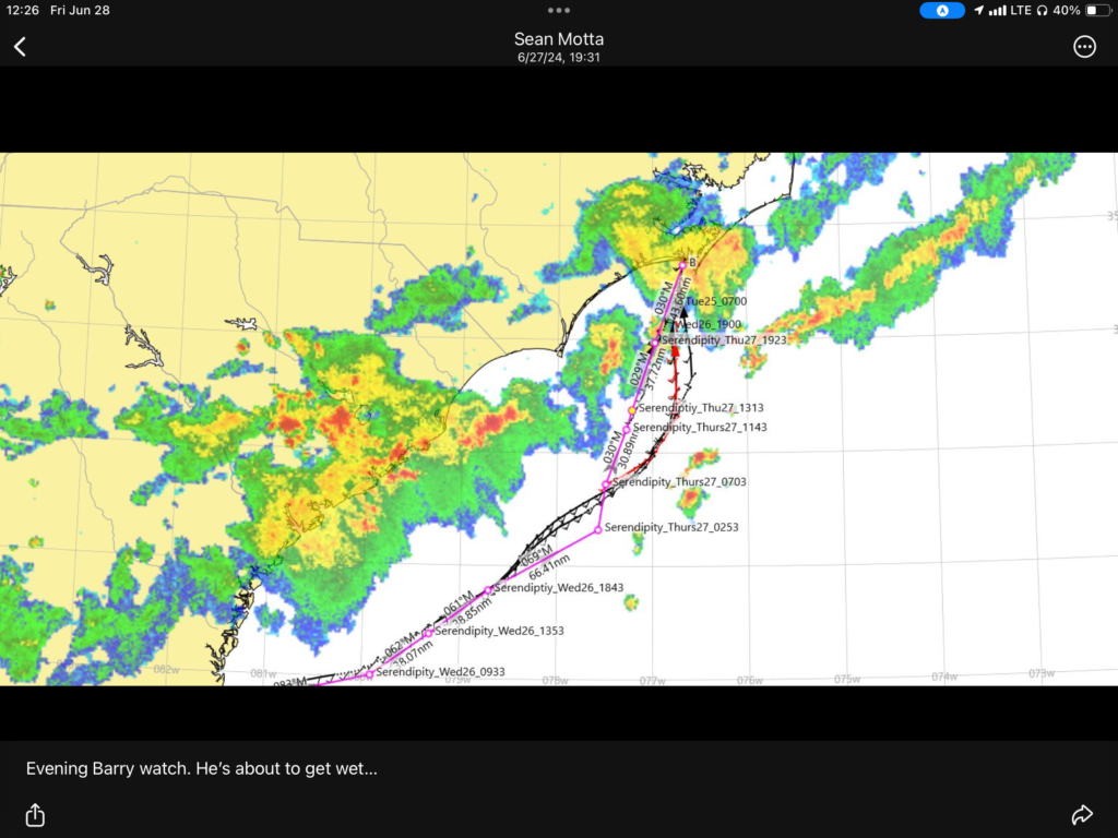
Distance: 386 nm/Time: 60 hours
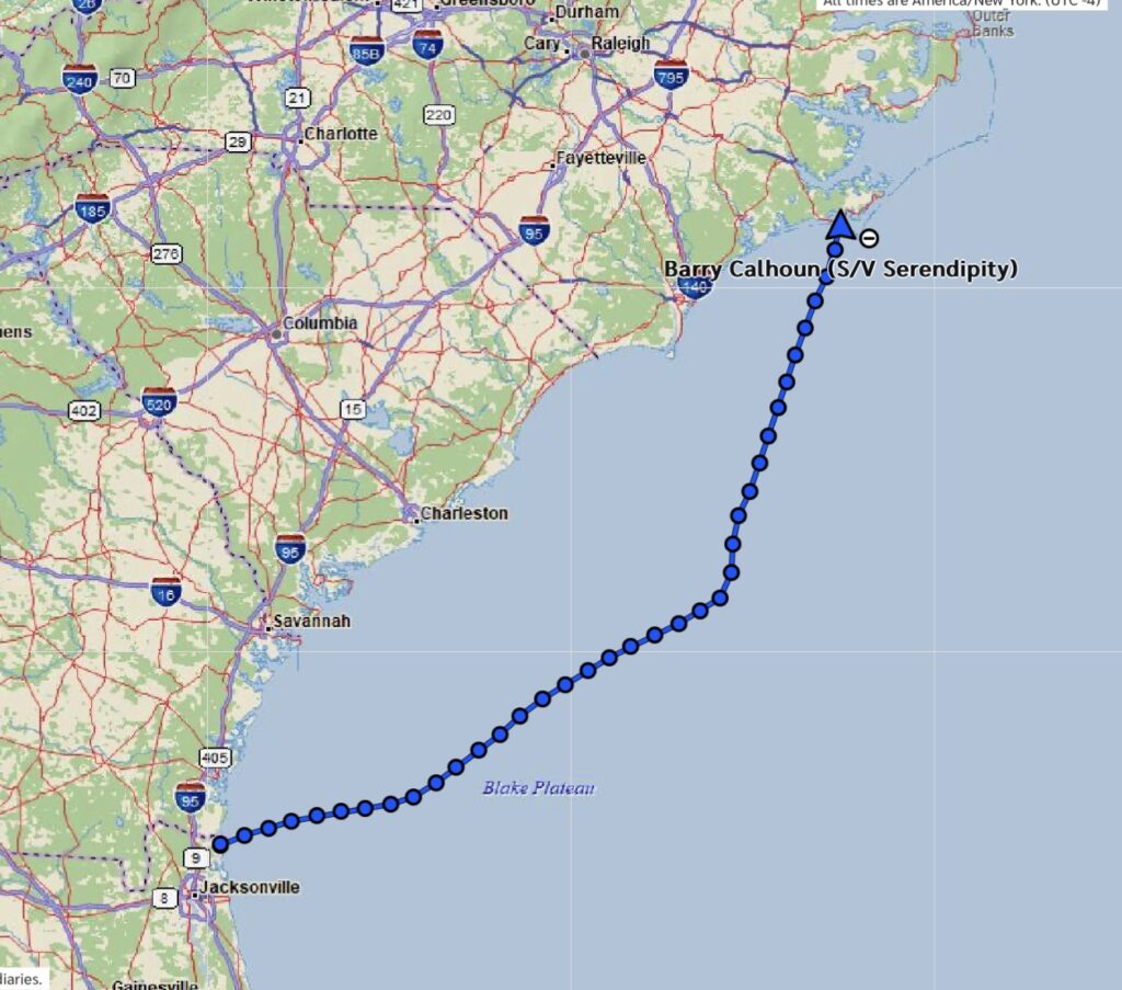
I had originally planned to leave at first light Tuesday morning, regardless of whether I did an offshore overnight to Charleston, a day and a half offshore passage to the next pass north of Charleston (Cape Fear), or by adding another 24 hours, go all the way to Beaufort, NC, (just south of Cape Lookout). After reviewing the weather models and consulting with Sean Motta, I decided on option 3: Make the big leap!
This decision was based on the fact that doing it in segments (say, an overnight to Charleston, then another to Cape Fear, then another to Beaufort) would take up so much time getting inside, finding a suitable anchorage, perhaps resting for a day, then going back outside–all the while trying to coordinate the inlet currents with the wind, hoping for a favorable weather forecast, etc. Also, because those routes were shorter, it wasn’t worth going all the way 70 miles offshore to capture the Gulf Stream, so I would lose its 2-3 knot boost. And the other option–doing it all in the ICW (at least 10 days’ worth)–sounded like pure torture, especially when I would be facing those shoal water/tide, Jekyll Ditch-like timing issues.
But, the offshore route would also be very tiring. Projections were if I departed the St. Mary’s inlet at 9 pm, I would be arriving at the Beaufort Inlet around 10 am on Friday.1 That would be three nights and two days of constant sailing, single-handed. As previously mentioned, the most I have done so far was a single overnight, single-handed. (I had done this twice). And, come to think of it, the most I had done with Nicholay was two nights in a row. So, this would be new ground.
But, to be honest, another factor in the decision was just wanting to be done with The Push. The reason I even launched in the spring instead of the autumn as originally planned, was because I am very concerned about this hurricane season’s forecast. Yes, the hurricane forecasters always predict gloom and doom, but this year there were factors and things lining up that I’ve never seen before. A little voice in my head said, “It’s time to leave”. So, my initial motivation was just to get out of the main hurricane zone, which would also get me (hopefully) out of the really hot and humid weather. In my mind, that meant getting first at least to Beaufort/Oriental, NC, a natural stopping point for destinations further north (and as far north as I had been in a boat).
By doing the 400-mile offshore route, I would be there in three days. Going through the ICW, or making three separate jumps offshore, would delay that by at least a week–more likely two or more. After all, the same distance (from Marathon Key to Fernandina Beach) had taken me three weeks. And, I was getting pretty tired of just pushing hard.
But the shear distance involved didn’t really register with me until I compared it with an offshore passage I had done three times (never single-handed): Tampa to the Dry Tortugas. That had been anywhere from a 58-hour to a 38-hour passage, and it was only 200 miles. I would be going twice that far, single-handed. Yikes! Another comparison was the longest offshore passage I had done at all, which was 300 nm from Pensacola to Tampa. But that was with three other people doing 2-hour watches. I would be doing 400 miles, solo.
Was I ready for this? I thought I could pull it off if nothing went wrong, but I had serious doubts if something did go wrong.2 So, I set some conservative boundaries for myself, mainly the sea state. A forecast for less than four-foot waves was a requirement. The wind speed wasn’t a factor in and of itself. I can adjust and reduce the sails to deal with strong winds; it’s the waves that cause the problems and discomfort.
But even four-foot seas can be uncomfortable if they are coming from the wrong direction. The forecasts called for both the wind and seas to be “following”, meaning after of the beam (from behind), which is generally the most comfortable. The worst is beating into waves. This makes for a rough ride, with a lot of spray, and slowing of the boat. The second worst, as far as I was concerned, was beam seas–coming directly from the side of the boat. This causes the boat to constantly rock from side-to-side and makes doing anything on the boat difficult. Seas coming from the rear quarter gave probably the best ride, and these are what were forecast.
I got what rest I could during the day Tuesday, but it was quite hot on the boat, and I was getting
nervous, so didn’t successfully nap. I planned to detach from the mooring ball around 6:00 pm, motor the hour and a half out the St. Mary’s Inlet to the sea buoy, then put up the sails, and head 080 degrees for 70 miles to intercept the Gulf Stream. Leaving the mooring field around 6:00 pm would allow me to get offshore and set the sails in the daylight, which I preferred. Around 5:30 pm, Sean and I did some more last-minute weather evaluations and decided the conditions were appropriate for me to “send it!”, as he says.
But, I had a big disappointment when trying to come off the mooring ball. I had used two of my best double-braid dock lines on the mooring pendant for a number of reasons, but when I tried to release them, it turns out they had become very tangled over two days of switching currents and winds. There was no way I was going to get them untangled short of getting in the water, and I wasn’t going to do that with the 2-knot current that was running. So, I just tossed off the lines and departed. Nothing else I could do about it. 🙁
It was a beautiful evening to start a passage. After releasing from the mooring ball, I turned turning north, for a mile and then turned east out the inlet. The winds were pretty light while motoring out, which I was both happy about (because it would make transiting through the inlet smooth), but also worried because I needed enough wind to sail.3 It turned out that as soon as I cleared the coastline, there was indeed wind, and it was a bit higher than expected (probably 12 knots) which made the last part of the inlet pretty squirrelly, with four-foot seas in my face which brought my speed down from six knots to around 3. But, that only lasted a couple miles and things calmed down outside the constriction of the inlet.
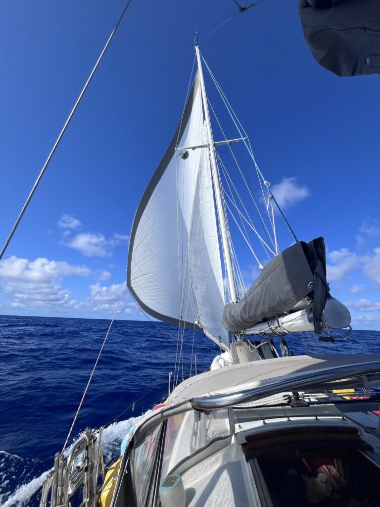
I decided to set just the mizzen and the Genoa (a sail plan referred to as “jib & jigger” for some reason). I have found that the mainsail on my boat quite easily gets overpowered and causes too much heeling and weather helm, so didn’t want it up during the night. In the event, that was enough sail area to keep me at six knots, and I even ended up rolling up (roller reefing) some of the Genoa when it started getting overpowered after the winds picked up a bit.
I had everything fairly stable as the sun set, and my left turn to 050 after intercepting the Gulf Stream wasn’t going to be until morning, so I pulled out some cushions and decided to start my 20-minute sleep cycles. As I set up my cockpit “bed” facing aft, I suddenly noticed a bright flash in the sky to the south. That got my attention! I could see a huge cell had formed up nearby just in the last few minutes. Being caught in a thunderstorm with any significant amount of sails up can be big trouble (I’ve heard) due to winds gusting 35 to 40 knots or even higher. I couldn’t tell how far away it was, nor which direction it was moving. I suddenly felt very vulnerable!
As the saying goes, what is the most scary is the unknown. I know this is the case for me. And what I have been discovering during this journey was how many unknowns there are for me since I’m fairly inexperienced. That means that there have been a surprisingly large number of things that if not scaring me, at least cause me significant worry. I’ve been finding that as I experience these things (and make it through successfully–or it not successfully, I’ve learned what not to do next time), they fall off my “scares me” list. But, the list hasn’t been getting smaller because there are always new things being added to it! Lol.
In fact, many of these basic things, like familiarity with one’s boat, how it sails under different conditions, anchoring, mooring, and many others (I had a list!) I was planning to do this spring and summer back in Tampa. My original plan was to finally start sailing Serendipity a lot: weekends, week-long trips, and so on–to get used to and learn all these things before heading out cruising full time.
But the hurricane forecast had changed all that. I used every moment available to me from April thru May to get ready to launch. This was a huge process, not only completing last-minute projects on the boat, but dealing with my stuff-full 10’x20′ storage unit–all my stuff.
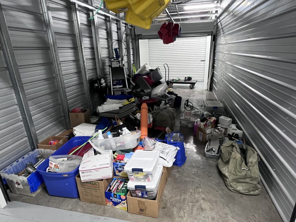
Most of it had to go on the boat somehow, other things had to be sold or given away or thrown away. It was a lot of work. And lastly, I had to sell the van. So, it was a very busy month and a half, with no time to go sailing.
So, admittedly, a lot of the difficulties (or just fears) I encountered during this passage would probably not have been a big deal had I had the chance to do as much practice as I originally intended–if I were more experienced. But, I felt there was a better chance of my boat being damaged in a 150-mph hurricane if I remained in Florida than me damaging the boat by doing something ignorant while I learned “on the go”. It was all the hurricane forecast’s fault! So if a major storm doesn’t hit Tampa this season, I’m going to be pissed! (just kidding)
Anyway, being caught in a thunderstorm was definitely still on the “scares me” list! It was about 9:30 pm, not too late for a call, so I decided use my InReach to text Sean Motta so he could tell me which way the storm was moving. I had totally forgotten that my now-working radar could also see weather. While mine wasn’t sophisticated enough to provide a specific course and speed for a target, by measuring the distance manually, I’d be able to tell over time if it was getting closer or not. I remembered this just as Sean was responding with the welcome news that the cell was just growing in place and not moving anywhere. That matched what I was seeing and was a relief, and allowed me to enjoy the amazing light show the storm provided for the next hour before it ended up dying as quickly as it had formed. Good riddance!

The rest of the night was uneventful. The boat rolled quite a bit with the waves almost off the beam, but I could sleep okay tucked against the lee cockpit combing. We cruised along at a comfortable five and a half knots almost directly away from shore, toward “the elevator”, as some of my esteemed colleagues refer to the Gulf Stream.4
As we finally reached the Gulf Stream the next morning, we turned about 30 degrees to join it. This changed the winds from almost a beam reach to a broad reach, about 30 degrees abaft the starboard beam, with the 2-3 feet seas coming from the same direction, so a fairly comfortable ride. Since it was daylight and the apparent wind had decreased a bit since we were heading more away from it, I unrolled the Genoa all the way and saw GPS speeds from 7.5 to 9 knots, which was good enough for me, and quicker than the planning software had projected.
I didn’t want to go too fast because I would arrive too early for the correct current/wind combination at Beaufort Inlet two days hence. It was a beautiful morning and we were just chugging along, but it was sort of hard for me to grasp how far we still had to go.
Because I am not very familiar with the East Coast, I don’t have a basic understanding of the distances between cities on the east side like I do for the Gulf Coast. It wasn’t until I compared this leg–from the top of Florida to the bottom of North Carolina–to what I was more familiar with, did the distance start to impress me. The leg I was on was as long as the total length of Florida, then around all the way down to Marathon Key. In other words, it was the same distance which had taken me 15 days to travel over the last month (not counting my broken down time in Daytona). I would be doing the same thing in two and a half days!
But that was 60 hours of being anywhere from 75 to 105 miles offshore! Alone. Out of radio or phone contact with anyone.5 Crazy! A lot could happen in that time. I tried not to think about it–too scary!
Most of that day (Wednesday) of the trip is just a blur. Slight tweaking of sails now and then, but everything stayed pretty stable. Since the conditions were relatively benign, I decided to set the staysail just to see how it would work being sort of all tied up with the dinghy, and to see if it added anything to our speed. It was hard to tell, but I think it might have added a half-knot to our speed. It was difficult to trim it properly as the traveler car6 had to remain centered due to the location of the dinghy.
I also remember there was a beautiful sunset.
It wasn’t until the following day, when the wind started veering (moving clockwise) that I started having the sails-slamming issue–the same one which had raised its head during the offshore passage from West Palm Beach to Daytona. And that was this:
Being on a broad reach (about 135 apparent), I had both the mizzen and the Genoa trimmed out far. That was fine in and of itself. But combined with the 3-4′ beam seas we were now experiencing, the boat was rolling about 20 degrees every 5 seconds. This would unload the mizzen causing it’s boom to swing in then slam out with the next wave. At the same time, the Genoa would unload with each sway, then reload with a snap on the opposite wave. This was not how I wanted to experience the next 200 miles! I did have a preventer for the mizzen boom (that I had been using to pull it out of the way of my solar panels), and that helped for that sail. And, I theoretically had a whisker pole for the Genoa, but the spring-loaded connectors weren’t working well, I didn’t have the topping lift or anything else rigged for it, I had never put one up on my boat before, and so wasn’t going to try it the first time 80 miles alone offshore. The only other solution was to do what I did, and that was to bear up about 20 degrees so there’d be more load on the sails. That just meant that I was heading further offshore and would eventually leave the Gulf Stream if I didn’t jibe back toward shore at some point.
This brought the boat back up to 8 knots and made it stable, but at the cost of getting further and further from shore. And all the time the wind was slowly veering to the south. This continued until about 3 am on the second night when I couldn’t take heading further and further from shore any longer (at that point we were 17 miles to the west of course) and knew that I needed to jibe7.
This was going to be a bit tricky because (1) I’d only jibed once before in my boat, and that was when my roller furler had jammed and only my Genoa was up, and 2) This time I’d have two sails to jibe at the same time and in 3-4′ seas. I rehearsed in my mind what I would do: Trim in the mizzen as far as I could (so the boom wouldn’t slam as the wind swapped from one side to the other; then hit the autopilot’s auto tack function (which would turn the boat 90 degrees). As soon as the turn began, I would release the active Genoa sheet and haul fast on the lazy sheet to get the sail around the inner forestay. Then trim in the Genoa to something close to a broad reach, tweak the autopilot to a new broad reach heading, fine-tune the Genoa, and finally trim the mizzen.
The first part, trimming the mizzen, went well. But then it all went to hell. I hit the auto tack function on the autopilot and saw the wheel starting to spin the right direction. I then immediately put all my attention on the Genoa, released the active sheet, and started hauling in on the lazy sheet. But something was definitely wrong. The Genoa wasn’t coming around. I looked at the heading and the autopilot wasn’t doing anything! I tried to autotack function again, but nothing! Meanwhile, the Genoa is flogging all over the place in front of the forestay and impossible to pull over. So, I manually hit the 10-degree heading change button on the autopilot nice times, causing the autopilot to finally start turning the boat where it needed to go. Soon, I was able to finally sheet in the Genoa somewhat, but then it wouldn’t budge. I could see that somehow the Genoa had gotten backwinded, which I didn’t understand until I looked at our heading and realized that the stupid autopilot hadn’t turned 90 degrees to port, but 180 degrees! We were heading into the wind, but the autopilot couldn’t overcome the entire Genoa being backwinded, especially as we had pretty much come to a stop by turning directly into the wind. So, I had a boat in irons in 3-4′ seas, the Genoa hopelessly backwinded against the inner forestay, and threatening to turn the boat once again around. To do anything, I needed way on, and knew I needed to start the engine. Of course, because of my previous engine problems, that meant going below to turn on the electric boost pump, then come back up to the cockpit to start the engine. I did that, put it in gear, and managed to bring the bow back around to the west, which freed up the Genoa and allowed me to trim it properly, and we slowly gained way. I eased the mizzen out and eventually got everything set up as it was before, but on the opposite side. Then I killed the engine. What a nightmare. Not sure why the autopilot suddenly was not willing to do an auto tack, but had I known it was going to fail me, I would have done things differently. But, in the end, no damage, no injuries, and I was back sailing. Except…
Except that I could not get the speed back. We had been doing a consistant 7.5 to 8.5 knots before tacking, but now I was seeing only 5.5 knots, no matter what I did with the sail trim. I thought maybe I had gotten so far off course to the east that we had lost the current, but even after motoring northwest for hours (which would be crossing the northeast running current) I didn’t see any speed increase. And the weird thing was that it appeared to me that we were indeed going through the water at about five knots, so it wasn’t that the boat was moving slowly through the water. Rather, it was like the Gulf Stream had just disappeared. I couldn’t understand it (and still don’t).
But eventually, as the wind continued to veer to the south, I started experiencing the same problem as before, but on the other side. To stop the mizzen boom and the Genoa from loosing shape with each wave set, I had to aim farther west than I wanted to, which would certainly take me out of the Gulf Stream if I weren’t already. So, I was either going to have to regularly jibe back and forth as I went northeast in the Gulf Stream, or do something else. Having such a disastrous experience with the last jibe I had tried, I wasn’t keen on doing that a number of more times.
And I was tired. By this time it was 7 am, so I had been sailing 37 hours through two nights. I saw my choices as doing the jibe thing every few hours as I continued northeast in the Gulf Stream (assuming I could find it again), then turning toward Beaufort when I was further north, or just taking down the sails and motoring directly to Beaufort. At 5.5 knots, I would get there right at the 10 am tide change and wouldn’t have to worry about trying to jibe the boat multiple times with an autopilot that wasn’t functioning well. I didn’t have to prove anything. So, down came the sails and up came the RPMs.
Eventually, my speed picked up from my normally 5.5 knots motoring speed to 7.5 knots, so I somehow found some part of the Gulf Stream as I motored in. The good part of motoring was that my batteries were now getting charged quickly. While sailing, the solar panels hadn’t been producing much due to the mizzen sail right above them. But now, both the engine alternator, and because I was able to pull the mizzen boom away from most of the panels with a preventer, the solar panels were making electricity. That meant I could turn the ice maker on again, and leave the radar on all the time. It also meant that I was making such good time because was now on the hypotenuse of my original up-the-Gulf-Stream-then-turn-left route right triangle route, that I was going to be able to make it to the Beaufort Inlet at the slack tide at 3 am instead of the next one at 10 am. Sweet!

It also meant that we had a following sea on our new northerly course, so the ride became much more comfortable. I think it was the right decision. And, not having my sails up proved fortunate the next day when I had to penetrate a cold front between me and Beaufort. But more on that below.
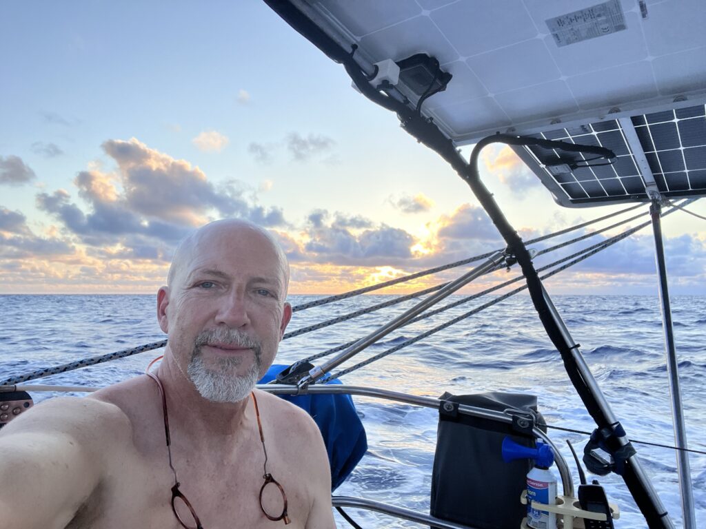
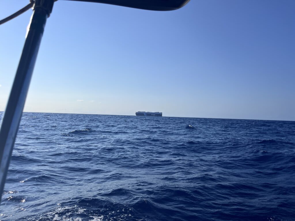
Thursday started out uneventful, sunny, and hot. One thing that surprised me was how little traffic there was. This is pretty much what I saw all day in every direction.
The winds had moderated to about 8 knots and due to the direct tailwind and us also moving at 8 knots, there was no relative wind over the boat. In the morning I napped as late as I could find shade somewhere in the cockpit big enough to lie down in, then just read books and listened to podcasts the rest of the day. And downed a lot of ice water. It was a fairly relaxing, if boring day.
But, I was also wary of the forecasts which been predicting a cold front moving into the area from the northwest later in the day, bringing squalls with it. It could turn out to be bad timing, but there was nothing for it but to continue on and see what would transpire.
As we approached to within about 40 miles of the coast, I finally finished my Led Zeppelin biography, set the book down and looked around, and was shocked to see a huge line of what appeared to be thunderstorms all along the coast from well south of me to well north of me. Yikes, this must be the cold front! And I was heading straight toward it. More unknown worries.
This time I remembered my radar, and sure enough, it painted cells all along the coast. I reached out to Sean to get his perspective on size, severity, movement, etc. He confirmed it was the cold front, and that there were some massive cells to the south of me and some big ones to the north, but it appeared that only minor ones in front of me. And the best news: It was a thin squall line and moving southeast quickly, which meant that I wouldn’t be subject to its effects, whatever they would turn out to be, for very long.
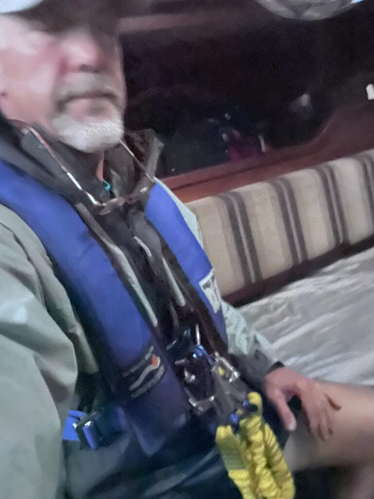
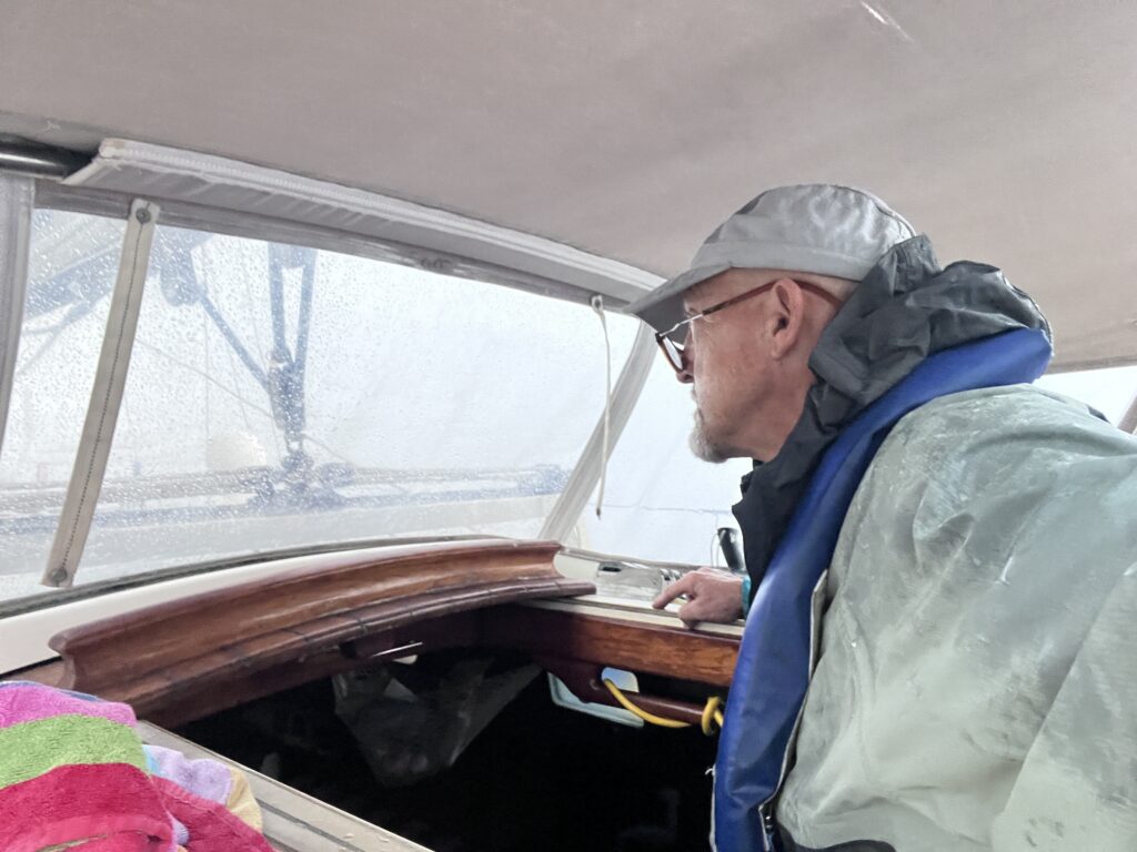
While waiting on Sean to check into it, I got the boat and myself as ready as I knew how. I dogged all the portlights8, removed anything unessential from the cockpit, put on a rain coat, my PFD and tethers (in case I would have to go forward for some reason), buttoned up the dodger windscreen, and closed all the hatches. I was then as ready as I could get for whatever I would encounter.
Already by this point the winds had swapped to northerly at about 20 knots (outflow from the squall line). My speed, which had been getting us to the Beaufort Inlet about 20 minutes before the 3 am slack current, now dropped to half of what it was as the waves built to 2 feet from the north, then 3 feet, and eventually 4 feet. At times this would bring the boat to almost a dead stop in the trough of some of the bigger swells. The bow was riding up and down about 10 feet. Nothing scary, per say, but lots of spray and little progress.
It was obvious that if this reduced speed continued for much longer, my 3 am Beaufort Inlet window would be lost, and I would get there with hours to wait for the 10 am one. But, I would have to cross that bridge when I got to it. In the meantime, I might have ti deal with much stronger winds, lightening, and perhaps even higher seas.
As I was scanning the horizon to see if it might be worth me altering course to avoid the bigger cells, I suddenly saw a red flare being shot off about 2 miles east of me. I could also just barely see some kind of vessel there, and noticed that it was painting on my radar. As I watched over the next minute or two, another five red flares were shot off. This wasn’t due to the weather–the line hadn’t reached them yet. But, I knew I needed to call it in. I noted my position and the position of the vessel on my radar, then attempted to call the Coast Guard using my hand held radio. They could barely hear me, so I went below to the “big” radio (antenna on the mast) and reported what I had seen. They replied back that what I was seeing was a Coast Guard cutting doing flare drills. Good! At least I wouldn’t have to divert over there to provide assistance in these increasing large waves.
Long story short, in the end, the bigger cells were on either side of me, and all I experienced was a couple hours of rain and strong winds off the nose. It was scary (mainly just because of the unknown thing), but it was really pretty much a non-event. And the boat got a much-needed freshwater rinse, which it hadn’t received since Daytona.
Eventually, the seas calmed back down again, and the wind almost died. However, the GPS said that I was going to arrive around 4:30 am, at which point, as per the latest forecast I had with moderate winds from the south, I would have to wait around till 10 am to transit the inlet. It being the outside with extremely deep water, there would be nowhere to anchor and wait, so I would have to just float or motor around for six hours. Or conversely, I could just throttle back to about 3 knots, save some gas, and arrive around 10 am. I opted for the latter.
But then after some back and forth with Sean, he informed me that the forecast for my arrival time at Beaufort was now forecasting calm winds. That meant I could enter the inlet at any time; it was only the winds combined with the current that could cause the dreaded standing waves. As it were, if the current were coming out, it would just slow me down, but wouldn’t cause any issues. Great news! I throttled up to cruise RPM, and over the next few hours, I picked up some other current and ended up getting to the inlet right at 3 pm after all! Geez, what a merry-go-round!
And the winds were indeed totally calm when I arrived. It was all so peaceful after what had been so disturbed just a few hours ago. It seemed like I was the only one awake. I saw no other boats or even activity as I entered the inlet and very carefully wound my way another few miles to the anchorage. It felt great to be back inside and safe even though it was by now 4 am and I was exhausted. However, what I hadn’t really counted on was how crowded the anchorage was!
I had gotten spoiled. Everyone tries to leave Florida (or put their boats “on the hard”) in the summertime because of the heat and hurricanes. All the anchorages and marinas had had plenty of space in my travels so far. But, on the rest of the East Coast, summer is when everyone is out boating! And, when Nicholay and I and our buddy boat had anchored here in December, there was plenty of room because not very many people were interested in recreational boating in the winter.
Imagine my surprise, therefore, to turn the corner into the anchorage and discover that it was FULL. I knew there were no other suitable anchorages close; getting to one would have required hours of cruising the ICW in the dark. Not what I was fit to be doing in my current condition. So, I slowly cruised up and down the anchorage, comparing the depths on my software with any kind of open space that I could see between boats, but it was obvious that the open spots were because the water was only 4′-5′ deep in those places.
I finally chose a spot that was really closer to other boats and the adjacent channel than I would have chosen in other circumstances. But, I just needed to get the anchor set and get to bed. I was ragged out. So, I picked a spot, ensured the anchor set well, then crashed. My bunk never felt so good!
And before ending this passage’s blog entry, I would to give credit where credit is due. Sean Motta was an incredible help. Not only did he freely spend a lot of his time researching and sharing weather and planning info (coupled with his extensive experience) with me (at all hours of the day), but he was also very encouraging at times when I needed it most.9 Thanks, Sean! (And thanks Amanda for sharing him with me during those times!)
After Thoughts & Feelings About the Passage: I have very mixed feelings about it as I write this (now two days later). It was exhausting. Not that the weather was super-demanding, but the lack of decent sleep for 60 hours, coupled with the stress I was experiencing being so far offshore, the difficulty just jibing my boat, the threatening thunderstorms, all really wiped me out. I’m still trashed. I remember when passing through the inlet at Beaufort, finally inside after almost three days, I thought to myself, “Well, I’m not doing that again anytime soon!” Way too scary, way too stressful, way too lonely.
Yet, I also felt a tremendous sense of accomplishment. Holy moly, I had just single-handed 100 miles offshore for almost 400 miles! I did not plan to do anything so rash until I had gained much more experience, but it had worked out. This is what my boat was built to do, and I had to admit that in the big scheme of things, it beat the hell of out two weeks single-handed in the ICW.
What did I learn?
1) That most of the things I worry about never come to fruition. I tend to “catastrophize” outcomes. Some of this is due to my previous profession as a helicopter pilot where the attitude of “if something bad isn’t happening, you know it’s about to” is actually a healthy one. But, it sometimes keeps me from enjoying the moment. I think as I get more experience and the stress level goes down, the enjoyment will go up.
2) This would be much more enjoyable experience for me with a partner or at least crew aboard. Just to have someone else there for company, to bounce ideas off of, to provide a second set of hands would be very valuable. As I discussed in a previous blog entry, single-handing has proven quite exhausting for me, both mentally and physically. I definitely love my independence, but I think I would value companionship more at this point.
3) I need Starlink10. Being virtually without any critical information once beyond cell phone service is just not safe. I needed updated weather information, at one point seasickness medication information, and other critical information that we so take for granted. Luckily, Sean was available and willing to provide the most critical information to me when I needed it most. But, I could have been better prepared, experienced less stress, and made better choices if I had more information and had it sooner. So, before I do another long, offshore passage, I plan to have Starlink aboard.
After Thoughts & Feelings About the Trip So Far:
Well, I’ve jumped the first major hurtle! I’ve made it to my first goal, the place where I feel like I am away from at least the main hurricane zone. I had estimated that it would take me at least a month to get from Tampa to Beaufort/Oriental, and indeed it has taken me 34 days. This was as far north as I have been on a boat. Anything further north would be–for me–terrra incognita, Here be dragons! and all that. From now on it would be more fun, continuing north for sure, but not in a hurry, taking the time to explore, to smell the roses, to get rest and relaxation! In other words, cruising!
But suddenly I’m faced with “What now?” Lol
Tomorrow’s business. Or maybe three days from now business. In the meantime, I’m going to check out Beaufort and get some much-needed and deserved R & R!
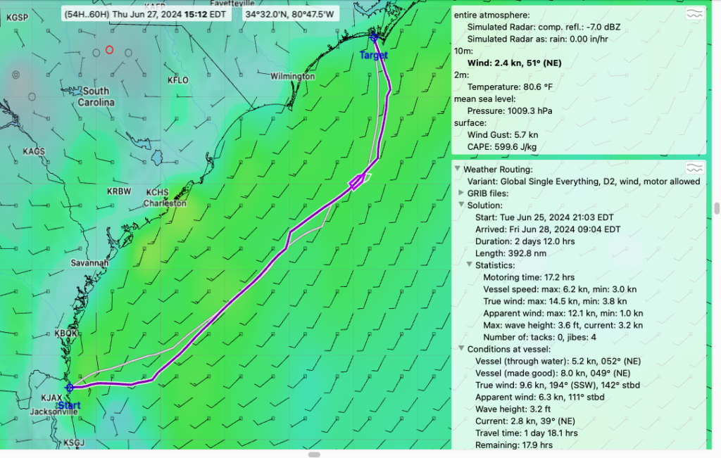
- The timing into the Beaufort Inlet would be important. Because the winds were forecast to be from the south at 10-15 knots (right into the inlet), it would be too dangerous to try to go through it when there was any current; I needed to arrive right when the current changed directions, i.e., slack current. That changed every six hours, and 10 am was one of those windows. So, if the weather and flight planning models turned out to be exactly right, I could transition inside when I arrived there. If not, I would have to adjust my speed to arrive at one of those windows. It would also allow me to arrive in the daylight, which is always preferred, although in this instance, because I was familiar with this inlet and the anchorage, and it was well-marked, I was comfortable doing it at night if necessary. ↩︎
- I wasn’t completely without options if something did go wrong. I had two EPIRBs (Emergency Position Indicating Radio Beacon), one in a “ditch bag” and the other attached to my PFD. I also had the InReach, which not only allowed people to track me, but had a basic text function and an emergency beacon function. And if the worst happened, I had a 6-person, offshore life raft (although it was overdue for its 3-year inspection) ↩︎
- While I did have just enough diesel aboard to motor the entire 400 miles if I had to, I obviously would rather sail. It is cheaper, quieter, and makes the boat more stable. ↩︎
 The Gulf Stream with my projected path on top of it.
It was sort of weird to think that it was worth going all the way 70 nm offshore at the beginning of the leg and all the way 70 nm back to shore on the last part of the leg–140 nm–just to get on and off the elevator. But, for such a long leg, the extra 2.5-3.0 knots makes such a big difference that it is indeed worth it.
I was a bit worried about how I would determine when I was actually in the Gulf Stream. The water in it is noticeably warmer than the surrounding water, so measuring the water temperature is a simple way to figure it out. Unfortunately, I have no water temperature transducer on my boat, so this wasn’t an option. The other way is to compare one’s GPS speed (which is how fast one is moving over the surface of the earth as detected by satellites with ones actual speed through the water. If one is moving through the water at five knots but the GPS is reading 8 knots, then your in a river of water carrying you along at 3 knots. Unfortunately, I also didn’t have the little paddlewheel-type transducer that measures my speed through the water, so that wasn’t an option, either! And since I was intercepting the Gulf Stream at almost a 90-degree angle, I wouldn’t see a simple increase in GPS speed either (until I turned north into the stream).
So, before departing, I had measured the distance offshore where I should intercept the Gulf Stream and put that in as a waypoint in my GPS. I also measured the direction the Gulf Stream ran for the time I would be in it (050 degrees), and the point where I’d have to depart it to make landfall, then put these in as waypoints, too, then created a route connecting them. That would give me a pretty good chance.
But, it turned out that I discovered it in a completely accidental way! The next morning when we were approaching the waypoint which indicated the Gulf Stream and the turn to the northeast, I was watching the GPS carefully for some kind of indication that we’d hit it. I expected the course to change to show that we were moving a bit sideways, but it never did. But, I noticed that my magnetic wet compass in the binacle was about 15 degrees off of my GPS heading. This had happened before when I had put something metal (or even my handheld radio) too close to it. I looked all around it to see what was causing it to be off, but couldn’t find anything magnetic or metallic. Then it suddenly dawned on me that this was the very indication I had been looking for! (Sleeping only 20 minutes at a time tends to dull one’s brain.) The boat’s heading at this point was 090 degrees, but the GPS “heading” was 075 degrees. Why? Because we were being swept sideways by the Gulf Stream. (The satellites don’t know which way we’re facing, just which way we’re moving.) We were there! Since the significant part of it is about 30 miles wide, I decided to go another hour or so just to get us in the middle of it. Then, as soon as I turned northeast, the GPS speed jumped from 5.5 knots to 8 knots. Yeehaw! ↩︎- As previously mentioned, I wasn’t totally incommunicado. My InReach tracking device also had basic texting capabilities which I definitely put to use to get wx updates from Sean. ↩︎
- The traveler is a track on which a “car” rides. The sheet–the line that controls the lateral position of the sail, i.e., used to trim the sail–runs through this car. Repositioning the car controls the twist in the sail, necessary for optimal sail shape and efficiency in various conditions. ↩︎
- A jibe is a maneuver used to change directions–to cross the wind–similar to tacking. The difference is that tacking is when the bow crosses through the wind, and a jibe is when the stern crosses the wind. Tacking is much easier because the booms and sails are all sort of streamlined into the wind already and they just swap sides in a relatively gentle was as the nose comes through the wind. A jibe, on the other hand, is more difficult because the booms and sails are way off to one side to capture the wind coming from the stern, and as the boat is turned, at a certain point the wind will immediately jump to the other side of the sails and boom, bringing them from all the way out on one side to all the way out on the other. If this isn’t done in controlled manner, damage and injuries (and even death from getting hit by the rapidly swinging boom) can result. ↩︎
- Closed and locked all the windows. ↩︎
- For anyone who is interested in having Sean look over your shoulder as you venture offshore, he and his wife, Amanda have started a business, Mottafied Adventures. They specialize in canvas work, race data performance analysis, marine electronics consulting, and weather routing. I highly recommend! ↩︎
- Satellite high-speed internet service. ↩︎
What an amazing accomplishment. I had no idea our Pensacola trip was your longest offshore. I’m glad you did this one. Even if you don’t do another for a while, you gained an insane amount of experience and perspective. Job well done!
Thanks, Sean!
Wow, what a journey! Glad you made it safely. Crack open one of those dark beers and celebrate!
Just one!?
Congratulations! With each challenge, you get more skilled. You made the first best decision, to go north. Hope Nicolai is out of harms way from Beryl.
Thanks, Francine. Nick is stuck in Isla Mujeres right now, still, after 6 days, trying to get the inprocessing paperwork done! They don’t have time to make it to Guatamala before Beryl passes through, so right now we’re all hoping that it goes further south. If you care to track him, he’s also got an InReach going for that purpose: https://share.garmin.com/mexicana