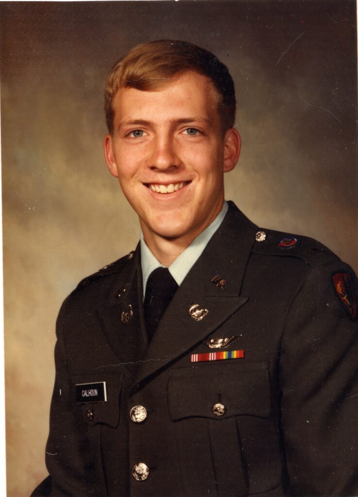
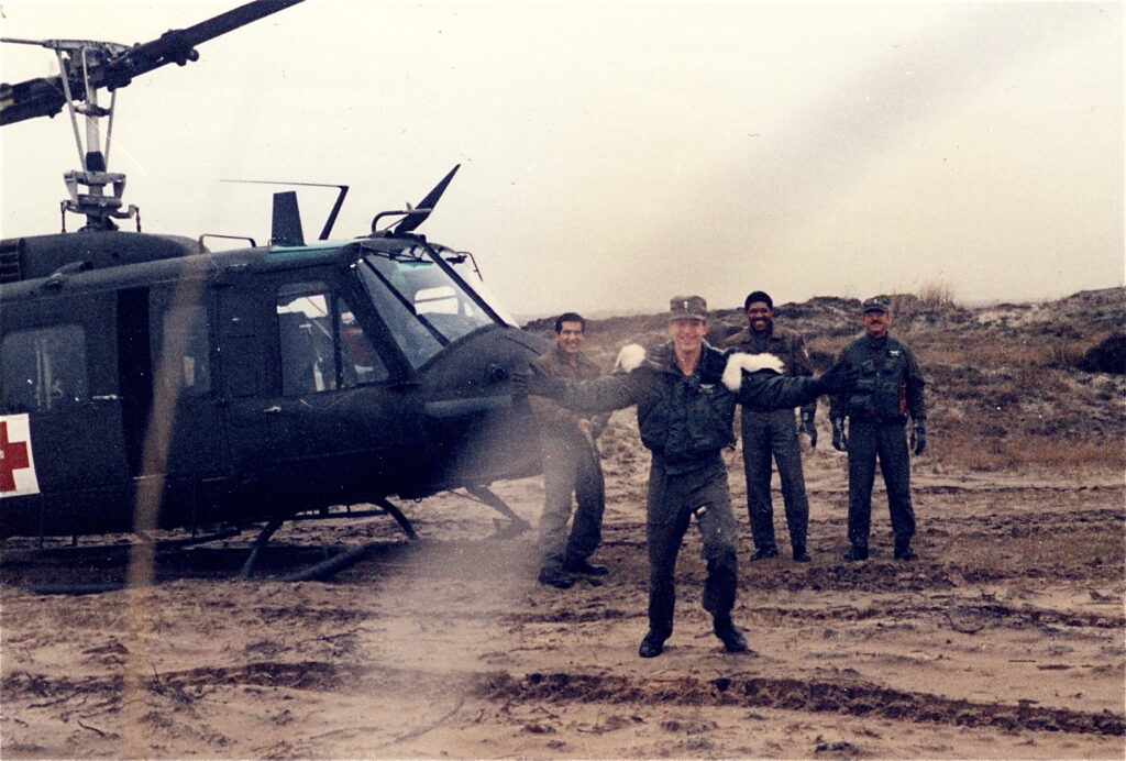
After a year of Army Warrant Officer and flight training at Fort Rucker, Alabama, I graduated as a WO1 with a silver bar and a set of Army Aviator wings and was promptly sent to Germany, to the 15th Medical Detachment, a UH-1V (Huey) medevac unit in Bavaria.

The unit was at a place called Grafenwoehr, a huge NATO training range where combat units from all over Europe would come to conduct live-fire exercises, using everything from M16s to F16’s. We were there to provide immediate medical assistance (and evacuation to a trauma center, if necessary) to any troops that got injured during training –a not uncommon occurrence.
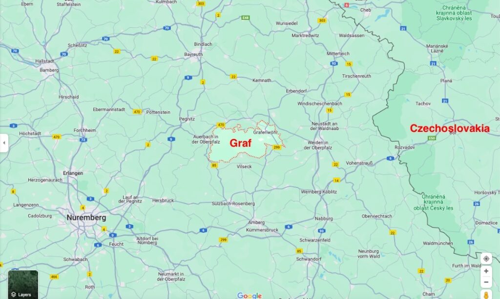
This was 1984, the height of the cold war, and “Graf” was located only 15 miles from the “Iron Curtain”, in this case the Czechoslovakian border. The 15th Med Det was also there to provide medical evacuation to the many Army units guarding the politically sensitive border.
One of the requirements for a pilot arriving in country was to go through an indoctrination course which covered all the rules and challenges of flying near the border of a country aligned with the Soviet Bloc (i.e., East Germany and Czechoslovakia). These borders were actively guarded by troops on both sides and straying across the border would be the cause of an international incident, if not an active shooting incident. (And regardless, would be the end of a pilot’s flying career.) The Soviets would also try to lure Army Aviators across the border by setting up navigation transmitters on their side of the border that had the same frequency as those in West Germany, which they would turn on during bad weather!
To guard against accidental incursions into the “enemy’s” territory, strict aviation rules were in effect for Army aircraft, for which there were three categories.
The first were aviation units whose responsibility was to patrol the border. Those pilots received extensive and exhaustive familiarization on the border. Additionally, they flew it every day and so got to know it like the back of their hands. Because of this, they were allowed to within ½ mile of the physical border. (One-half mile when flying is basically nothing. Fifteen seconds of inattention will have you blow right through ½ mile in a helicopter.)
The second category was basically all the other aviation units in Germany. Because they were not specifically familiar with the border and didn’t receive the specialized training, those aircraft had to remain at least five miles away from the border at all times. As a further protection, there were U.S. Air Force radar units which covered this area and could warn aircraft over military radio frequencies if they were getting too close to the border (which would also result in punitive action against any such pilots).
The third category was us–helicopters assigned to medevac units. Because there were so many Army ground units (grunts) patrolling along the border, they would sometimes need medical evacuation via helicopter. This was very hilly terrain with many unimproved roads, so getting anywhere quickly by vehicle—especially an Army vehicle—was difficult. Therefore, to preclude units having to drive a severely injured soldier five miles from the border to be evacuated, medevac helicopters were authorized to also get up to ½ mile of the border, but only during an actual medevac. For training flights, they were considered the same as all the rest of the “normal” units in Germany and had to remain five miles away.
What this meant was that during a medevac we had all the same hazards associated with flying so close to a politically sensitive border as the units routinely patrolling the border, but received none of their critical familiarization training. So, the first time we would be able to see the challenging terrain in question was during an actual high-stress medevac. Great.
A month or two after arriving in Germany, I was pulling overnight medevac duty with Bill Sorenson. I was the copilot and he was the PIC (pilot in command). He was also our unit’s SIP–Standardization Instructor Pilot (basically, head instructor pilot).
Sometime after dark we received word that the son of the U.S. Ambassador to Prague was sick and needed to be evacuated to the American Army hospital in Nurnberg (West Germany). Initially, they were trying to get us clearance to cross the border and fly all the way to Prague to pick him up (which would have been AWESOME), but the commies wouldn’t allow it, so he was going to be driven by vehicle to the West German/Czech border, cross through, and we would pick him up in an LZ (ad hoc designated landing zone, i.e., a field) ½ mile on the German side of the border. Then we would transport him 100 miles further west to Nurnberg.
After estimating when the vehicle with the patient would likely arrive at the LZ, we began planning the flight. Because this was an area we couldn’t train in, we had no large-scale (detailed) maps of the area, just the 1:250,000 scale “sectionals” which showed only major roads, cities, and most towns. That was the first problem.
The second problem was the weather. It was not good. Ceilings were around 700 feet and visibility was a mile or so. Our weather minimums for an actual medevac mission were 500’ ceiling and ½ mile visibility, so we were legal, but it was going to make navigation—especially at night in hilly terrain—very challenging. That was problem number two.
Problem number three was that Bill wanted me to navigate while he flew! Huh? I had just turned 20, was fresh out of flight school, had only navigated in the flat, wiregrass area of southern Alabama, and he wanted me to get us safely up to within ½ mile of a hostile border at night in bad weather in an unfamiliar area? Are you kidding me?!?!
There was one saving grace: Because time wasn’t urgent (i.e., the LZ was only 15 air miles from us but 200 road miles from Prague) we didn’t have to go direct, but1 could take our time to follow major landmarks most of the way, in this case highways; we’d being going IFR.
We took off with me (understandably) very nervous. A major screw up–allowing us to stray across the border–would likely result in an international incident and the end of both our careers (if not ending up in a Soviet prison as propaganda pieces). But really, that might not even be considered a major screw up because this border wasn’t a straight line—not even close. It undulated all over the place. And, if you weren’t near a checkpoint, the border wasn’t very distinguishable from any other part of the countryside, especially at night. So, it was not that hard to stray across, hence all the rules and precautions. But even a minor screw-up while under the scrutiny of our head instructor pilot—possibly embarrassing him as the PIC…well, the ramifications of that were too dire to even contemplate! At the minimum, I would never make PIC myself! All I could do was try my best.
We took off, and with my finger on the map tracing what I hoped was our progress, we picked our way among the dark, overcast, sparsely-populated hills and valleys of northern Bavaria, heading for Czechoslovakia. (Did I mention that to save electricity some German towns would turn off all their lights at night, making navigation even more difficult?) As we got closer, we received a radio call from the Air Force radar guys saying that a Russian Hind-D helicopter gunship had shown up on the other side of the border and was mirroring our movements as we approached the border.
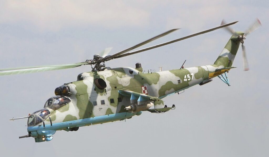
Obviously, the enemy was tracking us on their radar, too. If this wasn’t seriously enough already, I can tell you that the thought of our little Huey being peppered with 23mm rounds if we strayed across the border totally pegged-out my fun meter!
The flight only lasted about 25 minutes but seemed like hours. Most of the time, I was pretty confident that we were where we were supposed to be (on the correct route to the LZ), but there were times when I was only pretty sure that I knew where we were on the map. Imagine my relief then, when we finally rounded a hill and saw a bunch of illuminated vehicles and a well-lit LZ that the grunts had set up for us. Just past that, we could see the road pass through the border fence into Czechoslovakia.
To be honestI don’t remember the rest of the flight, but I know that we landed, picked up the boy, and transported him safely to the trauma center in Nurnberg where he did fine. But, man, the entire thing was a startling introduction to the level of responsibility the Army expected of me in Germany during the Cold War, even as a 20-year old! This shit was real!2