December 11 to December 30, 2023
Nicholay Calhoun (Captain) and Barry Calhoun (Crew)
Towards the end of November, I received a phone call from Nicholay asking if I’d like to help him move Mexicana from Oriental, NC, back to Tampa. He had been in North Carolina for months, having started cruising from Tampa in April and working his way around the Keys and up the east coast to settle in Oriental by May. He and his girlfriend, Sierra, had done some cruising around the Outer Banks in the summer, but otherwise he had been there working on some projects on his boat, but mostly earning money doing projects on other peoples’ boats. But, now he was done with all that, had just finally finished replacing his transmission, and was ready to get out of the cold weather and come back to Tampa for the holidays. To make the trip go as quickly as possible, he needed at least one other crewmember. He said he would be ready to go on December 6th. Of course, I jumped at the opportunity to spend time with him while hopefully gaining some offshore sailing experience in the Atlantic.
I would be arriving on the 6th, so we planned to depart—weather permitting–on the morning of the 7th. About a week prior to departing, we started looking seriously at the weather forecast. I was using a very sophisticated piece of software called LuckGrib that could download any number of marine weather forecasts from around the world and display them in a graphical format in conjunction with a planned route. It allows the user to select many variables: different departure times (because sometimes delaying just a few hours can make a big difference); max wave heights or winds one is willing to sail in; how often one is willing to turn the motor on to make some time; and many other variables to provide not only fairly accurate forecasts of conditions along a chosen route, but how long a route will take based on your particular boat’s performance figures, max winds and waves along the route (or at any point on a route), and other very useful information. It even allows the combining of forecasts from different sources to see how much in agreement they are (which indicates confidence that the forecast will be accurate). As with all forecasts, the accuracy decreases the further out the forecast is, so even though some of these forecasts would predict out 16 days, they were really only vaguely accurate about 5 days out and reliably accurate out to three days.
In choosing routes, we basically had two choices: offshore, or the Intracoastal Waterway (ICW). The ICW is a route of protected waters (basically a channel) all along the East and Gulf Coasts, typically between barrier islands and the mainland. Think of it as a nautical highway, with buoys and markers and lights depicting the route for over 1,000 miles. This is very convenient and safe, but also very slow. Slow, because it often meanders. Slow because it is very challenging and tiring to navigate in the dark (so boaters typically anchor somewhere or stop into a marina each night) and slow because there are frequently other boats and obstacles to avoid. It is also usually more tiring than offshore sailing because someone always must be at the helm to keep the boat in the channel and avoid hitting things. An autopilot is not accurate enough for such a small channel. Oh, and there can also be drawbridges (or even canal locks) on certain schedules that often cause delays. Depending on its cruise speed, a sailboat typically average 50-75 miles per day when transiting down the ICW. For us, due to the short winter days, we’d be looking at round 50 miles per day.
The other choice was offshore. This meant leaving the protected waters of any bays, inlets, or the ICW and going out into the open ocean (in our case, the North Atlantic). This is much easier because precision navigation isn’t necessary (at least not until getting close to the destination). The boat can be aimed in the general direction perhaps hundreds of miles away, the autopilot (or wind vane—more on that later) set, and then the boat basically steers itself day and night with only occasionally minor adjustments needed. This makes for a faster trip not necessarily because the boat is moving through the water any faster, but because it is going day and night, non-stop, and in a straighter line towards the destination. Thus, a boat like Nicholay’s sailing offshore, assuming adequate winds, might make between 100 and 150 miles per day. And, assuming the weather isn’t terrible, this makes for a much more relaxing trip.
But the weather is the deciding issue and is why getting forecasts as accurate as possible is so important. Boats don’t travel fast, so if unforecast weather is encountered offshore, it can take hours (or even days) to make it back to a protected inlet. Seas can get very uncomfortable, making the hoped-for relaxing trip instead an exercise in not getting sick, trying to manage normally simple things like eating and going to the bathroom, and hoping the rig holds up! So, most sailors willing to go offshore will begin studying the forecasts as if their lives depend on it a few days prior to departure, updating them with increasing frequency as the departure time approaches.
Initially, the forecast looked very promising: moderate winds out of the northwest on the 7th and continuing for several days. This was just about perfect for where we were going. Winds coming from over the land, while perhaps a bit shiftier than winds coming from offshore, nevertheless were much preferred because there wouldn’t be as much fetch—distance the wind has to act on the water to build up the waves. For example, 20 knots of wind coming from over land that is 2 miles away may only produce 2-foot waves, but those same winds coming from the east having hundreds of miles to influence the water, may produce 6-foot waves. Since we would be heading mostly southwest initially, the wind would be off the beam (side) or on the quarter (towards the rear), both generally efficient and comfortable points of sail. (Once the wind direction moves forward of the beam, the ride gets windier, the boat has to pound through the waves, there is often spray in the cockpit, i.e., generally just a less-comfortable ride.)
Oriental lies on the Neuse River, so is actually inshore quite a ways. We would have to motor for a day or so to get offshore. Optimally, we would try for a single, offshore passage from the Beaufort Inlet just west of Cape Lookout all the way to Fort Pierce Inlet, about two-thirds of the way down Florida’s east coast. (This is where we would go back “inside” to take the Okeechoobee Waterway across the state. Much more on that later.) This would be about a 500-mile leg and would take 4-6 days. To be able to knock out 500 miles in a single (albeit tiring) passage would make the entire trip significantly shorter, not to mention getting us quickly out of the cold climate and back down to the “civilized” weather. 🙂 So, as I spent a couple of hours each day doing detailed analysis of the forecasts and routes and would share what it was looking like with Nick, he and I got very excited talking over the phone about how it was panning out.
Wednesday, December 6th (Tampa, FL to Oriental, NC)
On December 6th I arrived as scheduled in Raleigh. My first impression, even as I walked up the jetway from the plane, was how cold it was! The temperatures were in the 40’s, but to me, it was very cold. Years of living in Florida had evidently made my blood very thin! Nick showed up in a car he borrowed from Simon and Lara Manetta, old friends from the marina he used to work at in Dunedin, FL. They had since bought a slip in Oriental and were living aboard their 30-foot sailboat there.
A couple hours later we stopped at an amazing supermarket called Harris Teeter in New Bern– bigger town on the way to Oriental–to stock up on “provisions” for the boat. This place was amazing! Not only beautiful and huge, but it had a sushi bar, and even more incredibly, an actual bar serving wine and beer (and good beer at that)! Nick said that sometimes they even had live music. In a grocery store! Being able to drink a beer while grocery shopping! Brilliant! We bought about $200 worth of food, headed back out into the even colder and now dark evening to load the groceries into the already stuffed-full-of-boating-gear car, and continued on to Oriental.
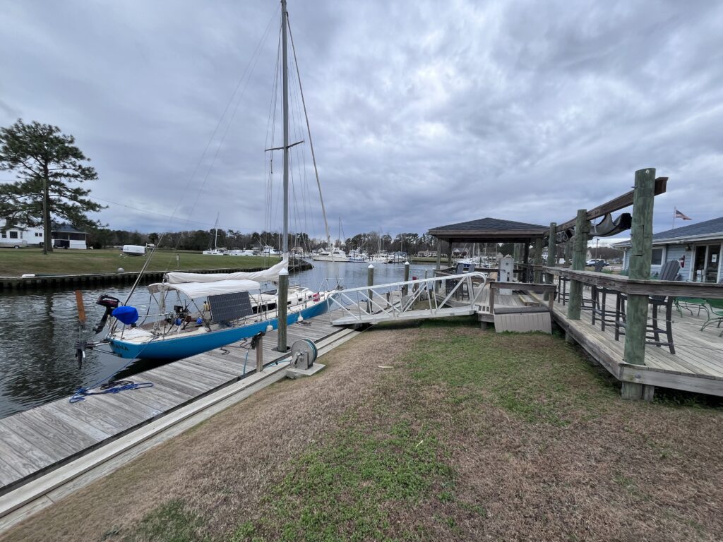
Although it was dark by the time we arrived, I could see why Nick liked Oriental so much. It was a very quaint—and totally boating-oriented—community, although smaller than I envisioned. After a quick tour of the town, we headed for Oriental Harbor Village Marina, where Nick had his boat. By now it was very cold, and by the time we had taken a few dock-cart’s worth of groceries and other supplies to the boat, I was very uncomfortably cold. Miserable is probably a better word. (All my real cold-weather gear was still packed up.)
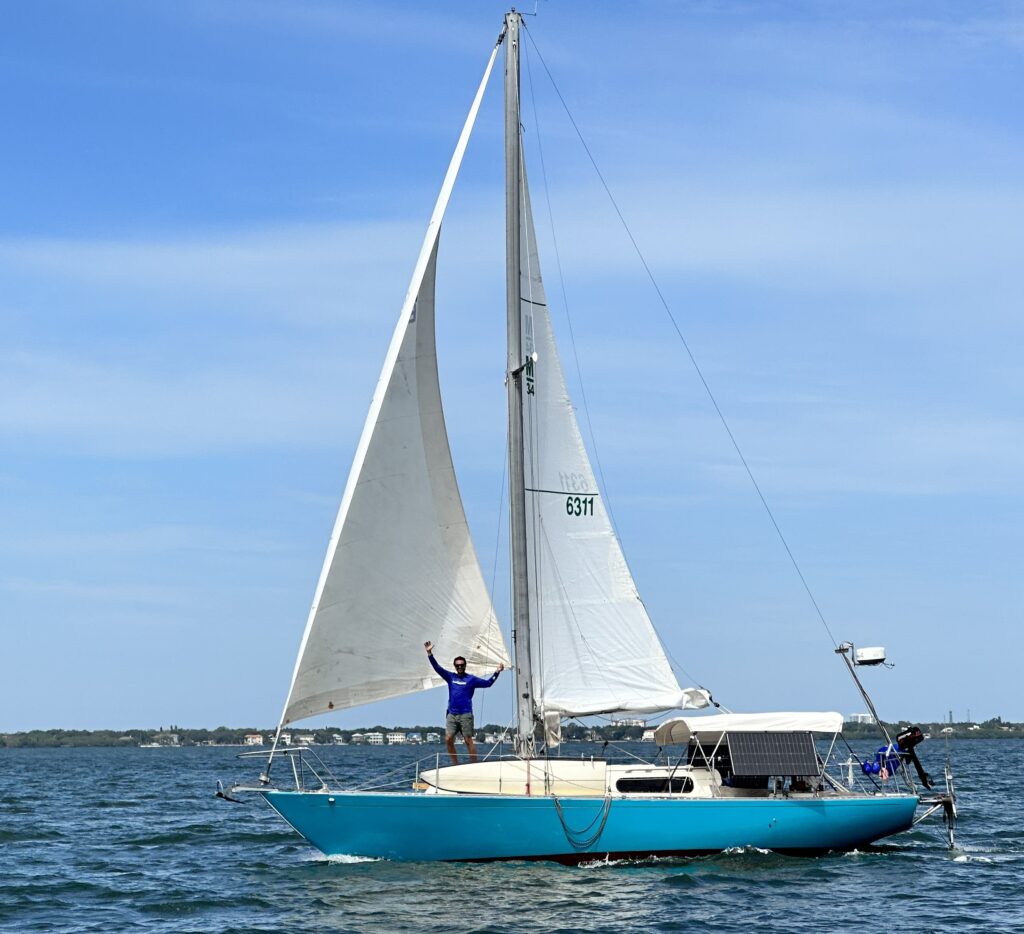
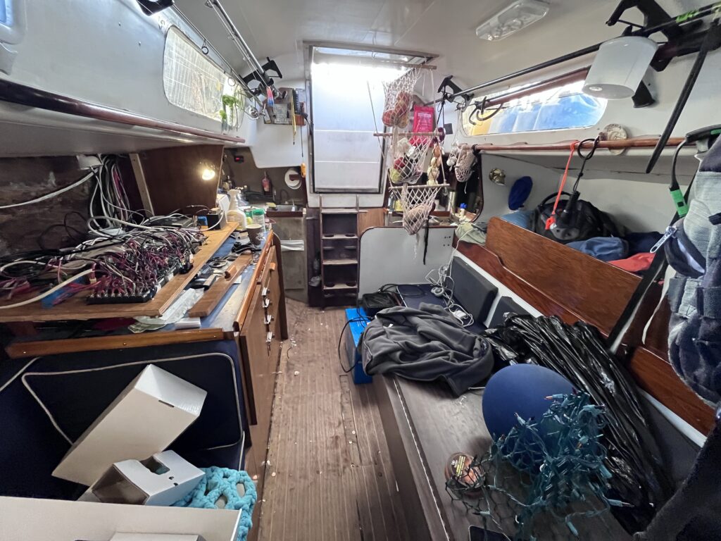
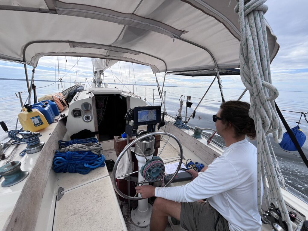
Climbing back down into the cabin on Nick’s boat for the first time in almost eight months brought up memories for me: All the work he had done on his boat throughout the years and how proud I was of him for cruising on his own for the last eight months; memories of the only other passage I had done on his boat—a 400-mile round trip passage to the Dry Tortugas for New Years in 2022. The passage down had been very challenging and miserable for us. I wondered what this trip would hold. Granted, since then, Nicholay had made a lot of improvements in his boat, including a state of the art lithium electrical system, an upgraded GPS, a radar, an AIS (transponder system to allow us to see and be seen by, other boats), and most importantly, an Aeries wind vane, which was basically a manual autopilot that would steer the boat while we were offshore.
As I got used to the new surroundings, we began stowing all the rather exotic foods we had purchased at Harris Teeters. I was looking forward to the interesting dishes that Nicholay was going to prepare. I’ll digress here a minute and talk about Nicholay and food prep. He has truly become a master chef. Very early on he had shown an interest in cooking and experimenting with food, even researching the basic sciences behind flavors and the chemical interactions that occur when cooking or baking. As soon as he started living on his own, food preparation became a big part of his life. It had been eight months since I had eaten anything prepared by him, and while it had always been good, I would soon find out that now it was excellent! He could do wonders with just about any ingredients on hand and loved finding obscure recipes (or coming up with his own combinations) to experiment with. Most of his meals astonished me with how good they were. And all very healthy, mostly vegetable-based meals. So, his cooking was invariably a morale booster for me during the cold voyage.
Another thing that became apparent to me early in the trip was my age, not only how it affected the difference between Nicholay’s and my perspective on and tolerance for things, but between me and the crew of our “buddy boat”. They were all in their mid-30’s, and the level of discomfort they were all willing to endure amazed me. At first, I thought I was just a natural-born wimp, averse to any kind of discomfort. But then I remembered myself in my earlier years—especially those in Alaska—when I was their age and the chance for adventure completely outweighed any considerations of comfort. So, it seemed then to simply be a factor of being almost 60; I just don’t like being uncomfortable anymore! I realize that I still want some adventure, but at the cost of only a small amount of discomfort. If the discomfort is going to be too much, I’ll forego the adventure. Don’t need it. Been there, done that.
I’m just getting old. Lol
Another challenge of living on his boat this trip would be managing my “stuff”. Nicholay’s boat was already very full as a function of him living aboard full-time; everything he owned had to fit on the boat. In addition, he had graciously acquired some free “goodies” for me during his last few months in Oriental. Oriental is a popular waystation for cruisers who stop for extended work on their boats, to provision on their way south, etc. He had somehow acquired for me a $400 Fortress (collapsible, aluminum) anchor; a $2300 6-man offshore life raft, a lithium battery charger/inverter worth $1300 which only cost me $350, and a few other things. These were all large and heavy, so shipping them to me would have been too expensive. But, he was willing to let them take up space on his boat to get them to me in Tampa. So, it was hard to complain about the lack of space knowing that a lot of it was caused by my stuff! Nonetheless, it was a bit challenging for me to live for almost a month out of two duffel bags on the floor.
But I digress; back to December 6th. After getting all the groceries and supplies stowed on the boat, Nicholay told me that we would likely be having two or perhaps even three other buddy boats join us for the trip south and asked if I wanted to meet the crew of one of them. They were having dinner at the marina restaurant. I said “absolutely”.
The term “buddy boat” is fairly self-explanatory. For sailboats at least, it doesn’t mean sailing side-by-side everywhere; each sailboat’s sailing characteristics are too unique to allow this. In actuality, it means departing around the same time, heading to the same destination, and meeting up again after both (or all) the boats arrive. It is both a safety thing, and a social thing. I had never sailed with a buddy-boat, so was interested in how it would all play out.
The crew we were meeting were on the boat Palarus, a Pacific Seacraft 37. Jesse and Kate were the owners, had recently gotten engaged, had been in Oriental for a while, but finally had the boat ready to cruise. Their intentions were to head to the Florida Keys to visit friends and relatives and then to the Bahamas. Also at dinner were two other men who would help crew their boat: Madison and Clint. Madison was from Vermont but had a boat in Oriental and had been living there for a while. He was planning to help crew Palarus for a week or so, then jump ship to fly up north for the holidays. Clint was just going to join Palarus for the first leg—the motoring down the Adams Canal from Oriental to Beaufort on the coast. There, he would depart and head back to Oriental. (Madison would be driving Clint’s car the first day to Beaufort to join the boat there, thus providing Clint with ride back to Oriental.)
But, it turned out nobody was ready to actually depart quite yet. Jesse and Kate still had some mechanical things to do on their boat (mainly install a wind-vane), as did Nicholay, and as he shared with me, so did the other two boats that might be joining us. We decided to move our launch date to Saturday, the 9th of December, mid-day. That was disappointing since we would miss our coveted weather window, but it would also give me a chance to see more of Oriental and meet some of the many friends that Nicholay had acquired during his stay there.
Thursday, December 7th (Oriental, NC)
The next day was quite cold. The good thing about being in a marina hooked up to electrical (shore) power, was that we could run the space heater in addition to our heated blankets. (When using battery power only, Nicholay’s system was robust enough to run our electric blankets, but not a space heater which takes too much electricity.) So, thankfully the boat was tolerably warm inside despite the 38-degree temperatures outside. Nonetheless, waking up to frost on the dock was a shock to my system! Luckily, it wasn’t windy.
We spent most of the day doing various and sundry things to get the boat ready for cruising. We also did some errands around town, such as filling up the jerry cans with gasoline (for the dinghy’s outboard engine) and diesel (for extra main engine fuel), picking up my charger/inverter from the electronics shop where it was being held for us, fueling up Simon and Lara’s car before returning it to them, and picking up a new tiller autopilot that Nicholay had ordered as part of Mexicana’s upgraded self-steering system.
Having a self-steering system is very important on any passage because hand-steering a boat for extended periods of time can be very tiring—especially when there is any significant sea state. When offshore (where exact positions and headings aren’t important), having a self-steering system makes the passage significantly more enjoyable and even safe from a crew-fatigue standpoint. These systems can often be set and left alone for hours or days (or, if in the trade winds, even weeks) at a time.
There are two major categories of self-steering systems for a sailboat: electronic autopilots and wind vanes. The former are what you’d imagine an autopilot to be: a modern electronic system using a compass or GPS to hold a heading or course determined by the crew. These can either be very robust (and expensive) systems fully integrated into the boat’s steering mechanisms (below deck), or less robust and less expensive “wheel steering” systems which connect a small motor to the helm to turn the wheel in the cockpit. Smaller boats with tillers instead of wheels use an almost portable linear actuator to move the tiller back and forth which uses a compass built into the actuator to hold a designated heading.
Wind vanes, on the other hand, are completely mechanical systems. They use the power of the wind and the waves to maintain a boat’s heading (relative to the wind—not a compass heading). These are somewhat large contraptions mounted to the stern of the boat and control the boat either by using their own rudder or a series of pulleys and ropes to turn the wheel (or tiller) in the cockpit. Nicholay had an Aries brand wind vane on his boat, which was connected to the wheel.
The way a wind vane works is that it has a small paddle (very similar to a ceiling fan paddle) which sits vertically at the top of the contraption (which is mounted to the transom of the boat). This paddle can be rotated so that the thin edge faces the wind. It is hinged, so can also tilt left or right from vertical. So, if the boat (or the wind) veers, the relative wind hits the one side of the paddle or the other, pushing it to one side or the other. There is a shaft attached to the base of the paddle which is connected to a small, underwater, rudder-looking device called a servo. When the wind paddle tilts, gearing turns the servo the corresponding way in the (rushing-by) water. Like sticking your level hand out the window of a speeding car and then tilting it up or down, the strong force of the water against the turned servo pushes it to one side or the other. Through a series of ropes and pulleys, this motion is then transferred all the way into the cockpit and turns the wheel just enough to bring the paddle back to vertical (thin side back facing the wind) which has correspondingly brought the boat back to the desired heading (relative to the wind). No electrical power is required, and they are entirely quiet (as opposed to autopilots which have a constant electric-motor sound when operating). Nick installed his wind vane before leaving Florida the previous spring and had used it to great effect on the passage up from Florida.
The limitation of wind vanes, of course, is that they need wind to work, and they are not very precise, even if there is enough wind. Precision is not needed offshore, but inland (such as in the ICW) or if there is not enough wind to sail, wind vanes don’t work. This is where an electronic autopilot is useful. Unfortunately, cost is a huge issue with those. The robust autopilots (that hook directly to the boat’s rudder system) cost between $4k and 6$k, and even the less robust wheel-steering systems cost half that much.
However, the small, portable, tiller actuators only cost about $500. While these are designed for boats with tillers instead of wheels, many sailors with wind vanes have discovered that you could remove the detachable wind vane paddle and attach a tiller autopilot in its place which would provide a very inexpensive, but powerful (still using the underwater servo to turn the wheel) autopilot that would work whether motoring or if there was no wind; the boat would be steered off the compass that was built in to the tiller autopilot. Brilliant!
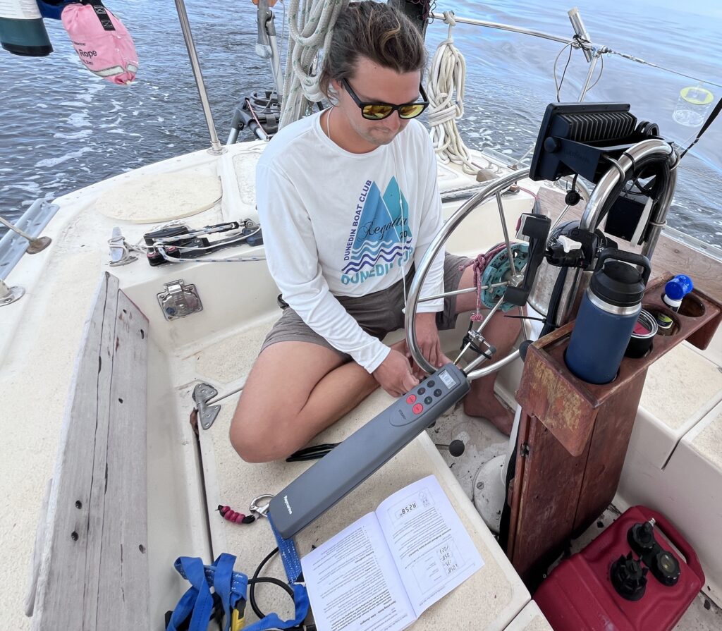
And one of these tiller autopilots is what Nicholay had ordered, and which arrived on the 7th. However, his plans were not to install it into his wind vane mechanism (because he had discovered that due to the boat’s propeller wash when motoring, there was too much play in the system for the tiller pilot to work.) Instead, he had the idea that he could hook it directly to his wheel and get the same effect as if he still had a tiller. He was very excited to get it installed and try it out, knowing that on any trip the length of ours, there would be long periods of time with no wind (or when motoring down the ICW) when such an autopilot would be very convenient. So, as soon as we got back to the boat, he dug into the instructions and began installing it. We hoped to test it the next day out in the Neuse River if we got enough of the other critical things done in the meantime.
Of course, there was also a lot of weather planning going on. The forecasts had begun to become less favorable, with a cold front coming through the area Sunday night. It looked like we would not want to be offshore until Monday afternoon, at the earliest. We still would depart Saturday but would anchor off Beaufort Saturday and Sunday to wait for the favorable weather.
That night Nicholay and I walked downtown with plans to have dinner then meet up with some more of his friends at a local tavern, called The New Village Brewery. It was a cold evening, windy and 43 degrees, which put the wind chill right about freezing. I decided to try out my heavy-weight fleece jacket for the walk around town. It turned out to be a good thing that I did, because on the way to the restaurant, we passed by the tavern and all the friends we were planning to meet later were already there sitting at a table. On the porch. Outside. Drinking cold beers. And Nicholay said, “Let’s join them”!!! So, we did. Luckily, after the first round, a table opened up inside and we moved into the warmth of the tavern. It turned out that the tavern was celebrating something, and so had a bunch of food laid out, so we hung out there for the evening talking and munching.
His friends were all very interesting people, most in their mid-30’s, and all doing something nautical-related (as it seemed like virtually everyone in Oriental did). Some had been cruising and now were taking a break for one reason or another. Most were getting ready to go cruising for the first time and were taking advantage of the resources in Oriental to get their boats ready. Later, Simon and Lara joined us. The last time I had seen them was on Davis Island in the spring when they had driven down to Tampa to handle some administrative issues in the area and had stopped by to take Nicholay and me to lunch. It was great seeing them again.
Friday, December 8th (Oriental, NC)
It turned out to be a slightly less cold day than the previous one. We spent the morning finishing up various projects/preparations on the boat. One of our buddy boats was a Cabo Rico 38 owned by a guy named Matt, whom I had yet to meet. He was anchored just outside the marina in the Oriental basin. According to Nick, he was ready to head down to the Bahamas and so planned to head south with us and Palarus and the fourth boat.
However, that morning as we were walking along the dock, we ran into man who said that one of the big fishing boats coming into the harbor had just collided with a sailboat that was at anchor. When he described the sailboat, we realized that it was Matt’s boat. Nicholay called him up to get details, and it turns out that the fishing boat had gotten way too close on its way back into port, had snagged Matt’s anchor, and pulled the sailboat into itself, colliding mainly with Matt’s bowsprit and the port side of the Cabo Rico. He initially didn’t think the boat had much other than cosmetic damage, but then noticed his rigging was loose, and so wanted Nicholay to come look it over. He came by in his dinghy a short time later and picked us up.
I had never seen a Cabo Rico 38 sailboat, but it had been on my “short list” of boats to buy when I was searching for one. In fact, I had ranked it as #4 on my final list of ten. So, I was excited to see what one looked like in person. His was a beautiful boat, but the collision had indeed done more damage than Matt initially thought. The bowsprit had gotten knocked a couple of inches to one side, which had loosened up a lot of the rigging on the boat. It was not sailable and would need the damage repaired and the rig tuned. That meant hauling it out of the water at a boat yard. It also meant that he was not going to be able to come with us, and likely wouldn’t be able to depart for weeks. He was very disappointed (as were we). The only good things about the whole incident were that a neighboring boat had captured video of the entire incident, the fishing boat was part of a huge company, and Matt had gotten the Coast Guard involved right away, so it was likely that the company would have to pay for all his damages.
So, that was one down from our four-boat fleet. Nicholay also shared that the other boat (whose owner I never did meet) would also not be coming due to mechanical issues. So that left just us and one buddy boat and crew: Jesse, Kate, and Madison in Palarus. I was glad that at least one other boat would be going with us.
We managed to get the rest of our chores done by mid-afternoon, and because Nicholay was still excited to test out his tiller-autopilot-attached-to-the-wheel setup, we motored out to the Neuse River and did a bunch of testing and configuring trying to get it to work. Fortunately, the weather was rather mild, with temps in the low 60’s and winds and seas calm, which helped with autopilot testing. Unfortunately, Nick didn’t end up having a lot of luck with it. The autopilot didn’t seem very responsive, causing the boat to zig-zag 30 degrees either side of the set heading. Not really good enough. Nicholay watched a bunch of YouTube videos, called the retailer who had sold it to him, and even the manufacturer, but because he was trying to use it in a non-intended way, they really couldn’t offer much help. Although he played around with it some more on the way to Beaufort the next day, it proved too inaccurate to be useful for our trip. 🙁
When we pulled back into the marina, we noticed a bunch of people in costume and on Christmas-decorated kayaks and paddleboards. We asked around and learned that the annual paddle board and kayak Christmas parade around the marina was about to begin! Seeing that we were done with everything for the day, we got warmly dressed for the rapidly-decreasing evening temperatures and headed downtown to where the parade would be, intending to watch that first, then head for the BBQ place Nick had been trying to take me to the previous evening.
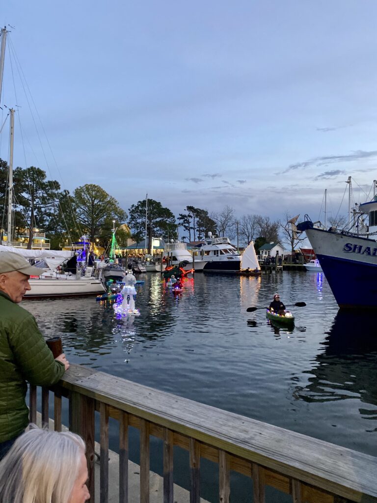
It was very fun parade! Most of the 25-30 participants had obviously gone to a lot of trouble to decorate themselves and their small vessels. There was even an amazing fire-breathing dragon!
After the parade we walked to the town’s BBQ place, one of the weirdest restaurants I have ever been to. The owners had taken over a failed bar in town, but instead of capitalizing on all that would have to offer, atmosphere-wise, they instead turned it into a more like a warehouse vibe with super bright lights everywhere and just used the beautiful huge bar to store things. Very strange. But, the service and the food were fantastic!
On the way back to the marina, we popped into the tavern again. Well, I should say that we walked into the backyard/courtyard of the tavern where there were outdoor tables and chairs (and a window to the bar to order beer) and met yet more of Nicholay’s friends and some of the same ones. We hung out there for a while and then headed back to the boat.
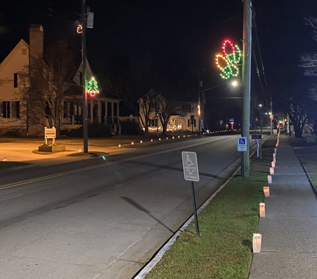
I didn’t mention it earlier, but the town was decorated very tastefully for the holidays with lit decorations hanging from the light poles (including some that were sailboats, of course!), and most impressively that night, hundreds of candle-lit paper bags along the streets. Real candles. Hundreds of them up and down every street and even across the bridge that ran out of town. We had a hard time fathoming how long it must have taken to light them all, but we appreciated whoever had done it because they were very beautiful.
We eventually made our way back to the boat and hit the sack, excited that we would finally be starting our journey the next day!
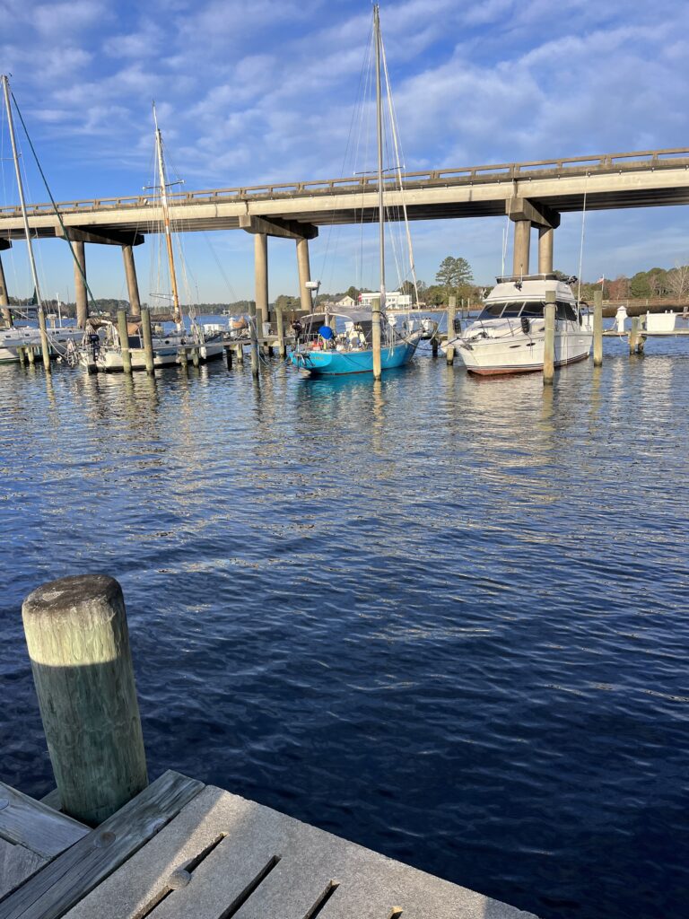
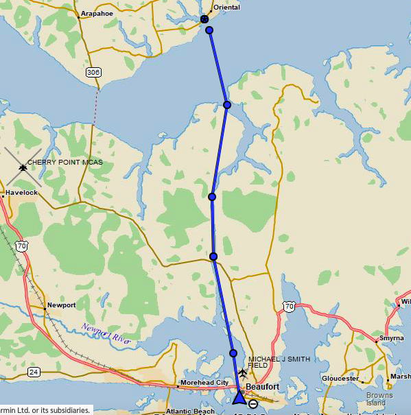
Saturday, December 9th (Oriental, NC to Beaufort, NC, 21 nm)
The next morning, we completed our final preparations which included stowing most of the dock lines, topping off the freshwater tank, emptying trash, and then saying good bye to a plethora of people who came to see Nicholay off. I was very proud to see how well-known and popular he was in the town. The last ones to visit us were Simon and Lara who had brought donuts, which was very sweet of them. (Ha! Ha!) While it had started out as another cold morning in the 40’s it soon turned into a relatively warm and sunny day with temperatures in the high 60’s by the time we were ready to slip our lines.
Around 11:00 am, right when we were getting ready to cast off, Nick got a phone call from Jesse on Palarus, who had left about an hour before us. They had run aground, right at the entrance to the Adams Creek (which connects the Neuse River to Beaufort)! Evidently, they had not been paying close enough attention and cut across a small curve in the channel. Palarus had a much deeper draft than Mexicana (5’ 6” vs 3’ 6”), so straying out of a channel could easily cause a grounding—as they had just discovered. So, we told them we were launching and would try to assist them.
In the meantime, a motorboat from Oriental had arrived on scene with the Palarus to try to help. As we crossed the Neuse River, we watched through our binoculars their attempts to free themselves, but it didn’t appear they were having much luck. By the time we got there, the motorboat had left. Talking with Jesse, he said that the guy had not been listening to him and was pulling him in the wrong direction, so he just told him “Thanks, anyway”. Jesse just wanted to be towed exactly backwards from the direction he had run aground. We thought we could do that, so using their dinghy, they brought a tow line to us, we tied it off to our bow, and Nicholay backed Mexicana down in the direction Jesse wanted, and poof, they were free! Easy, peasy. (Jesse had worked on tugboats and so knew a lot about such things.)
Thankfully, the bottom had been mostly mud, so there was no damage to Palarus. However, they couldn’t leave immediately; after going aground, they had initially dropped their anchor to “kedge” off the grounding (taking the anchor a distance away in the dinghy and dropping it, then pulling the boat toward the anchor), but hadn’t had have any luck. For some reason, when the motorboat came to assist, they detached their anchor and left it set (marked with a buoy). Now, they needed to retrieve it. Because it was in water too shallow for Palarus, and because they had already requested the Sea Tow1 guy out of Oriental to assist them, they were just going to wait for him to arrive to retrieve their anchor. Since we needed to stop for fuel anyway at a marina halfway down Adams Canal, they told us to take off, and we would meet up later.
About an hour later, we stopped at Sea Gate Marina to top off our fuel. Sleepy place—sort of in the middle of a housing development–but at least there was no waiting. While we were pumping fuel, we waved to Palarus as they motored past us, their anchor now securely affixed to their bow.
After fueling, we continued another couple of hours to Beaufort, arriving around 4:30 pm and anchored just off downtown, next to Palarus. Because Clint had crewed aboard Palarus on the way down but needed to return to Oriental, and because Madison had driven down from Oriental and was waiting in Beaufort to join Palarus, Jesse and crew needed to take their dinghy ashore to affect the crew change. They also invited us along to check out downtown and perhaps grab some drinks and dinner. We, of course, accepted.
Palarus had what most cruisers use for a dinghy: an 8’-10’ rigid-hull, inflatable boat with an outboard engine. When not in the water, they stored their dinghy on their foredeck, which allowed the dinghy itself to be launched rather quickly. But for an engine, they had a very heavy 4-stroke, which was not easy to deploy. Mexicana, on the other hand, used a “PortaBote” for a dinghy. This is a small, collapsible, plastic boat that Nicholay keeps stored, folded up, on his side deck. When collapsed, it was about the size of a short paddle boat. It took about 20 minutes to setup and tear down. His outboard engine, though, was small and light, and attached to the stern rail of Mexicana when not in use, making it easy to deploy. So, since Palarus had the easy-to-deploy dinghy, and Mexicana had the easy-to-deploy engine, we decided to use Nicholay’s engine on Jesse’s dinghy. (We followed this practice for the next few days while we were together.)
It took a couple of dinghy rides to get everyone ashore where we met up with Madison. We spent a few hours in town, hitting a bar and a great Mexican restaurant called Mezacalito’s that had excellent food, reasonably priced. The town was very quaint and tastefully decorated for Christmas. I had heard a lot of good things about Beaufort from other cruisers. The town seemed very nautical-oriented. I would have liked to have spent more time there.
We were glad when we were back at the boats, however, because the anchorage in front of the town can be a bit tricky. It is subject to strong tidal currents, and if the winds are contrary to the current, it can cause the boats to swing around their anchors in weird ways. It being a tight anchorage, there was always the worry of an anchor slipping and boats colliding. Since we hadn’t kept anyone on the boats doing an anchor watch, we felt better being back aboard. It was also getting very cold.
Sunday, December 10th (Beaufort, NC)
We woke up the next morning with not much to do except wait for the cold front to pass, which it was forecast to do during the night. We did do a lot of weather forecast downloading and evaluating for the offshore passage we were planning for Monday. In the evening, Jesse, Katie, and Madison came over to Mexicana in the dingy and asked if we wanted to explore Carrot Island with them, the small land mass we were anchored just north of. It supposedly had wild horses living on it. Nicholay declined, but even though it was raining, I took them up on the offer because I knew it would likely be the last chance to get some exercise for a few days, if not longer. We beached the dingy and secured it to a sign, then found a trail and started hiking. We saw a lot of horse droppings, but no actual horses. It was very muddy and wet which gave me a chance to try out my new, waterproof socks (worked great).
After about a half hour, we ended up back at the dingy. They dropped me off at Mexicana and returned about an hour later for dinner: a very interesting, and surprisingly good pickle soup that Nicholay prepared for us all. We spent time after dinner updating the weather forecasts and coming up with the plan for the next day. It looked like, after things had settled down post-cold front passage, we would have a three-and-a-half-day window with acceptable winds and seas to allow us to head offshore. Unfortunately not enough time to get to Fort Pierce, but hopefully to Savannah, GA.—a passage of about 300 nautical miles. But, the forecasts also predicted that shortly after that window–by night fall on Thursday the 14th–the offshore seas would build rapidly, so there wasn’t much room for delays. We decided to go for it.
We also discovered on a NOAA website that there were several offshore weather buoys along our planned route which measured things like wind speed and direction, temperature, and some of them even wave heights and periods. What a great resource to check what it was like “outside” and whether the actual conditions matched the forecast!
The cold front was due to pass in the middle of the night with winds up to 40 knots. This was also obviously going to stir up the seas offshore. Even though the cold front would be gone by morning, according to the forecast, we would have to wait until late afternoon for the seas to get down below six feet with periods that were somewhat civilized.2
We also had to consider the tidal current and the wind direction when transiting through the Beaufort Inlet out to the Atlantic. When a current runs opposite to the wind direction, “standing waves” can form, which means waves with faces that are close to vertical. This makes for a very uncomfortable, and even dangerous ride through them. After frontal passage, the winds would be out of the northwest, while the inlet ran southeast. We didn’t want to exit the inlet on an incoming tide. But, we also needed to wait until the seas offshore had settled down from 10’-14’ to a more manageable 6’ or so. The problem was that the tide changed from outgoing to incoming around 2:30 pm, so we would have to be through the inlet before then to avoid that standing waves. Our dilemma was that the offshore waves weren’t forecast to settle down until later in the afternoon. Hmmmmm……
That gave us three choices: 1) Wait until 6:30 pm that night for the tide to change yet again, but that would mean transiting the inlet in the dark which none of us wanted to do; 2) Wait until 9:30 the next morning, the next earliest daylight tide change, but that would cost us a day which meant that we wouldn’t be able to make Savannah; or 3) Transit the inlet at 2:30 pm and take a chance that the offshore waves would have diminished enough by then to be safe/comfortable. The problem there was that if we found out that the seas were too high, it would be too late to turn around and go back inside (because at that point, running into an outgoing current with such waves would be much more dangerous than just enduring the waves themselves in the open ocean.)
After a lot of discussion, we decide that barring any forecast changes the next morning, we would chance transiting the inlet on the 2:30 slack tide. (I think everyone was really tired of the cold and just wanted to get south!)
Monday, December 11th (Passage from Beaufort, NC to Charleston, SC, 215 nm)
We were woke at 3 am by strong winds and hard rain—the cold front passing. All the boats around us in the anchorage were doing lively dances, but luckily, none drug anchor. The front passed violently but quickly, and we were soon back in bed again. We woke up to still quite strong winds from the south and temperatures in the high 30’s. It was cold, but as typical after a cold front, it was also sunny and beautiful! As the morning progressed, the winds gradually weakened and veered to the northwest as predicted.
Not long after sunup, the Palarus crew came over to have another weather discussion. The forecasts were holding consistent, and the offshore buoys seemed to match the forecast. (Still strong winds and 10’-14’ seas but predicted to lessen throughout the day.) All the weather models still showed our window lasting until Thursday evening or Friday morning, when the seas would build rapidly to 11’-14’ with short wave periods.
Satisfied, we all moved over the Palarus (which had a wonderful diesel heater in the cabin!) to have a nice, warm breakfast, with plans to weigh anchor at 1:30 pm to clear the inlet by 2:30 pm, and hopefully arrive in Savannah by Thursday afternoon/evening.
We ended up weighing anchor on schedule, with Palarus leading out of the inlet. A large fishing vessel worked its way in between our boats as we worked our way out the channel. He was only going a few knots, and for some reason had his outriggers down, which meant he was taking up virtually all of the channel, making it impossible for us to pass him. Nicholay decided to take advantage of the situation by taking the time to set sail, so we did a 180 to head into the wind and set the sails. By the time we turned back on course to the southeast, the fishing boat was well in front of us and we were able to continue at full speed out the inlet.
Meanwhile, Palarus had continued to motor straight out of the inlet, turned south on course, and then set her sails. They not only had a good head start on us but were also a faster boat, so as expected, we fell further and further behind them during the passage. But we planned to meet up with them in Savannah, about 300 miles down the coast.
We got through the inlet without any issues and were pleased to find that the seas and winds were less than forecast (4’-5’ seas and winds N-NW at 10-15 knots). Later, the winds veered to the NNE and remained consistent. We were on a dead run, sailing “wing-on-wing” for much of the day.3 Because wing-on-wing is such a tricky point of sail, we couldn’t rely on the wind vane to hold our heading precisely enough to prevent an inadvertent jibe, and so took the main sail down as night approached and sailed (slower) the rest of the night with Genoa only. We had our sights set on Savannah, and at our current speed, it looked like we would get there before the bad weather.
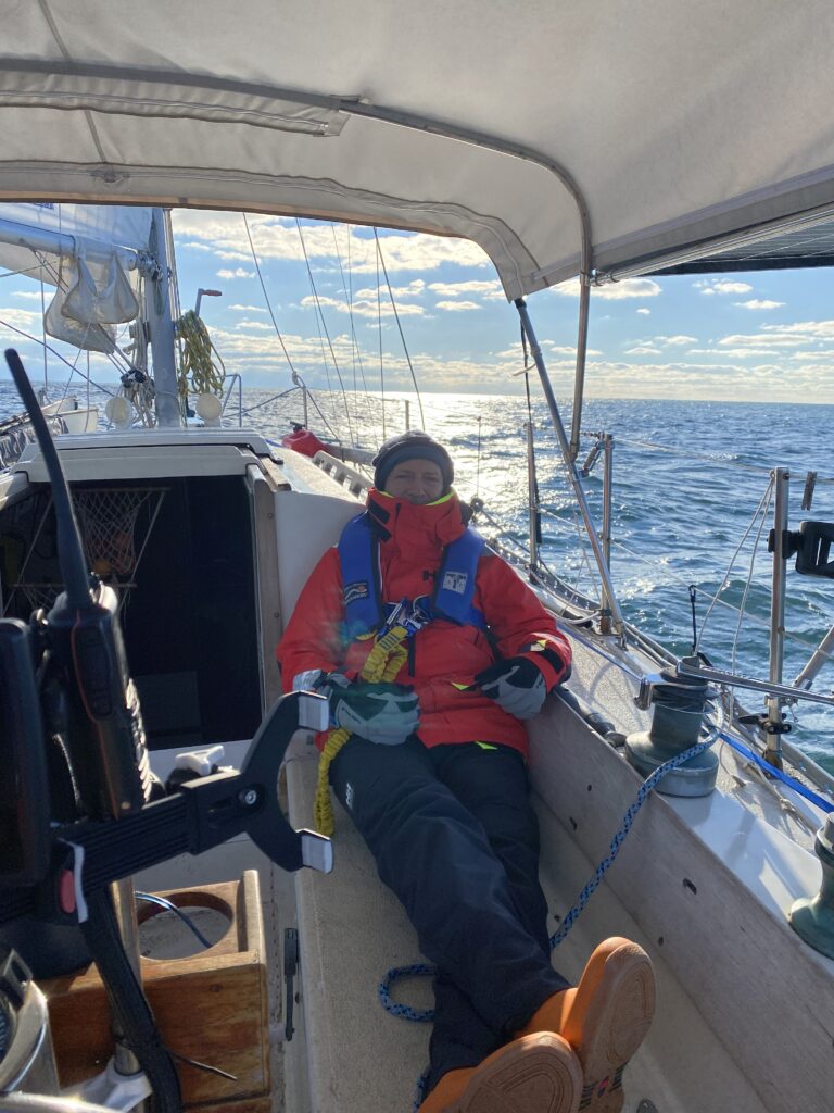
The sail through the night was uneventful, but very cold. We had decided on two-hour watches, and at sunset (which was around 5 pm that time of the year), we put that into effect. Basically, one person would rest/sleep/eat on their two hours off watch, while the other person monitored boat traffic, the wind vane, the weather, etc. The temperatures were in the mid-40’s, and I found that even with my three layers of fleece covered by my wind- & waterproof foulies, after two hours of sitting in the unprotected cockpit, I would get pretty cold. It was wonderful at the end of my watches to climb into my berth, turn on my electric blanket, and crash in my warm cocoon of a pilot berth. (Having to leave that coziness at the start of each new watch wasn’t as enjoyable, however!)
Tuesday, December 12th (Enroute from Beaufort, NC to Charleston, SC)
Tuesday was a cold but pleasant sailing day, but the weather wasn’t exactly as predicted. The original forecast had called for 6’ seas leaving Beaufort, slowly diminishing throughout the three-day passage to 4’-5’ seas. But we were experiencing just the opposite: The seas had been 4’-5’ on the first day, but they had been slowly, but steadily increasing ever since. Daylight brought us 6’-foot seas, and a slight increase in winds. The good news was that we were making better time towards Savannah, but the fact that the weather was not following the forecast was a bit unsettling.
Because we were 40 miles or so offshore and thus had no Internet connection, we were unable to update any weather forecasts or conditions through normal means. However, I did have my Garmin Inreach with me–a GPS tracker that also had limited texting capabilities through the satellite. We had previously arranged to get textual updates when offshore from Sean Motta (an experienced sailor who was back in Tampa and tracking us diligently), so we reached out to him via text that afternoon to get a weather update. The report we got back was surprising and quite a change from the forecast we had received before departing.
He texted:
TODAY NE 5-15 kt. Seas 3-6′
TONIGHT NE 10-20 kt. Seas 4-7′ with Shwrs.
WED NE 15 to 25 kt. Seas 4-8′ shwrs.
WED NIGHT NE 20-30 kt. Seas 6-10′
THU NE 20-30 kt. Seas 8-14′
THU NIGHT NE 20-30 kt. Seas 8-14’
Primary waves out of the SE at 7-9 seconds
This was not good news. Instead of having 10-15 knots of wind and 4-5’ seas the rest of the way to Savannah as the original forecast called for, the new forecast called for winds up to 8’ the next day, and as high as 10’ that night. As neither Nicholay nor I had been in 10’ seas before, we were not keen to experience them the first time at night. It would have been one thing if the forecasted wave period was 12 or 15 seconds, but at 7-9 seconds, it would be a very un-fun ride. Since Palarus was well beyond radio range at this point, we relayed this information to them via our InReach (they also had one). It was time to make a couple of decisions.
The main one was whether to continue to Savannah, or divert to Charleston, about 70 miles and 12 hours closer. We quickly decided that we didn’t want to continue to sail into Wednesday night so wanted to be “inside” before then. We decided to divert to Charleston and altered our course to starboard. Our calculations indicated that we would arrive there around mid-day Wednesday, hopefully before any of the big weather would affect us. We relayed our decision to Palarus, and they replied awhile later that they had also decided to head into Charleston. We planned to meet at an anchorage there the next day.
The sail throughout the night was again uneventful and cold. And, we sort of unofficially decided to modified our watch routine. Instead of two hours, we would each keep the watch until we were too tired or cold to continue. This resulted in longer watches (typically 2.5 to 5 hours) which gave the off-duty person much more and better sleep. We both preferred it, so we continued this type of watch rotation for the remainder of the trip’s night passages.
Wednesday, December 13th (Enroute from Beaufort, NC to Charleston, SC)
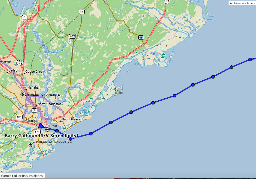
We arrived at the Charleston inlet around 10:30 am on Wednesday and proceeded in towards downtown to link up with Palarus. They had arrived some hours earlier and were already anchored across the channel from the city marina. We finally dropped the hook at noon after a passage of two days and 215 nautical miles. We spent the afternoon resting and enjoying the sunshine and a relatively balmy 55 degrees.
That evening, we all dinghied into shore to check out the town and have dinner. We walked about a mile to get to the quaint part of town and found a cool place called Henry’s on the Market that Jesse had been to once. Very classy place, with the entire roof turned into various patios, seating areas, and bars. It was also ridiculously expensive. Nicholay and I each ordered a Dark & Stormy (rum drink). We were very disappointed at how diluted it was and were very angry when we got the bill and discovered they were $17.50 each! The food was also just mediocre. Like so many popular American places these days, all show and no real quality. (Sigh)
Because the temperature was once again dropping into the low 40’s, and we were too tired to walk back, Jesse sprung for an Uber ride for us all back to the marina where we hopped into the dinghy and back to our cold, anchored boats, heading straight to bed to be rested for an early departure the next morning.
While at Henry’s, we had planned the next day’s trip. Because the weather was going to prohibit us going outside for at least another day, we would be taking the Atlantic Intracoastal Waterway (ICW). This would keep us in protected waters, weather-wise, but would require someone to be always actively on the helm as the channel was narrow. It would also require more precise navigation, especially for Palarus as her draft was 5’ 6”. (We wouldn’t have to worry about it as much in Mexicana, because with the center board up, her draft was only 3.5’.) Jesse had chosen as our destination an anchorage he knew about near St. Helena Island which was close to an inlet we could then take outside the following day if the weather permitted. It was about 40 miles away and should be attainable before dark. We would then reevaluate the weather and proceed offshore the following day, if possible, hopefully then making a 2-day passage to Jacksonville.
The only glitch in the entire ICW plan for the next day was the Wappo Creek drawbridge, a mile south of our anchorage. Its vertical clearance when closed was only 33 feet, so we would need an opening. Normally, that happened throughout the day on every hour and every half hour. The problem was that during morning and afternoon rush hour, the bridge remained closed. (The road it was on was evidently a main artery into Charleston.) We called the bridge tender that evening to confirm that the bridge would remain closed the next morning from 6:00 am to 9:30 am. He confirmed that but said that if we wanted an opening before that, we would have to be there by 5:55 am at the latest. Otherwise, we would have to wait until 9:30 am.
To make it to our anchorage before nightfall4—especially against the current that we expected for much of the day–we could not afford to wait until 9:30 am to pass the bridge. That meant getting up early enough to weigh anchor by 5:30 am then transiting the mile to the bridge in the dark to make the last opening before rush hour. But, transiting a relatively straight and short span of the ICW in the dark would be preferable to possibly hours of winding, unfamiliar ICW in the dark that evening. And, since it would be light around 7 am, we would have less than an hour after the bridge to navigate the ICW in the dark.
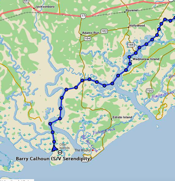
Thursday, December 14th (Charleston, SC to St. Helena Island anchorage) 40 nm
Surprisingly, everyone was up and ready to go at 5 am, so we weighed anchor on schedule and followed Palarus south into the ICW. It was dark and cold, with temperatures in the low 40’s. It was also windy, and would remain so all day, with winds between 10 and 15 knots. Luckily, they were out of the northeast, so would be behind us. In such conditions, a good hood was worth its weight in gold when at the helm! We transited the bridge on time and without a problem, then continued south with Palarus in the lead.
Nicholay and I had heard from many sources that the ICW in South Carolina and Georgia was very laborious and challenging. Not only did the channel wind all over the place, but it often went through desolate, marshy, unappealing geography. Add to that, uncharted shoals and strong currents (up to 2 knots) with each tide, and most people strongly recommended avoiding those sections if possible. We had planned to do so, but the weather had forced us inside, so we would have to deal with it. We had also heard many stories about shoals right in the middle of the channel despite the Army Corps of Engineers being responsible for keeping the ICW at least nine feet deep.
So the night before, Nicholay and I had proposed that Mexicana, with her 3.5’ draft, take the lead to sort of run interference for Palarus (who would follow at a safe distance with its deeper draft). If we encountered any shallows on our depth finder, we could inform Palarus in time to allow them to stop while we found a deep enough path around the shoal. But, in the morning, Palarus weighed anchor first and so ended up in the lead going down the ICW.
And then promptly ran aground about ½ mile past the bridge! The had been what seemed to us like the far-right side of (but in) the channel, when we suddenly saw them stop (which sailboats can’t really do), and so knew they were aground. We slowed down as we passed them to get a look, turned around into the wind and current, and anchored abeam them in the channel to offer assistance and determine how Jesse wanted to tackle getting off the bottom. (Normally, it is illegal to anchor in a channel, but because the bridge was closed for a few hours, we knew that nobody was going to be coming along.)
Like the first time they had gone aground, Jesse reported that he was in soft sand/mud, could feel the boat almost coming free, but wanted to wait 30 minutes until daylight to proceed any further. And the tide was coming up, which would help. That seemed like a good idea, but the wind and current seemed to be pushing them further and further out of the channel. Nicholay suggested they free themselves now and then just tie off to our stern to wait for daylight. The tide had come up just enough while these discussions took place that Jesse was able to break himself free with a few bursts of power from his engine. He then motored over to us, threw us a line, and we all just hung out for a half hour, waiting for day. Then, moving forward (at least until out of the shallows), Mexicana took the lead southbound.
The rest of the day was very windy and cold, but because the wind was behind us, we were able to unfurl the jib and motor-sail much of the time to give us an extra knot or so over what just the engine was able to give us. There were times when Mexicana and Palarus were motor sailing together in formation, with only 20 feet separating us. That was fun.
Surprisingly, the currents ended up being mostly in our favor, and with the extra speed from the motor sailing, we made great time. In fact, we ended up at our anchorage just after 1:00 pm!
That evening the Palarus crew came over for an early dinner so we could devise a plan for the next day. After the cold, winding, boring day in the South Carolina ICW, we were really wanting to get outside to make some distance south. The weather forecast looked like we’d have a window of moderate northeast winds and seas in the 5-6’ range until early in the morning Saturday, when a nasty low-pressure system would be coming up from the Gulf and crossing into the Atlantic right along our path. That gave us just enough time to make Jacksonville, a passage of 150 nautical miles if we left at dawn. Jesse wanted a bit more weather margin and suggested we depart earlier to give ourselves more time. But, once again we were going to have to balance the forecast winds with the tidal current when going out the inlet; it was supposed to be slack tide around 5:00 am, which would give us the smoothest ride out the St. Helena Sound inlet. But that wouldn’t give us the weather margin that Jesse was looking for at the tail end, so we agreed to depart at 2:30 am. The offshore winds were supposed to have calmed down enough by then that hopefully they wouldn’t be interacting very much with the outgoing tide. (This turned out to be a pipe dream!)
After dinner, Nicholay and I discussed how we would manage the watch schedule since we would be getting up in the middle of the night. Nicholay said he was comfortable weighing anchor by himself since he had been doing it solo for months, so we decided that I would just sleep through the departure and take over the watch when Nicholay needed relief. We got the boat as ready as we could for departure, including replacing the large Genoa foresail with a smaller jib due to the stronger winds we anticipated. We also put a reef in the mainsail so that we wouldn’t have to go on deck to do it in the dark while sailing. Then we both hit the sack.
Friday, December 15th (St. Helena Island anchorage to Sapelo Inlet anchorage, 85 nm)
The next thing I knew, I was wakened by Nicholay yelling down to me from the cockpit that he needed help. That had never happened before, so I knew something desperate must be going on. Still mostly asleep, I jumped out of my berth in my long johns and climbed straight up into the cockpit. My first impression was that it was cold (mid-40’s) and windy and we were obviously in some rough water as the boat was pitching a lot. Nick yelled that one of his solar panels had come loose and was getting damaged, and he needed me to take the wheel immediately, so I relieved him at the helm while he rushed over to tend to the panel mounted on the railing at the side of the cockpit.
I took the wheel and immediately realized I was totally disoriented. I was barely awake, had no idea what time it was, where we were, what direction we were heading, or even where I was supposed to go. Not having taken the time to grab my reading glasses, I could not focus on the GPS. Since I could barely make out the compass, I asked Nicholay for a heading since I was having to manually steer the boat, and he said that we were still heading out the inlet and to head southeast. It was then obvious that the offshore wind must be higher than forecast, that we had indeed encountered 5-6’ standing waves transiting the inlet, and that the rough waves had knocked the windward solar panel loose.
I was eventually able to make out some red and green lights (buoys) in front of us, and what I figured must be the white stern light of Palarus about 30 degrees off our starboard bow. As I got used to the motion of the boat and began getting oriented, I was able to point the bow between the red and green lights, and ignore Palarus, which I realized must have already exited the inlet and turned south. We had to continue until we passed the sea buoy (the farthest buoy offshore marking the entrance/exit to the inlet) before we could follow them, or we would risk running aground.
One thing I learned on this trip is that it can take a long time to transit an inlet! On the map, they appear short, but when measured they are often miles long. In fact, at first glance, I would have estimated that it would take about 30 minutes to pass through this inlet, but the fact was that it was almost eight miles long! And, in the kind of standing waves we were in, Mexicana was only able to make about 3 knots. That’s over two and a half hours of uncomfortable, teeter-totter action on the boat, with waves frequently breaking over the bow (causing spray all the way back to the cockpit). Add nighttime, cold, and strong winds, and it just isn’t what most people would call a lot of fun.
After what seemed like an hour to me still in my underwear (but was probably only 10 minutes), Nicholay had adequately secured the damaged solar panel and said he needed to go below to get something (not time-critical). However, at this point, I was already shivering uncontrollably. I also had no glasses, headlamp, or PFD/harness, so I said that I needed to go below first to get some clothes on and don my safety gear. So, Nicholay took over the helm and I went below to gear up. I then relieved him at the wheel, allowing him to do what he needed to.
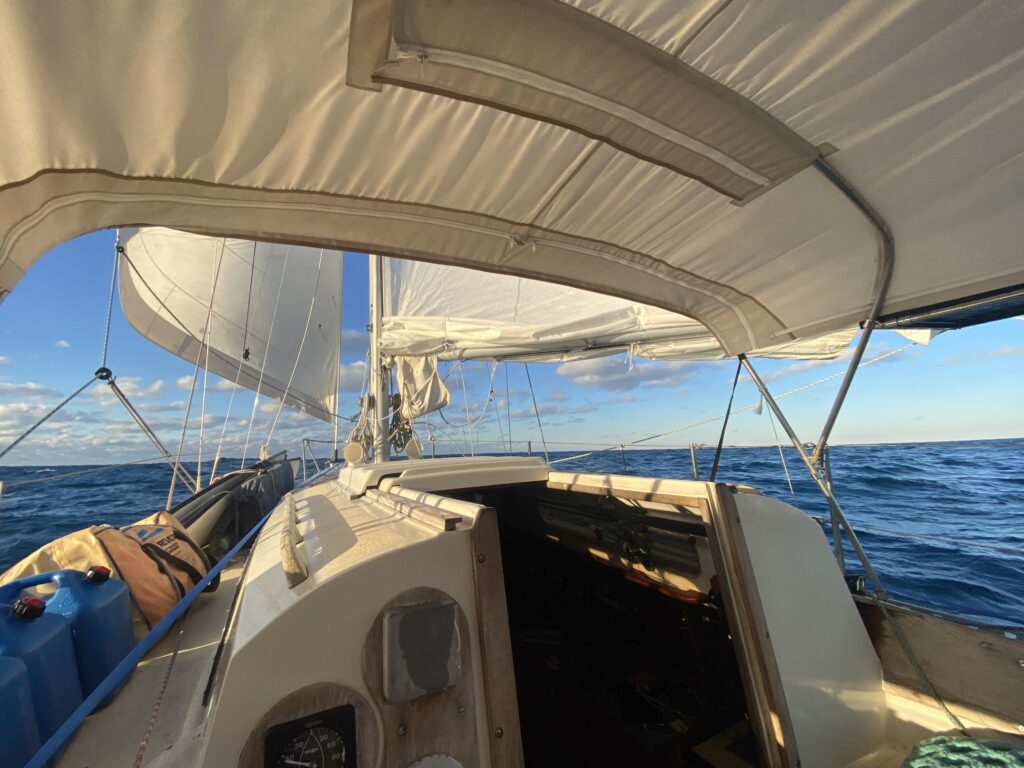
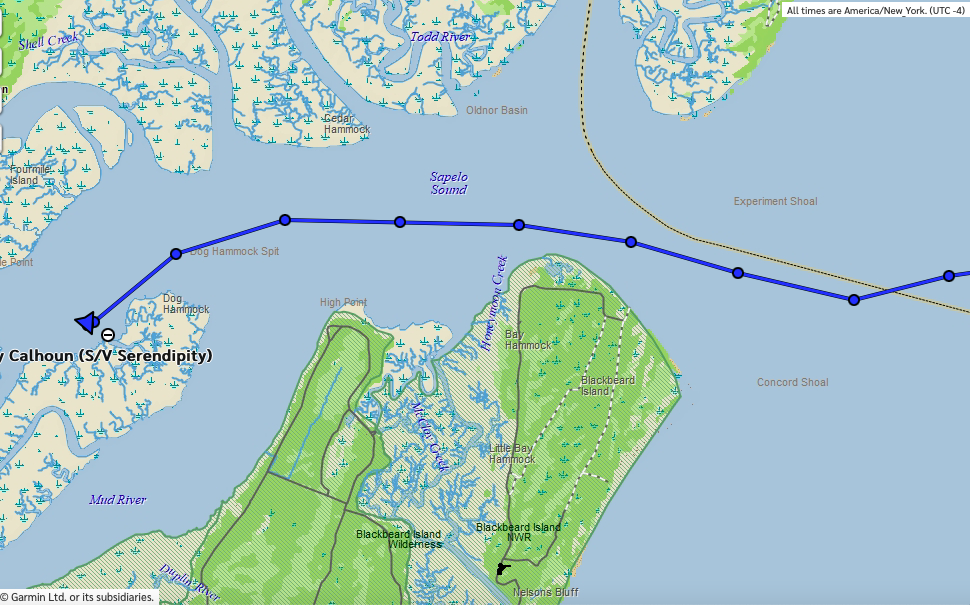
Eventually, we cleared the sea buoy, turned south, and the waves settled down. Winds were higher than expected, about 18 knots out of the northeast with 6-foot seas from the east-northeast with 8-10 second periods. We decided to take down the mainsail completely since it was still night and Nicholay needed to go below to get some sleep. However, even operating under the jib only, we had a decent speed as we headed for Jacksonville, now 140 nautical miles distant. The wind vane seemed to be keeping up with the current sea state.
As daylight arrived and Nicholay came back on deck, we decided to again hoist the main with a double reef to see if we could get a bit more speed out of the boat.5 We could also see that the seas had steadily increased in size. The local wind-produced waves were 3-4’ out of the northeast, while the 5-6’ swells were coming from due east, creating a little bit of a “confused” sea state.6 Everything was still acceptably comfortable and manageable, especially since the wind vane was able to keep up.
As the morning progressed and the winds increased, we watched as the waves increased to 6-8’ and then an hour or so later, to occasional 10-12 footers. This was the biggest sea state that either Nicholay or I had been in. The boat was handling them well, with just an occasional swell that would slap the side of the boat in a way that would dump some water over the side into the cockpit. The wind vane, though, was now having to work very hard to keep the nose on a southern course as waves and swell directions would hit the boat from random directions.
While we would have been okay continuing in those conditions (but not much more) in daylight, neither of us wanted to deal with it during the night. If the wind increased, we would have to change the sail plan (i.e., take down the main completely, etc.), and going out on the deck at night in those conditions would be sketchy. And, with the way the weather had been trending all day (worse than forecast), there was no reason to believe that things wouldn’t keep increasing as time progressed. The wind vane was just barely able to keep up with what we were experiencing now. Having to hand-steer the boat all night if the wind vane couldn’t keep up would have been challenging and exhausting in that sea state. Therefore, we decided to to try to get back “inside” before nightfall if possible. That decision was relatively easy.
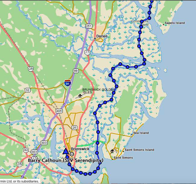
The more difficult decision was how to get inside because of the sea state, how far offshore we were, and the tide schedule. We didn’t want to turn 90-degrees and head the shortest distance to shore because of the wave direction. That would have put them right off our beam and the swells right off the stern, giving the boat a very uncomfortable and difficult-to-control motion that we knew the wind vane wouldn’t be able to handle (and through which neither of us wanted to hand-steer). And since it would realistically take 6-8 hours to make it to shore, even using the shortest route possible, we didn’t want to subject ourselves to that kind of ride for that amount of time. So, we turned slightly southwest at an acceptably-comfortable, more oblique angle and started evaluating inlets further down the coast. We happened to be passing a rather desolate area of Georgia between Savannah and Brunswick where most of the inlets were not recommended for other than those with local knowledge due to rapidly changing shoals. Some otherwise acceptable choices were deemed inappropriate because we would be arriving during an outgoing tide. (The standing wave problem.)
We eventually decided on Sapelo Inlet which seemed deep and well-lit, would have a slack tide at our ETA. It also had a reportedly decent anchorage about 5 miles inside the inlet along the ICW (which we’d be using the following day). So, around 9:00 am we altered course a bit more to starboard to head for the sea buoy off Sapelo Inlet, about 45 miles distant. We also texted Palarus to let them know of our decision. They eventually responded back that they intended to continue all the way to Jacksonville. With their bigger boat and faster boat and three crew members to share the watches, that might have been our decision, too. We wished them luck.
While the winds remained strong, as we got closer to the coast and the shallower waters, the waves did abate a bit, making our ride thankfully more comfortable as we approached the inlet just before nightfall. The transition though the inlet was uneventful, and we motor-sailed to the anchorage in the calm waters of Sapelo Sound, dropping anchor just after 6 pm, tired and glad to be safe inside.
In this area of the country, the anchorages always surprised me when we arrived. I had been used to anchorages in Florida and Alaska. In the latter, there was always protection from the wind from at least trees, if not mountains. In Florida, there was typically shelter from buildings or terrain, or at the very least, mangroves. This is what I would envision when looking at the chart in South Caroline and Georgia, but when we’d arrive, we’d find only marshland, so there was nothing protecting us from the wind, even if the water was smooth. We felt totally exposed, both to weather and privacy-wise. It was strange.
Knowing that we would likely be stuck somewhere for at least a day–perhaps two—due to the significant low-pressure system that was going to pass through the area starting the following evening, we decided we would try to find a marina the next night to hole up in. It would also give us a chance to do laundry, take a shower, reprovision the boat with food, water, and fuel, before proceeding further south. After some research, we decided to head for Brunswick, GA, the next day, which the GPS said was 41 miles via the ICW.
Saturday, December 16th (Sapelo Inlet anchorage to Brunswick, GA, 41 nm)
We woke up to another cool (low 50’s), overcast, and windy day (NE 10-15 knots). We contacted Palarus on the InReach to see if they had made it into Jacksonville safely. They had, but shared that they had a very rough ride, had to hand-steer the boat all night, all of them had gotten sick and were exhausted, and hinted that in hindsight, they would have gone inside for the night instead of pressing on. But, they were safe, and now days ahead of us. They planned, after the low passed, to continue south on their own (less Madison who departed the boat to return up north for the holidays). We would not see them again during the trip.
Knowing we had a long day and wanting to arrive at the Brunswick marina before they closed at 5 pm, we got underway right after sunup. Shortly afterwards, Nicholay noticed mushiness in the steering wheel. We pulled out of the channel and dropped the anchor so he could figure out what was going on. He discovered that the quadrant (the piece that connects the cables from the steering wheel to the rudder) was damaged and needed some major work. He thought this was likely due to the very active steering inputs which had to be made when we were offshore and the strain it had put on the system. This meant no going outside or anywhere else that would require more than gentle steering until it could be repaired. And repairs meant finding a machine shop that could fabricate the parts that Mexicana would need. We were hopeful we could find this at Brunswick, as it was an active commercial shipping and fishing hub for the region. So, we weighed anchor and continued towards Brunswick as planned.
The day was spent zigzagging through more marshy, boring ICW all the way to Brunswick. Once we had connectivity, we telephoned the marina to reserve a slip. The reviews for the marina were favorable and the price was quite reasonable (at least compared to Florida), so we were looking forward to the amenities.
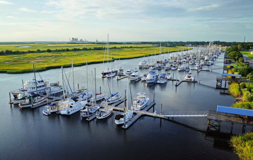
We ended up arriving around 4:30 pm and got into our slip. The dock hands were there to meet us, which was nice. We nosed into the slip at first, but after calculating the direction the strong winds would be coming from that evening, we decided to turn the boat around, and so did that using long lines and the dock hands again. Then they gave us a little briefing on the facility and a nice welcome packet with all kinds of information about the marina and Brunswick itself. (That proved very helpful as we would end up spending three days there.)
But first order of business was prepping the boat for the 35+ knot winds expected that evening as the low passed through. We put a bunch of extra dock lines on the boat and hung some fenders. Then it was immediately on to the second order of business: hot showers! It had been eight days since we’d had a real shower, and it felt like heaven. I also hadn’t shaved in that long, so looked ragged.
Being now all warm and clean and shaved, we decided to check out downtown, which was a just across the street from the marina. We found a warm pizza place for dinner and beer and just relaxed for a while. By the time we were done, it was much colder and had begun to rain, so we headed straight back to the boat and bed, intending to check out the town the next day if time permitted.
Sunday, December 17th (Brunswick, GA)
After breakfast and coffee, Nicholay began troubleshooting the quadrant. This required taking everything out of the starboard cockpit locker, which included sails, PFDs, fenders, lines, buckets, boat hooks, the ditch bag, and a bunch of other stuff which took up the entire cockpit and the side decks about halfway to the bow. While he disappeared under the cockpit, I tackled our six loads of laundry in the marina’s free laundromat. Sadly, during the wash, my lightweight Helly Hansen rain jacket disintegrated, so I would need to replace that.
I also needed some additional foot ware. Limited by the plane flight, I had only brought two: my Sperry sailing shoes and a new pair of sailing boots. Unfortunately, the first time I used the boots during our first offshore passage, I discovered they were too small, so I gave them to Nicholay (whom they fit). That left me with just one pair of shoes, which would inevitably get wet during the day, leaving me nothing dry to put on in the evening. That got old quickly, so I was determined to get something else while in Brunswick. Luckily, there was a West Marine, and it was in the same shopping center as the only grocery store in town, Winn-Dixie, about a mile-and-a-half walk away. I decided that walking for groceries and clothes shopping (for the exercise) would be my plan after laundry.
Unfortunately, the West Marine turned out to be quite small and didn’t have a large selection of shoes, so I ended up getting a nice pair of flip-flops (for $75!). They did have a decent selection of rain jackets, and so I picked up one of those for $100! Not money I was expecting to have to spend. But, both were essential, and my options were very limited. I then walked across the parking lot to Winn-Dixie and did some real-time, on-the-phone-with-Nicholay grocery shopping to ensure we had the right provisions. Then I took an Uber back to the boat and stowed everything away.
In the meantime, Nicholay had determined exactly what parts he needed to replace on the quadrant and had learned there were a couple machine shops in town which he would call in the morning (Monday) to see if they could do the work. We ate dinner on the boat that evening, realizing we were pretty much stuck in Brunswick until we could get the quadrant fixed.
Monday, December 18th (Brunswick, GA)
We woke up to a lot of rain and cold wind as the front was still passing through, but by 9:30 am or so, the rain had stopped, and the sky began clearing. We were looking forward to the mid-60’s weather and sunshine that was forecast for the day. Nicholay started making phone calls to machine shops, initially without much success. While waiting for call backs, he began experimenting once again with the tiller autopilot. He had dug out the emergency tiller7 to troubleshoot the quadrant issue and it dawned on him that perhaps he could attach the tiller autopilot to the emergency tiller instead of the wheel (which is what seemed to be the issue since it wasn’t designed to operate a wheel). So, he fashioned an autopilot-connecting pin to the emergency tiller, intending to test it out the next time we were underway.
Later in the morning, one of the machine shops finally got back to him and said they were willing to look at the part to see if they could make it, but even if it could, it would likely take a few days. So Nicholay grabbed one of the marina’s free bicycles and headed to the machine shop, about 4 miles away. When he returned, Nicholay reported that the machine said they could do the repair. Nicholay had used all his charm to convince them of our desperate situation.
Also, by this point, I had inherited a cold which Nicholay had had for a few days, so biked to Walgreens to get some Zicam and cough drops for us. It was a brisk but pretty day, and it was wonderful to be out working my legs and seeing Brunswick in the sunshine.
While I was at Walgreens, Nicholay phoned to say that the machine shop had called back to say that they were done with the part! His charm had evidently worked! Terrific news, as it meant that we would likely be able to leave the next morning. Even though the marina was inexpensive by Florida standards, it was still costing Nicholay $90/day, so the sooner we could get the quadrant repaired and get out of there, the better. Nick decided to take an Uber to the machine shop and back since I had the bike.
When I got back, he was working intently on the quadrant, and I began looking at weather forecasts. The weather seemed to be continuing the trend that had been with us almost the entire trip so far: moderate winds out of the northeast. The seas were marginally acceptable for an offshore passage, but we thought it prudent to not test out the quadrant repairs offshore, so elected to motor another day south in the ICW. Wanting to get as far as possible, and now being well rested, we decided we would get up early, fill the water tanks, and be at the fuel dock when it opened at 8:00 am to top off our fuel tank.
Tuesday, December 19th (Brunswick, GA to Broward Creek Anchorage, 60 NM)
We woke up to a sunny but cold day, with temps in the high 30’s and winds out of the northeast at 10-15 knots, as forecast. We got to the fuel dock about 8:30, topped off the diesel tank, and departed for a destination yet unknown to the south around 9:00 am.
The first part of the ICW that day was like what we had already experienced: Marshy and winding, cold and windy, but at least it was sunny for a change, and that seemed to make everything wonderful. Things got even more interesting later in the day as we approached the more-populated areas near Amelia Island. Particularly interesting was passing King’s Bay Submarine Base. Lots of interesting and huge submarine “hangars” and restricted areas.
A bit further south we encountered a long straight stretch, so we put up the jib to motor sail and give ourselves a little boost of speed. Shortly thereafter, the ICW took us across St. Mary’s inlet, a large inlet just north of Amelia Island. The offshore winds combined with an outgoing current gave us a rough ride for about 30 minutes until we could get in the lee of Amelia Island on the other side of the inlet. Not what we expected in the ICW! But once past the inlet, things calmed down again as we furled the jib and continued motoring south.
We were determined to get as far south as possible—to be as close as possible to a suitable inlet in case we wanted to go offshore the following day –and so pushed through into the dark heading toward what was reported to be a suitable anchorage called Broward Creek, right in the middle of a marsh about halfway between Fernandina Beach and Jacksonville. This was a very small spot, big enough for only one boat, just to the side of the channel in a very small estuary from a creek (evidently called Broward Creek). The challenge when anchoring would be dropping the anchor far enough away from the channel to be legal, but not so far that we’d go aground when the tide and current changed direction during the night. Since it was dark, we were using both the boat’s built-in GPS and the Navionics software on my iPad to navigate as we finally approached the anchorage at idle speed.
As was Nick’s custom, he entered the anchorage area and then circled around a bit, keeping an eye on both the GPS and the depth sounder to get an idea of the layout of the bottom to decide where to drop “the hook”. Once he had decided on a spot, he would approach it slowly from downwind (or down current, if the current were stronger), then put the engine in neutral and coast the final 20 or 30 feet. By this time, I would be up on the foredeck, ready to drop the anchor at his command.
We followed this procedure at this anchorage, and when it got to the point where I could tell that he was making his final approach, I noticed we weren’t slowing down. I didn’t understand why until I heard him yell that he couldn’t get the engine out of forward gear! This wasn’t particularly dangerous, as the engine could just be turned off and the result would be the same as putting it in neutral (as far as the action of the boat was concerned). However, it was nice to be able to stop the boat quickly if needed by throwing it in reverse, and to “back down” once the anchor was dropped to assist with setting it. Both of these required reverse gear, of course. If it had been the middle of the day cruising down the ICW, we would have probably just kept chugging while Nicholay went below to troubleshoot. But, as we had been sailing all day and were very tired and were at our anchorage, we decided to just cut the engine, hoped the anchor would set without using reverse, and troubleshoot the problem in the morning.
So, we circled around again, Nick turned off the engine, and we slowly coasted to a stop, heading into the wind and the current. As the wind began pushing us backwards, I dropped the anchor and payed out chain as we were pushed back until we had the right amount of scope out for the expected winds. Using the GPS and landmarks, we verified that the anchor was holding, then we had some dinner and went to bed planning to troubleshoot the engine in the morning.
Wednesday, December 20th (Broward Creek Anchorage to Pine Island Anchorage, 27 nm)
The next morning, we woke up to a cold, 40-degree-but-sunny morning. Nicholay began immediately troubleshooting the transmission problem while I gathered weather information. He quickly determined that the bracket on the engine to which the gear shift cable attaches had fallen off! Both mounting bolts had apparently just worked themselves loose. This he didn’t understand since he had recently replaced the transmission, reinstalled the cables, and had tightened everything down appropriately.
Either way, if the bracket could not be remounted, we would not be able to shift gears. This was a problem because it took very specific, 8 mm bolts, which weren’t really used anywhere else on the boat, and for which he had no spares.
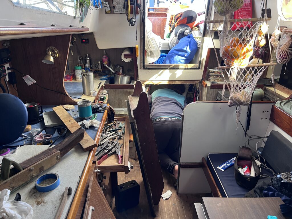
So, as he tried to determine how and why the bracket had some loose in the first place, I began blindly fishing around in the bilge with a 3-foot-long “grabber” hoping that I might be able to snag one or both bolts. Of course, this meant once again taking everything out of the starboard cockpit locker! I was eventually able to find one of them (in addition to a lot of other interesting things). Nicholay was able to temporarily jury-rig the bracket where other bolt had been and felt the bracket would be good enough until we got to a hardware store where he could get some 8 mm bolts.
But, while he had been doing this, he noticed that many other things on the engine had worked themselves loose—things he was sure had been torqued appropriately before the trip. He began to realize that he had a more systemic problem—probably an engine vibration–that was causing all these fittings to come loose. One of the more critical components this was affecting was the alternator; one of the two bolts which mounted it to the engine had sheared in half, with half stuck in the hole, which he could not get out. He ended up tightening the remaining bolt and then lashing the alternator to the side of the engine compartment with a rope to give it as much support as possible. After he finally got that straightened out and everything else tightened to his satisfaction (about two hours after he had begun), we were finally ready to start the engine, weigh anchor, and continue another day’s journey south in the ICW. (The northeast winds were still causing seas that were too high for us to venture offshore.)
While Nick observed the engine as I cranked it, he quickly yelled at me to stop and shutdown the engine. Right in front of his face, the oil filler cap had shot off the top of the engine right after it had started turning over. What now?! It made me very sad to see the look of frustration on Nick’s face. This was an entirely new problem! So, he began troubleshooting that issue, trying to determine what was causing so much blow-back that it would shoot the oil cap right off the engine! By hand-cranking the engine slowly with a big socket on the crankshaft nut, he eventually was able to determine that one of the cylinders had no compression; perhaps one of the valves was stuck open? Yet, they all appeared to be opening and closing the same amount.
After he tried a lot of things I didn’t understand, he finally ran out of ideas to fix it. But, as we were in the middle of nowhere, he wanted to determine if the engine could be run in its current state so we could at least get to somewhere with better facilities to repair it. Getting towed was always an option, but before we made that call, Nicholay decided to make a different one to Jeff Hoots, the engine mechanic he had worked with for years at Island Harbor Marina back in Dunedin. They talked and troubleshot on the phone for a while (thank goodness we had connectivity!), eventually agreeing that the engine could be run on two of the three cylinders with the symptoms it was displaying without causing further damage. We would just not be going very quickly.
So, with Nicholay again watching the engine as I cranked…it started up and ran just fine! The problem had vanished! Not waiting for the engine to change its mind, and it by now already being noon, we quickly weighed anchor and headed south down the ICW, now with only 5 hours of daylight left. The wind even inshore had risen to about 15 knots. The only good thing was that temperature had also risen to almost 60 degrees, the highest we had seen since leaving Oriental nine days prior.
The engine seemed to be operating fine as we approached Jacksonville and the St. John’s River inlet about an hour and a half later. The tide was incoming as we crossed the river, and the two-knot crosscurrent was formidable. I was having to aim the boat’s heading about 45 degrees to the left of where we needed the boat to go, like flying a slow plane in a very strong crosswind.
As we made it across the river and back into the ICW, the current moved off our stern giving us a boost of speed of over seven knots over the ground. After having gotten such a late start, we were grateful for any boost in speed because our choices for anchoring for the evening were quite limited. In about an hour, we would be approaching a 12-mile, very narrow stretch of the ICW where there were no anchorages. That meant we would need to anchor either before it or after it. Before it meant wasting another two hours of daylight, but waiting until we were on the other side meant possibly trying to anchor in the dark, something neither of us relished, especially after our experience the previous night. But, ever relishing excitement and adventure, we decided to continue to the Pine Island anchorage on the far side and chance anchoring in the dark!
With the current continuing to offer some help, and the wind behind us, Nicholay decided to set his new spinnaker, which might give us another knot of speed to get us to Pine Island before dark. While I steered, he pulled the spinnaker bag out of the cockpit locker, dragged it up front, and began the laborious process of mounting the spinnaker pole, the lines which managed the sail and pole, and then finally the sail itself. As we entered the very narrow section of the ICW, the spinnaker was flying beautifully, and we had gained almost an extra knot of speed.
This section of the ICW was rather strange. As I mentioned, it was very narrow and as straight as an arrow as far as the eye could see. The right side was all unimproved land, but the left side consisted of mile after mile of beautiful and large homes, each with its own dock and boat (or two) projecting almost halfway into the ICW. Because it was so straight, I was able to just lean against the backstay and steer with my feet, which was very relaxing, but required almost no movement of my body. Mile after mile. The temperature had dropped again, and I was getting cold. Because it was only a few days before Christmas, most of the homes were beautifully decorated, many had multiple chimneys, and some even had pools with hot tubs in the backyard. I had to continually fight a very powerful urge to just turn the boat up next to one of those homes’ docks, tie up, go up to the house, knock and the door, and ask if we could just sit in front of their fireplace for an hour to warm up! (I wonder what the reaction would have been.) But, instead we pressed on and eventually exited the narrow, straight section to find the ICW once again winding through wild marshlands.
As we left civilization behind again, I began to get a bit nervous about the sail plan we had up. Nicholay was up on deck constantly trimming the spinnaker, compensating for the shifting winds when we’d pass groves of trees or other obstacles. Because we weren’t offshore, he wasn’t tethered to the boat. We also still had a current behind us. My knowledge of spinnakers is very limited. They also intimidate me because they are very large and can easily overpower a boat or, as I had seen several times when racing, can collapse into the water during a lull in the wind, causing major problems as it fills with water and becomes very difficult to retrieve. In addition, this specific spinnaker was a “symmetrical” spinnaker, meaning that it had to be held out to the side with a large (12’ long) pole. The pole itself had to be held up with a topping lift line, and the sheet then run through the other end of the pole. To put it simply, it was quite a complicated setup, and typically needed to be constantly managed by at least two people. My worry was that if Nicholay fell overboard, I would have no clue as to how to take it all down while trying to steer the boat in the ICW without an autopilot, it possibly causing the boat to broach or damage the shrouds if it got backwinded, etc. And, I would have to either turn the boat immediately to pick him up out of the water, which would likely cause a lot of significant damage to the rig, or take my time to figure out how to get it all down while running back and forth between the foredeck and the cockpit, unable to stop, and getting further and further away from Nicholay, who would be treading some very cold water—or at best, trying to swim to one of the marshes. I could see me being a mile or more away before I’d be able to secure the spinnaker and turn around. Add to those concerns, nightfall was approaching quickly. So, I was very glad when we finally got Pine Island in sight, and Nicholay began the 10-minute process of dousing the spinnaker.
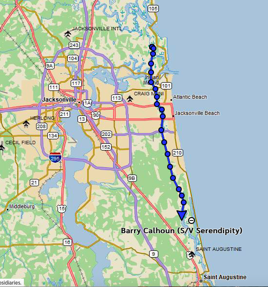
Our planned destination was an anchorage on the far side (downwind) of Pine Island. As we got closer, we could see that it was an actual island with actual terrain, and that we’d likely be sheltered from the wind for a change! We arrived just before sundown, and sure enough, found a spot that protected us from most of the wind.
We spent the evening having dinner, downloading and reviewing weather forecasts, and deciding whether or not to transition the next day to the outside via the St. Augustine inlet, which was just 10 miles to the south of us. Nicholay was confident about the repairs to the quadrant, and so was willing to chance going outside and leaving a lot of the steering to the wind vane. Although we both could now feel a significant engine vibration when sitting at certain spots in the cockpit, it had done fine all day, no doubt due to Nicholay occasionally having to tighten different parts of engine to keep more parts from falling off! At least offshore, we’d be able to give the engine a rest.
Indeed, the weather looked very favorable for a passage all the way to the Fort Pierce Inlet about 165 miles south, which was the closest inlet to the entrance of the Okeechobee Waterway (canal) we would be taking across the state. Using the canal had been our intention since departing as it would save us several days compared to going all the way round the southern tip of the state. We calculated that if we departed early enough the next morning and the winds remained as forecast, we would be able to just barely make the Fort Pierce Inlet before dark the following afternoon and before the ebb tide when the current would be against the winds. So, that became our plan, barring any major changes to the forecast in the morning.
Thursday, December 21st (Pine Island to Fort Pierce Inlet, 180 nm)
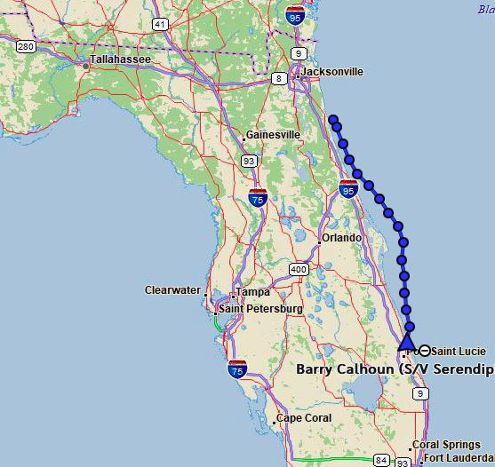
We woke up early to a beautiful, sunny day with light winds. The forecast called for temperatures that day in the mid-60’s, which we were very excited about. A quick weather review showed us that nothing major had changed in the forecast, so we quickly weighed anchor and began motoring south down the ICW towards St. Augustine. About an hour and a half later, we turned east to head out the inlet, and I think both were surprised about how rough the transition to the outside turned out to be. This inlet was known to be a bit tricky, with shoals shifting so much and so often that none of the buoys defining the channel were marked on any charts! Most of the reviews we had read said that it was not an inlet to experience first at night just for that reason, but that it was nonetheless well-marked with buoys and straight forward. We did find it straight, simple, and well-marked, so not an issue, navigation-wise, during the day. However, we had hit it on a flood tide, and the incoming waves were higher than we expected, especially considering the winds were only about 8 knots out of the north. We were only able to make about 3 knots against the four-foot waves and had spray coming into the cockpit a few times. It had been so long since we had been outside that we were a little bit unprepared. We quickly dogged the hatches, secured equipment, and put on our harnesses.
After about 45 minutes we cleared the sea buoy and turned south. Once clear of the inlet, the waves calmed down considerably. It appeared that the forecast was accurate with winds 8-15 knots out of the north, wind waves low, and swells six feet with long periods. It was also the warmest day we had yet experienced. Everything indicated that we would have a pleasant ride south over the next day and a half.
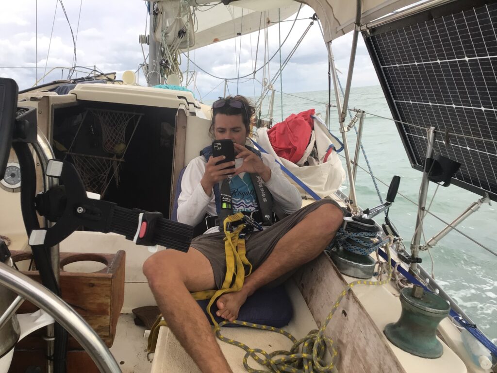
In fact, the winds were almost too light at times, threatening our schedule, so Nicholay opted to set the spinnaker for a few hours in the afternoon, which boosted our speed a bit and got us back on schedule. Nicholay was very excited to do so since this was the first time he’d used a spinnaker on Mexicana offshore. And because he was tethered to the boat this time, I wasn’t as nervous about having the spinnaker up, either.
However, as evening approached, we took it down as the wind was getting shifty, and we didn’t think it safe to have to deal with the spinnaker in the dark.
The sail through the night was uneventful, with the wind vane doing an acceptable job of keeping us on course. During the early morning hours, we passed Cape Canaveral and although we could see something brightly lit up on each of the launch pads—even from 15 miles offshore—we unfortunately didn’t witness any launches.
Friday, December 22nd (Enroute from Pine Island to Fort Pierce Inlet)
We were pretty much on track to beat the tide and nightfall into Fort Pierce until the winds got light and shifty and even almost died mid-day. We tried getting the spinnaker up, but as soon as we did, a big gust of wind appeared out of nowhere and started overpowering the boat, so we took it down. And the wind died again. Very frustrating. So, we sort of meandered towards Ft Pierce, with the wind vane not able to keep up very well, making the sailing a bit tedious.
By late afternoon we were approaching the inlet and could see some very dark clouds building just offshore. Having regained Internet connectivity, our radar app showed that there were three significant cells heading right for the inlet, and it looked like they would be arriving right when we were. Of course! And since we were behind schedule due to the half-day of light winds, we would also be arriving just after dark, and now also heading into an outgoing tidal current. It was going to be a triple-whammy!
We were moving very slowly by this point, but Nicholay did not want to start the engine any sooner than we absolutely needed to because of all the problems it had been having; he wanted to save it for when we would need it to get through the inlet. The only way, then, to avoid the cells would be to slow down and hopefully wait for them to pass. But the longer we waited, the faster the outgoing current would become (and hence the higher waves in the inlet). Also, it was hard to determine, the way the cells were moving and forming, if more wouldn’t just keep appearing anyway, following in a line right behind the ones we could see. So, we forged ahead toward the inlet, the skies rapidly darkening as the storms started overtaking us while the sun sunk below the horizon.
As we got within a couple of miles of the entrance, Nicholay took down the sails and started the engine with me at the helm. To save time, I steered toward an intercept of the channel as close to shore as the shoals would permit instead of going all the way around the sea buoy. We were now looking for specific navigation lights as darkness had fallen. Then the rain started.
About 30 minutes later, as we were ready to turn to starboard into the channel, Nicholay took over the helm while I backed him up with navigation on the iPad. Thankfully, the channel was well-lit and well-marked, although as the cells overtook us on the way in, visibility decreased significantly in the rain showers. The waves also built up to about four feet as we approached the narrow part of the inlet causing the boat to get very squirrely. But Nicholay did an excellent job keeping the bow straight and us inside the channel. It was a rather unwelcome and wet couple hours of stress at the end of an otherwise very pleasant passage, but we were thankful that we made it through the inlet without any significant problems.
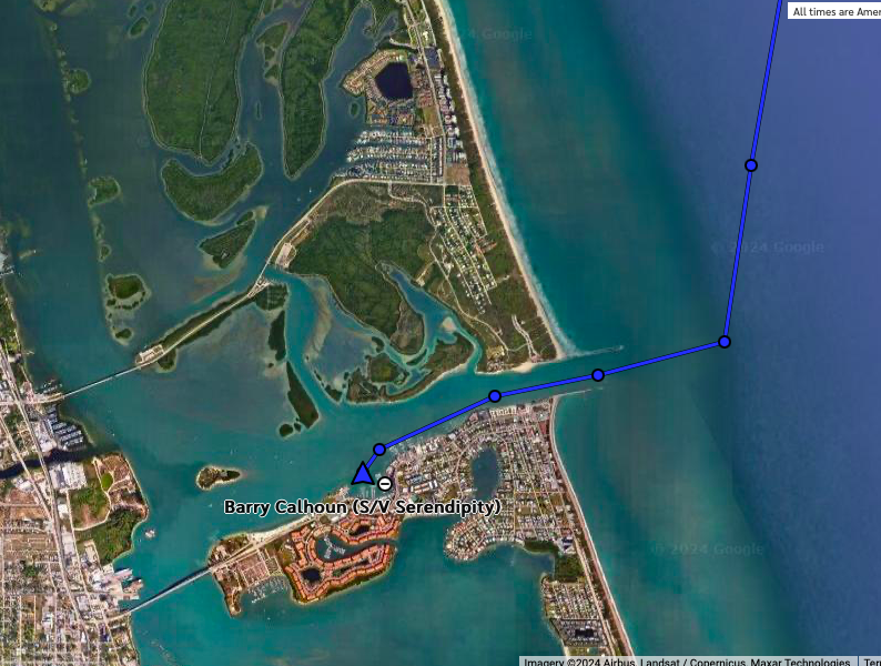
We had no desire to start navigating the ICW at night and were tired from the passage, so decided to grab the first spot we could find at the anchorage in front of downtown Fort Pierce. As we crossed in front of a very handsomely decorated and lit downtown, everything turned glass smooth, and the rain stopped. We dropped the hook, had dinner, and went to bed content with the knowledge that we had probably not only accomplished our last outside passage of the trip, but were technically now in South Florida and could expect warmer relative temperatures for the rest of the trip. It felt like we had reached a significant milestone.
Saturday, December 23rd (Fort Pierce, FL to Stuart, FL, 27 nm)
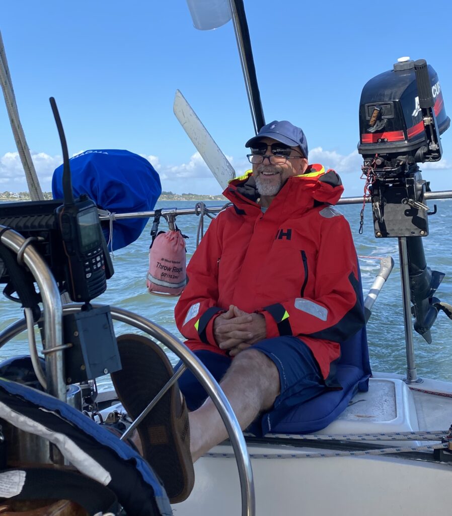
And, we were not disappointed, waking up the next day to almost 70 degrees, glorious sunshine, blue skies, and, of course, palm trees! We were back in Florida, baby, and it was great! Instead of two or three layers of fleece and foulies, this morning we put on shorts, T-shirts, and flip-flops! Glorious to feel the warmth of the sun again after almost two weeks of cold!
Our destination for the day was Pendarvis Cove, just to the west of downtown Stuart where a cruising couple, Schyler and Laure, for whom Nicholay had done some work in Oriental were anchored. They had graciously invited us to dinner on that night their boat, so we planned to anchor next to their CSY 44 Ocean Cowboy.
This would be a relatively easy 30-mile jaunt down the ICW, so we took our time getting ready in the morning, relishing the warm weather. After breakfast and Nicholay giving the engine another thorough look over, we weighed anchor around 10 am and headed south, once again on the ICW. (Goodbye, Fort Pierce! I’ll always have a good feeling about you!) The ICW here was very straight and easy, although a bit boring just because it was so wide most of the way. We did put up the jib to motor sail and were doing a nice six knots most of the way.
Just before 2:00 pm, we reached the mouth of the St. Lucie River, turned a hard right into it and then another hard right turn back north to follow the river around Stuart.
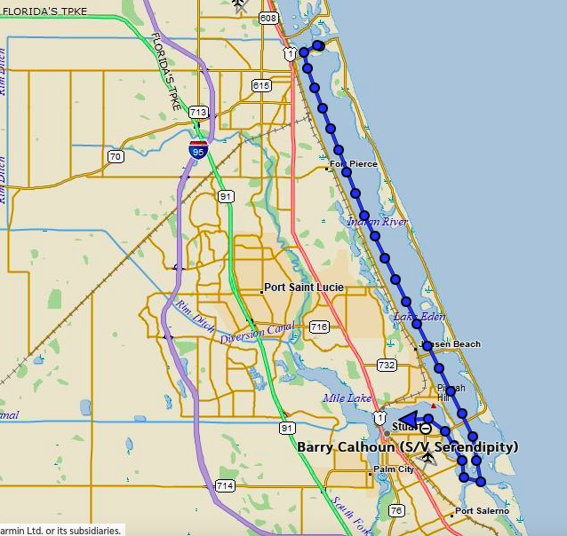
Everything seemed warm and sunny, and the colors just popped! I had forgotten how stunningly vivid the Florida greens and blues could be when the sun was shining through a cloudless sky! We spent the next hour competing for space in the channel with a lot of holiday boaters out enjoying the day as we worked our way upriver through one of the most beautiful waterways I’ve experienced. The homes on the shores were gorgeous, as were the boats that we passed. That five-mile jaunt up and around Stuart in the St. Lucie was my favorite part of the trip. Not only was it gorgeous, but I knew that the main challenges of the trip were over (the cold and offshore sailing), and that the rest would consist of the interesting chance to navigate the Okeechoobee waterway next, and then the comfort of being back in familiar waters on the other side as we worked our way north back home to Tampa.
However, we were not to our anchorage, yet! To get there, we would have to navigate three bridges, all within a couple hundred yards of each other. This also happened to be at a point where the St. Lucie River narrows to only a tenth of a mile (which is no doubt why they built the bridges there!) and makes a 90-degree left turn, making it difficult to see the situation at the bridges until it is almost too late to make any decisions about them.
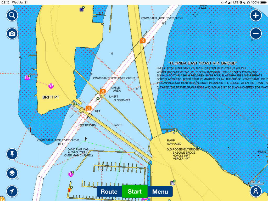
The first bridge, called the New Roosevelt Bridge wouldn’t be a navigation issue as it was a fixed-bridge 65 feet high. The second bridge, 500 feet past that, was a railroad drawbridge called Britt Point Bridge. Normally, railroad draw bridges are kept open because of the infrequent passage of trains; the bridge is lowered for the train and then raised back up after the train has passed. However, this bridge was down for some reason, so we would have to wait for it to open before we could pass.8 Of course, we didn’t know that, because it was around the bend and out of site until we were almost under the New Roosevelt Bridge. The third bridge was called the Old Roosevelt Bridge on the chart, but the bridge tenders seemed to be calling it the Stuart Bridge. This added yet more confusion to the situation. This bridge was a low drawbridge that was only 250 feet after the railroad bridge. Both drawbridges would have to be opened for us to make it through to our anchorage.
Drawbridge tenders are notorious for making sailboats come all the way to their bridge before they start the opening process (which can take almost five minutes), even after being given plenty of notice; they seem to get joy out of making boats wait. This causes the sailboat to have to either turn off the engine and sit in place if there’s space where it won’t block all the motorboat traffic (who don’t need the bridge to open), or if there is a lot of traffic or a current, to motor around in circles.
But this area approaching the bridges—and especially in-between the Britt Point Bridge and the New Roosevelt/Stuart Bridge—had no room to maneuver. To add to the danger, there was a steady parade of bumper-to-bumper motorboats streaming under the bridges in both directions, eliminating any chance of us motoring in circles to wait on the bridges. If the bridge tenders didn’t work together to get both bridges up by the time we got there, it was going to get very dicey, indeed!
As we slowed down, turned the corner, and immediately passed under the first bridge, we got our first visual glimpse of the actual situation. It was much worse than even it had appeared on the chart! There would soon be no way to turn around, no way to maneuver. It felt to me like we were getting sucked into a black hole and would soon be completely at the mercy of the bridge tenders. Fortunately, they seemed to know their business, and we watched with relief as both bridges opened just in time for us to get through. This was obviously a ballet they performed many times a day.
On the other side of the bridges the river opened up into Pendarvis Cove, in between Palm City to the west and Stuart on the east. This turned out to be a large, protected, and beautiful anchorage, used by many cruisers as a final prep spot before venturing to the Bahamas and other locations south.
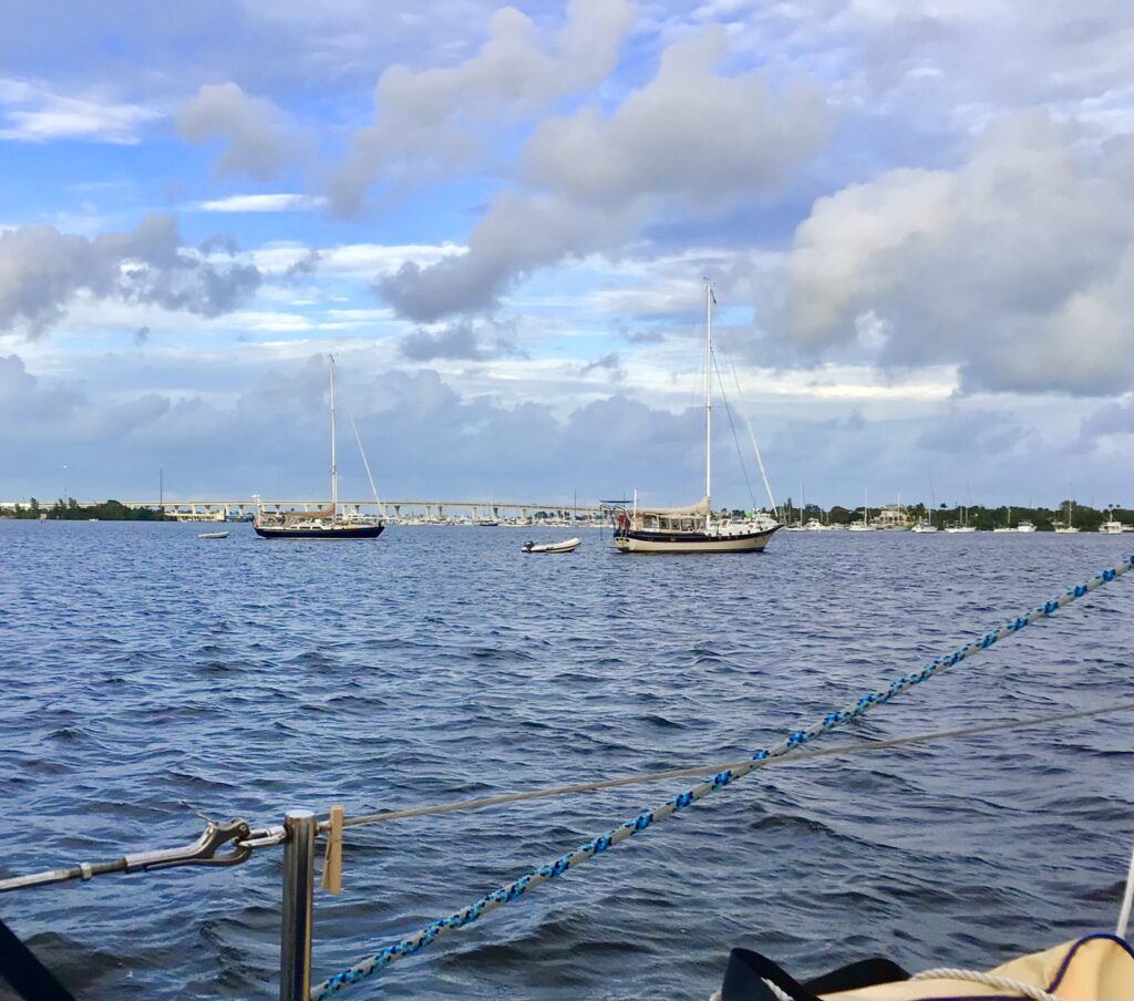
We found Ocean Cowboy in the anchorage and dropped our hook right next to her around 3:30 pm. Schyler soon came over in their dinghy to say hi and to offer us a ride to shore to dump our trash and make a quick grocery run. He also expected us for dinner and said that we were welcome to take hot showers aboard their boat before dinner! It now having been four days since our last shower, that sounded very enticing!
He took us across the cove to the city’s free dinghy dock, giving us the low down on Stuart, the local marina, and the local policies. It sounded like a very cruiser-friendly town. The dinghy dock was at Shepard Park, a small city park/playground right off Route 1 in Stuart. From there, it was a 10-minute walk to Publix, so Schyler dropped us off, promising to return when we called him.
It was strange to be back in civilization again, after having been living on the hook for so long. Even Brunswick had been a sleepy little town. So, walking next to the loud, busy, six-lane road was sort of a shock at first. So loud! But, it felt good to stretch our legs during the ½ mile walk to the grocery store.
By this point, seeing how cruiser-friendly the place was, and because there was another cruising couple that Nicholay knew from Oriental anchored on the other side of Stuart who had invited us to spend Christmas with them, Nicholay had decided that we would stay put here through Christmas. So, we purchased groceries with holiday celebrations in mind, and walked back to the park where Schyler was waiting to take us back to Mexicana.
After reprovisioning the boat and gathering our toiletries, he picked us up again to take us to their boat for a shower and dinner. Ocean Cowboy was an impressive CSY 44, a serious cruising boat. They had been making a lot of upgrades for the last few years with the intention of finally sailing to the Bahamas in a few weeks. They had just filled up their 400 gallons! of freshwater, so had plenty to allow us the hot showers. Afterwards, feeling all warm and clean, we gathered in their very comfortable and cozy, enclosed center cockpit for a very nice dinner and conversation into the night. Schyler took us back over to Mexicana around 10 pm where we hit the sack.
Sunday, December 24th (Stuart, FL)
After a leisurely wake up and breakfast, we made plans to head back into town to do more errands. Nicholay was hoping to find a hardware store to find the 8 mm bolts that he needed for the engine, especially important since we would be motoring for at least the first three days through the Okeechobee Waterway when we resumed our trip. While he was doing that, I planned to knock out a couple loads of laundry and grab a few groceries we had forgotten to buy the day before. I also wanted the chance to do some yoga at the park.
But first, we had to assemble and launch Mexicana’s dinghy. We hadn’t needed it yet on the trip (using Palarus’s and Ocean Cowboy’s dinghies), but we would the next few days to run our errands and visit other people in the anchorage (as we planned to do Christmas morning). It took both of us about 20 minutes to get it assembled, drop it in the water, and mount the motor.
We ended up getting everything accomplished except for finding the engine screws. Evidently, the “hardware” store had very little actual hardware—and none that Nicholay needed. I got two loads of laundry done for $20—the most expensive laundromat I’ve seen by far! The rest of the day was spent relaxing. We celebrated Christmas Eve by concocting some holiday drinks, turning on the little lighted, folding Christmas tree that Nicholay had on the boat, and playing Christmas carols on the boom box.
Monday, December 25th (Stuart, FL)
We had a nice Christmas breakfast, then made some hot homemade apple cider & rum using a spice packet that Alek had gotten in Maine and given to Nicholay. We then put it into a pitcher, grabbed some glasses, and visited a couple of nearby boats in the anchorage to meet the owners, wish them a Merry Christmas, and share a drink with them.
The cruising community is so awesome in that way. Everyone is friendly, generous, welcoming, and without exception, quite interesting! I couldn’t imagine just knocking on the door at a random house on Christmas morning with a pitcher of booze in hand, announcing that we were there to celebrate Christmas with them. Yet, that is exactly what we were doing in the anchorage and felt nothing but welcome and appreciation. Very cool.
At 2:00 pm, we took the dinghy to shore to be picked up by Jeff Johnson, the husband of another couple that Nicholay had done some work for up in Oriental. He drove us to Manatee Pocket, a cove on the other side of Stuart, where his wife, Una, was waiting for us on their anchored Island Packet 37, Andante. They had cruised years before, and were getting ready to do so again, (“one last time” as they stated), and so were also getting ready to head down to the Bahamas. They treated us to a lovely meal and great conversation, another very interesting couple.
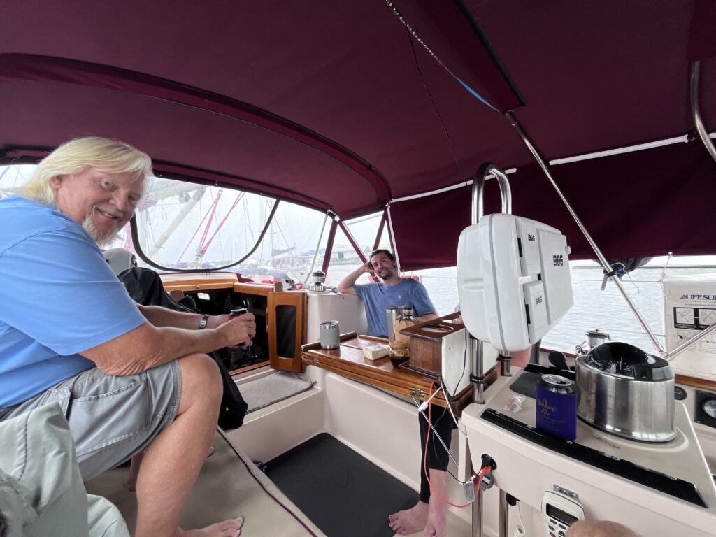
In fact, the conversation was so good, we ended up staying eight hours! and got back to the boat around 10:30 pm, definitely the most unique Christmas I have experienced.
Tuesday, December 26th (Stuart, FL to Clewiston, FL, 50 nm)
We woke the next morning anxious to get back on the road and start our journey through the Okeechoobee Waterway. This is a canal across Florida that was started in the 1930’s and finished in the 1970’s. Its purpose was mainly to control flooding and provide irrigation for Florida’s inland agriculture. When finally completed in 1977, it also provided a safer and quicker way to cruise from one coast of Florida to the other without having to sail around the Florida Keys. On the east side it started in the St. Lucie River near Stuart, then connected via canal to Lake Okeechobee, crossed the lake, then continued via canal to the Caloosahatchee River which finally led to Fort Myers and the Gulf Coast. It would be about a 150-mile-long journey during which we’d have to pass through five locks and several drawbridges. We expected it to take three days. Although there were occasional marinas along the waterway, there were also places to tie up for the night, so we decided to not plan the route out in any detail, but just play it by ear and stop when/where we needed to. The biggest limiting factor was the lock operating hours. They were only open from 7:00 am to 5:00 pm (but you had to be there by 4:30 pm as the openings typically take 30 minutes).
We tied the dinghy off to the back of the boat (we ended up towing it behind us the rest of the trip), weighed anchor at 9:00 am, and headed south down the St. Lucie River. It was a lovely, partly cloudy, 70-degree day with light winds out of the north. As we departed Pendarvis Cove, the river narrowed and turned southwest, and eventually west. Not having been in a canal before and not knowing what to expect, I was a bit surprised (and disappointed) to realize that it didn’t seem any different than many sections of the ICW we had been on. It was just a big waterway/river going through rural Florida. Perhaps the only unique thing we saw during the first part of the journey were many man-made bee hives along both sides of the canal at irregular intervals. Most of the time both sides were lined by trees, which would occasionally open to reveal canal-front homes—some lovely, some not so much.
During the entire three days we never saw any commercial traffic, even though one of the justifications for constructing the canal was to facilitate commercial traffic going from one coast to the other. In fact, when researching the rules about navigating the locks, a lot of them described commercial barges, how they had priority in the locks, how to share a lock with them, etc. Yet, we never saw a single one! Perhaps it was the season.
In fact, we saw very few other boats at all. There were occasional small, local motorboats out fishing, and every couple of hours a boat would pass us transitioning the canal in the opposite direction. But, we never had to share a lock with anyone, and only once did we have to wait for a lock to empty because it had a boat in it that was coming the other way. All in all, there was very little traffic on the waterway—at least that time of the year.
Even though we had done a lot of online research and understood the basics, neither of us had been through a lock before, and so didn’t know exactly what to expect as we approached the first one. We were understandably a bit nervous when the gates finally opened, and we were given the green light to enter the lock.
The first lock turned out to not only be the biggest but had the greatest vertical lift of all the locks. Like a drawbridge, we were required to radio the lock tender as we approached to request a pass-through. He had instructed us by radio wait for the green light before entering the lock, ensure we were wearing PFDs, and to tie up with our port-side to the wall.
In the event, the green light was on and the doors open by the time we arrived, so we just motored in very slowly, with Nick at the helm and me on the bow and fenders over the side to protect to boat from the unforgiving concrete wall. It was a bit intimidating to be entering this 250-ft long, 50’ wide, and about 30’ high concrete chamber. Nicholay gently steered us over to the left side where there were a number of dangling ropes hanging over the side wall of the lock. We were supposed to each grab a line and just hold on to them to secure the boat as the lock filled up with water. This first lock would raise us 15 feet to the level of the next section of the canal. It was important to not tie the boat off because the line length needed to keep the boat secure would change rapidly as the water level in the lock rose. So, we each grabbed a rope and then waited. We noticed that the lock doors behind us were closing very slowly.
Almost immediately after they had shut, the doors in front of the lock cracked open about 6 inches, and water began pouring in. We could see a wall of water 15 feet higher than we were, trying to flood the lock, but the small crack between the doors was controlling how much was coming in. It was very strange. The incoming water also started creating strong currents in the lock, moving the boat around quite a bit and requiring us to hold on tight to keep the boat in place and from banging against the wall.
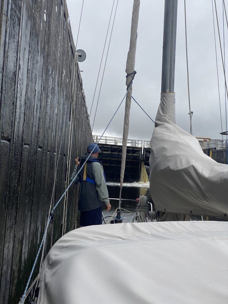
After the water in the lock equaled the water in the next section of the canal, the front doors were slowly opened the rest of the way, and the lock tender told us on the radio that it was safe for us to exit. We dropped the lines, pushed Mexicana away from the wall, and motored out of the lock to continue the journey. The entire process took about 20 minutes. Although this first lock was the biggest, the procedure was virtually identical for the remaining four locks that we negotiated over the next two days. We noticed that most of the locks had an accompanying RV park, and campers would sometimes walk over to watch us go through the locks.
About mid-day we stopped at a place called Indiantown Marina. This was a large boat yard/marina/RV park pretty much in the middle of nowhere in Florida, right off the canal. It had the reputation as a good place to keep the boat “on the hard” during hurricane season, and one of the rare boat yards left in the area which let owners work on their own boats while in the yard. (Most boat yards want all the contract work, so don’t let owners work on their boats themselves, or if they do, charge exorbitant daily fees.) I wanted to check the place out as a possible future haul-out location for Serendipity, and we needed to top off our fuel tank, so we ducked in to give the place a quick check out.
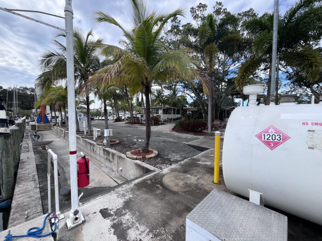
It was quite interesting. We pulled into the relatively small marina and tied off to the fuel dock, topped off our diesel, then decided to wander around and check the rest of the place out. It was a huge boat yard, with a “work” section, and a “storage” section. Lots and lots of boats, lots of people living in RVs, other people living on their boats in the work area. As expected, it had a combination boat yard and RV park vibe to it. Weird! Nicholay took advantage of the fact that we were in a boat yard to ask around for the bolts that he still needed but again got no satisfaction. We weren’t impressed by the employees we encountered during our visit, but the reviews for the place were generally very favorable. Nicholay wasn’t enamored of the place, pointing out that it was simply too isolated–that if one was working on his boat here, it would be a 3-hour roundtrip drive to get to the nearest boat supply or hardware store. Knowing how often I am having to run to the store during any of my boat projects, I could see his point.
The other limiting factor for me and Serendipity would be the dreaded “Highway 441 Bridge”, which was the limiting vertical obstacle in the waterway and just a bit to the west of Indiantown. This was a railroad drawbridge, which when fully raised, was only 48 feet above the water. (The next shortest bridge on the waterway was 55 feet.) The air draft9 on Nicholay’s boat was 46 feet, which is why we could take his boat through the canal. Serendipity, on the other hand, had an air draft of 50’, which meant that if I wanted to take my boat to Indiantown, I would have to sail her all the way around the Keys, back up the East Coast to Ft. Pierce, then down to Stuart, and then the way we had just come—in the best of circumstances, a week-long trip. More likely, two weeks. So, probably not a good option for me.
After spending about 30 minutes there, we jumped back in the boat, cast off, and continued west in the canal, looking for the aforementioned Highway 441 Bridge and shortly after that, the Port Mayacca Lock at the edge of Lake Okeechoobee. We had been hoping to make that lock before 4:30 pm, expecting to continue across Lake Okeechoobee in the evening.
As we rounded a slight bend in the canal, we could see the railroad bridge looming in the distance, a strange metal frame, looking out of place in the middle of rural Florida. As we got closer, it indeed looked quite short (and very old), so we approached it very, very slowly, with Nicholay ready to slam to boat into reverse if the top of the mast contacted the bridge. Especially disconcerting was the fact that unlike all bridges in the ICW, this bridge didn’t have a gauge/sign at the base of the bridge with depth markings so you could see, based on the current water depth, how much clearance there was in real time between the water and the bottom of the bridge. So, we slowly crept forward with both of us craning our necks upwards to watch for contact. But thankfully there was none, and after passing, we accelerated back up to cruising speed, heading now for the Port Mayacca lock which we could see a short distance ahead.
We entered the lock and while it was filling to the level of Lake Okeechoobee immediately on the other side of the lock doors, we chatted with the tender. He asked where we were planning to spend the night, and we were rather vague about our answer. He cautioned us about crossing the lake at night, and we just nodded, knowing that was exactly what we planned to do.
His cautions were valid; Lake Okeechoobee is very large (one of the largest lakes in the U.S.) but is very shallow. This means that it can produce large and choppy waves (like standing waves) with relatively light winds. There have been many boats sunk and people needing rescued on the lake when the wind picked up unexpectedly.
In addition, there are so many shallow spots that there is a designated channel across the lake that is kept dredged and which takes about 4 hours to navigate. The problem is that there are few navigation aids at all defining this channel, and even fewer lighted navigation aids, so it can be challenging after dark.
However, the weather forecast called for calm winds all night, and we had already made the decision to press on to an anchorage on the other side of the lake. We planned to arrive a couple of hours after sunset. We hoped that with careful navigation, assisted by Mexicana’s radar (which can pick up some navigation aids at a distance), we would be able to cross the lake safely.
As the front doors to the lock opened and we motored out, we were startled with the vista that presented itself. We hadn’t realized that Lake Okeechobee was right there. From having been in what was basically a narrow, enclosed ditch for the past few days to suddenly exiting to this vast expanse with no horizon was very surreal. In addition, the water was very flat (no winds) and the lock actually stuck out into the lake a ways, so even our peripheral vision could see nothing but horizonless mirror-like water. It felt like we were transitioning through some kind of portal into a different dimension!
As we waved goodbye to the lock tender around 4 pm, we headed into the channel with Clewiston as our destination, a small town out of sight on the other side of the lake. We were at least glad that, as forecast, the winds were calm, and we hoped they would stay that way for the four hours it would take us to cross the lake.
We set the course in Mexicana’s GPS and the iPad and headed for the first turn, 13 miles distant! The first navigation aid along the route was a day board which was over the horizon, over six miles away! Lake Okeechobee was considered an integral part of the Okeechobee Waterway, and so had navigation aids like the ICW, but the eastern side of the lake is deep, not requiring precise navigation. The idea (we guessed) was that you only needed an aid every so often to ensure you were at least going in the right general direction!
However, on the other (southwestern) side of the lake where numerous shoals created hazards to navigation, we would need precise navigation. The good news was that the frequency of the aids increased the closer we got to Clewiston. The bad news was that it was going to be dark.
The problem with the navigating the lake (or the ICW) at night is that many of the navigation aids are unlit day boards—just red- or green-painted plywood boards that indicate where the boundary of the channel is. While they are reflective, one typically must be within a couple hundred yards for a handheld spotlight to illuminate them. Some of them do have flashing lights which helps tremendously. But, this can also be confusing as they are identified by the flashing sequence they use (e.g., one red flash every four seconds) and for some reason, most of them all use the same flashing sequence! You can imagine straining to see forward in the darkness, looking desperately for the next mark to ensure that you’re heading down the channel and not out of it, shining the spotlight in an arc back and forth off the bow of the boat hoping to see the reflection of the next day board before you either 1) collide into it; or 2) wander out of the channel and go aground. Or, if a lit aid, looking for the next “Green, rapid flash, every four seconds”, only to see four lights answering that description fanned out in a 45-degree arc in front of the boat, making it impossible to determine which one is closest.
In such situations, it is easy to get disoriented, especially so if there are rough seas and the boat is moving around a lot, rolling and yawing back and forth. The GPS becomes critical at such times, which is why each of us was looking at a separate GPS device, from different manufacturers. This last part was crucial because GPS’s renowned accuracy doesn’t always manifest if the background maps aren’t accurate. We had already experienced the somewhat intimidating situation when transitioning through the ICW early on where one GPS’s map would show us dead center in the channel, the other would be indicating that we were out of the channel to one side or the other. Not knowing which one (if either) was the truly accurate one, we would typically split the difference by having one GPS show us on the right edge of the channel and the other the left!
One piece of technology with which Mexicana was equipped helped these situations: radar. Nicholay had been given the radar by a friend and had started using it on his trip up to North Carolina in the spring. We hadn’t found much use for it offshore (although we did use it to “paint” the rain showers as we approached Ft. Pierce), but this night it would get a lot of use and prove its worth. The reason was that most navigation aids would reflect radar energy, and so would show up as small dots on the radar screen. The dots would often appear well before we could get close enough to light them up with a spotlight, so added a welcome level of verification of our GPS position and our heading.
But, it was still very tedious, and got more so as we approached the far shore in the dark. The water got shallow, and channel began turning more frequently to avoid the shoals, and we were getting tired after having been sailing for 11 hours. We had, after all, motored almost halfway across the state already that day!
As we reached the far shore and the town of Clewiston, the channel made a 90-degree right turn to become a canal again, now paralleling the south shore of Lake Okeechobee. We followed it around the turn, then began looking for the set of “dolphins” that we planned to tie up to for the night.10 We found them about a ¼ mile after the turn, tied off our bow, and using the dinghy, tied off our stern. It was relatively easy since there were no other boats and no wind, but I could see that it would have been tricky had that not been the case.
We were surprised to not have been bothered by any mosquitos or other bugs while tying up. After all, this was inland Florida, with a lot of stagnant water around. There had been a short period of time just before leaving the lake when we started getting pestered, but that had stopped for some reason. We anticipated being set upon once we were stopped and vulnerable during the dolphin tying-up process, but no bugs materialized (thankfully). We set up some window and hatch screens anyway, had dinner, and hit the sack, planning to get an early start the next morning.
Wednesday, December 27th (Clewiston to Wilson Pigott Bridge anchorage, 51 nm)
We woke before sunup with the intention of getting moving by dawn. There were three more locks left to get through, and our intention was to try to get to the final one (“WP Franklin”) by 4:30 pm that day. The challenge was that it was 47 miles away, and at our motoring speed of 5.5 knots, that meant eight and a half hours. 4:30 pm minus 8 ½ hours meant we would need to depart by 8:00 am. However, that didn’t account for the delays we would encounter passing through two other locks and a couple of drawbridges. That meant we needed to depart by 7:00 am at the latest and hope we didn’t encountere too many unforeseen delays along the way.
As I got out of the berth, turned on the cabin lights, and put the tea pot on the stove, I noticed that the companionway screen was almost completely covered with mosquitos! I shuddered to think what it was going to be like to leave the cabin and spend the 5-10 minutes on deck it would take to detach from the dolphins; we were going to get eaten alive! I told Nicholay what I was seeing, and he stated that he had some bug spray in the head if needed. I don’t typically like putting bug repellant on my skin, but I knew that this time it would be essential, so I rooted around the head until I found the bottle, only to discover that it had only about 1 teaspoon of repellant left in it! I spread it around my head as best as possible, planning to wear long pants and long sleeves, at least until we motored out of the area and left the mosquitos behind.
We scarfed down some coffee and snacks and got dressed just as the sun was making its presence known. But, wonder of wonders, as we got ready to remove the companionway screen to make our way outside, all the mosquitos were gone! None. A very pleasant surprise! We had a surprisingly uneventful departure and headed west as the sun rose over the horizon behind us.
It was turning into another beautiful Florida day: light winds, clear skies, and temperature about 60 degrees, which would climb during the day to the mid-70’s. Most of the day was uneventful, just passing through increasingly-populated areas as we got closer to the Gulf Coast. We were using the GPSs to calculate our ETA to the final lock, and all day it was hovering around 15 minutes on either side of 4:30 pm. Nick was pushing the engine as hard as he dared because he really wanted to get out of the canal that day, so we were doing slightly better than our planned speed. The longer we’d motor at the faster speed, the further we’d see the ETA tick back 4:30 pm to 4:25 pm, then 4:20 pm, etc. But, every time we’d hit a lock or drawbridge, we’d lose all the cushion time we had banked. It was going to be hit or miss whether we could get to that final lock by 4:30 pm! As the day went on, we become more optimistic because all the lock and bridge transitions were very quick and smooth.
One of the more unusual things I remember seeing during our transition of the canal occurred during this leg. As we were transiting a well-populated area, we saw a motorboat ahead pulling a skier, zipping around all over the place. As they passed close by, we saw that the skier was woman about 80 years old, slalom skiing very fast, back and forth, occasionally falling, but getting right back up again. For the next mile or so, they just zipped around us, back and forth. It seemed to us like this was a regular thing for them, and she seemed to be really having a ball.
As we finally got within a mile of the WP Frankin Lock, our ETA was showing 16:28. Not wanting to take any chances, we reached out to the lock tender by radio, announced our ETA, and queried whether we would still be able to get an opening. We heard with relief the nice lady’s reply that she would wait for us. She did, and we ended up exiting the west side of the last lock at 5:00 pm! We had accomplished our goal but now had only about 30 minutes until sunset, so it was time to find an anchorage.
The chart showed a nice, easy anchorage about three miles downstream. (We were now technically in the Caloosahatchee River.) It was just before the Wilson Piggot drawbridge, so we wouldn’t have to wait for an opening until the next morning, and even better, it was right across the river from a dockside restaurant called the Boathouse Tiki Bar and Grill that looked very enticing! We could dinghy over have a celebratory meal and beer! And that’s what we did. It turned out they had live music, as well. Perfect! A great end to a beautiful day.
Thursday, December 28th (Wilson Pigott Bridge to Cabbage Key, 39 nm)
When we woke up early again the next morning, things felt different. We were on the west coast of Florida now, in home waters at last, and anxious to get home for New Years. The sense of adventure—at least the part about seeing new things—was mostly gone. We were anxious to be on our way, like the horse whose pace noticeably quickens when it turns back toward the barn!
Unfortunately, but as forecast, the winds had veered to the north-northwest and were to remain so for the remainder of our trip, so there was no chance of sailing, and no point of going outside where we’d hit heavy seas; we would be motoring in the ICW the rest of the way home, which would likely take another three or four days.
The start was a bit amusing as the anchorage we were in was just off the ICW behind some trees just a couple of hundred yards from the Wilson Pigott drawbridge. As we weighed anchor, I immediately called the bridge tender to request an opening and told him we were exiting an anchorage to his immediate northeast. He didn’t seem able to comprehend what I was telling him and seemed confused, obviously looking for us approaching from up or down stream. I finally got him to look to the side of the river where he saw us and opened the bridge right away for us.
This day would turn out to not be as pleasant as the previous. It was cooler, windy, cloudy, and grey, and the river widened up so much that anything that might have been interesting on shore was too far away to see. We were having to just trudge down the Caloosahatchee until we got to Ft. Myers where we’d make a right turn and for the first time in the trip, start heading north.
Our goal for the day was an anchorage off Cabbage Key, a very small island along the ICW northwest of Ft. Myers. Cabbage Key is a unique place. It is family-owned and hosts a restaurant and a few rental cottages. It also has a small marina and boat house. It is very cute, and the restaurant has a reputation for unique and good food. The only way to get there is by boat. Nicholay had been there a few times, but this would be my first time. He was excited for me to finally see it.
As morning turned to afternoon, the sky cleared and the sun came out, and by our 3:00 pm arrival at our anchorage across the ICW from Cabbage Key, it had turned into a truly lovely day with calm winds and the temperature just below 70. We dropped anchor across the ICW from Cabbage Key, took our first deck showers11, put on some clean, Florida clothes (shorts, T-shirts, and flip flops!) and took Nick’s dinghy to the Cabbage Key cove and beached it in front of the restaurant.
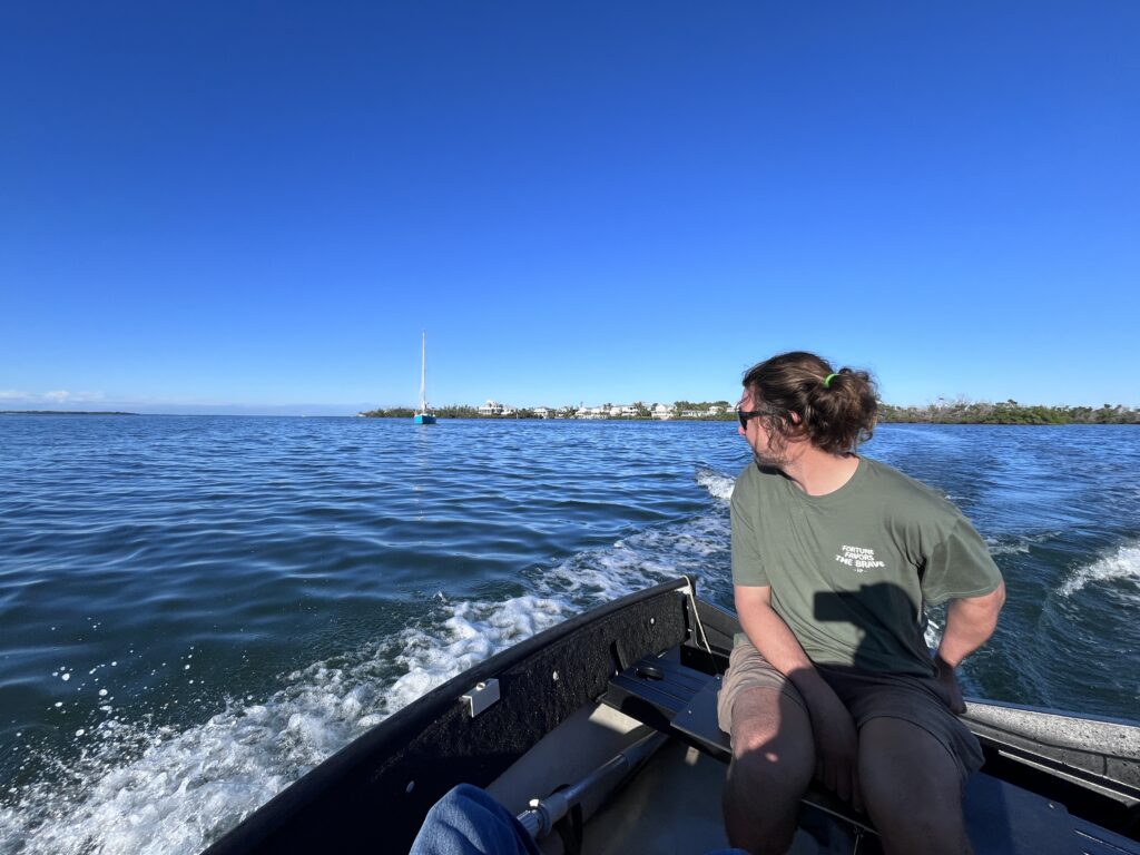
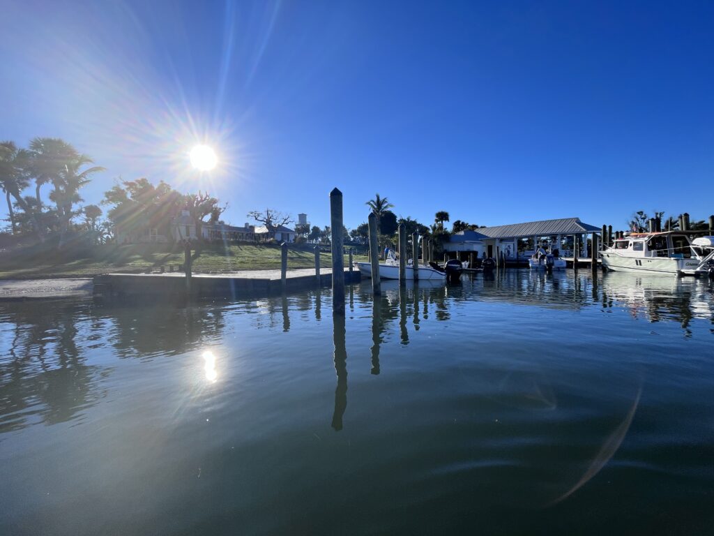
What a charming place Cabbage Key was! Everything was clean and trimmed and lovely. There was a small marina with a quaint little boat house, a half-dozen or so cabins which were very attractive, and numerous (protected species) gopher tortoises wandering around, each given a name and a home (a fenced-in yard around their hole in the ground). There was a small nature trail, and a 60-foot wooden water tower built in the 1930’s. It stills provides water to the island, and we were able to climb up it for a great view of the island and surrounding area (and Mexicana at anchor).

But the restaurant was the highlight. Very quaint, with a very cozy bar and good food and drinks. We spent the evening there enjoying both the food and the company of many holiday revelers who had boated over from the mainland and sort of took over the place.
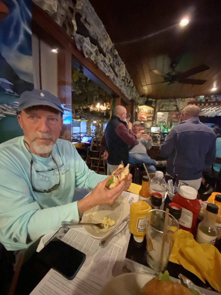
Nicholay especially had a good time as he had made friends with the bartender the previous year. They reconnected and had a fun time experimenting with exotic drinks. Perhaps too fun a time as Nick ended up sleeping out in the cockpit that night in case he got sick!
Friday, December 29th (Cabbage Key to Venice Yacht Club, 35 nm)
We woke up to a sunny, but windy day, with temperatures in the mid-60’s and winds out of the north-northwest at 10-15 knots and forecast to remain so for rest of the day. Since that was generally our course back home, we would be motoring into the wind all day as expected.
Our hope was to make it to Venice—specifically the Venice Yacht Club–about 35 miles distant. Being a member of a Florida yacht club, I had “reciprocity” privileges with most of the other Florida yacht clubs, which meant that we could get a free slip in their marina for a night (electricity, water, etc.), reduced rates on fuel, and the use of their facility (pool, SHOWERS, restaurant, etc.) I had phoned the yacht club the previous day to see if they had any transient slips available but could never get anyone to return my calls. So, we weren’t sure if we be able to stay there or not, but we could always anchor in the cove in front of the club and still use their facilities even if they had no slip availability, so off we went.
The day was pretty, but the wind made it cold. With the 5-6 knot boat speed against the 10-15 knot wind, we were experiencing 15-20 knots of apparent wind in our faces all day, which got old. But at least it was sunny and warm, although as we could expect the temperatures to drop a bit as we moved north. We had to go through a number of drawbridges that day, some of which were “on demand” and others for which we had to sit around and wait for an opening. But, that was the Gulf Coast ICW; we had been here before and were used to it.
Despite repeated attempts to contact the Venice Yacht Club dock master, we didn’t get a call back until we were 15 minutes out, and then received very good treatment. They did have a transient slip for us, and it was on the end of the “T-dock”, which meant that it would be very easy to get in and out of, which we were grateful for.
Approaching the yacht club on our way through Robert’s Bay (one of the prettiest waterways I’ve encountered—neck and neck with the St. Lucie River northeast of Stuart) we prepped the boat for docking and stayed in the channel until just off the yacht club’s dock. The water in the anchorage east of the yacht club had gotten very shallow over the years, and when we arrived, many of the small, anchored boats were obviously aground at what was now low tide. This was yet another time when Nicholay’s 3.5’ draft proved invaluable.
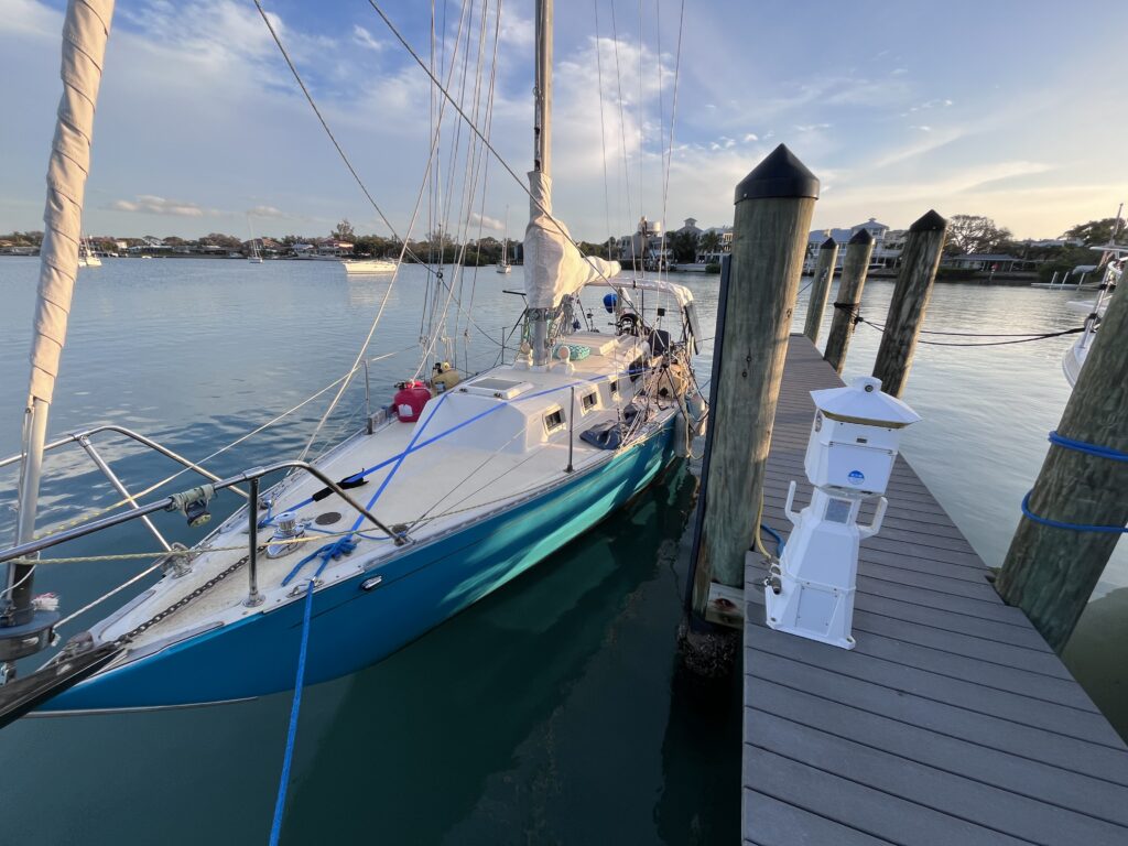
The dockmaster, Jeff Towers, was on hand to help us tie up, give us the lowdown on the club and the combination to the showers. We finished securing the boat, grabbed a wonderful shower, then had a nice dinner and beers at their Tiki Hut overlooking the water. We then returned to the boat warm, clean, and sated and had our first night’s sleep in a marina since Brunswick, 11 days prior!
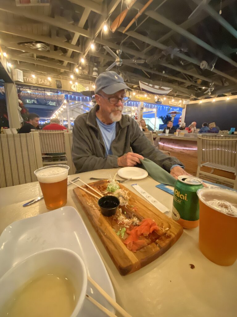
Saturday, December 30th (Venice Yacht Club to Davis Island Yacht Club, 59 nm)
The day started off a bit chilly (mid-50’s), but sunny. We were in a hurry to get the day started with our destination still undecided. We would either meet up at an anchorage off of downtown St. Petersburg with Robin Groelle, a neighbor of mine when I lived aboard in Twin Dolphins Marina in Bradenton. She was sailing her cutter-rigged sloop from Bradenton to anchor off St. Petersburg for the weekend to enjoy the New Year’s Eve fireworks up close. Knowing we would be passing by on our way to Tampa, she invited us to anchor next to her and dinner on her boat.
The other option was to continue all the way home, to the Davis Island Yacht Club to terminate the voyage. I was rooting for the former as I didn’t see any need to get into the yacht club late at night and would have liked to see my friend again, but Nicholay seemed focused on getting all the way back if possible. I understood; I had been away for three weeks, but he had been away for 10 months! I’m sure he also was anxious to see Sierra. But, he wanted to see how our progress went during the day before making a decision.
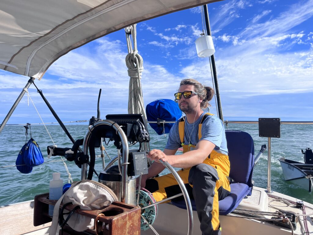
The winds stayed consistent out of the north—right off the nose—and so we motored all day again. Despite all its issues and of Nicholay’s babysitting, the little three-cylinder engine had been chugging along, day after day, getting us home. We had to transit more drawbridges north of Sarasota, and then around 4 pm the Sunshine Skyway Bridge came into view—the entrance to Tampa Bay—and we knew we were finally on the home stretch.
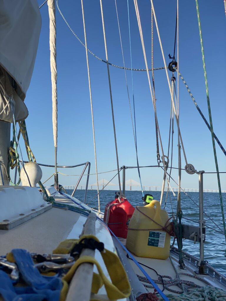
There was only another hour of daylight, but also only another five hours until we’d be all the way home at DIYC. Nicholay made the decision to press-on to DIYC.
We had an uneventful (but cold after the sun went down) journey through Tampa Bay and arrived at the DIYC floating dock just before 9 pm, our journey complete.
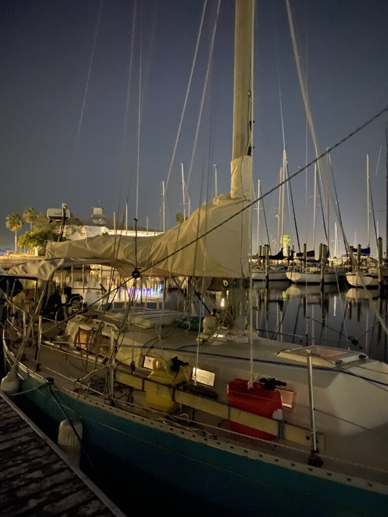
After securing the boat, we headed up to the clubhouse where we had a drink to celebrate our challenging, tedious, cold, sometimes wet, but ultimately successful delivery of Mexicana from Oriental, North Carolina to Davis Island, Florida.
We had motored or motor-sailed 447 nautical miles on inland waters and sailed 480 offshore miles in the Atlantic Ocean for a total journey of 927 miles. It had taken 22 days.
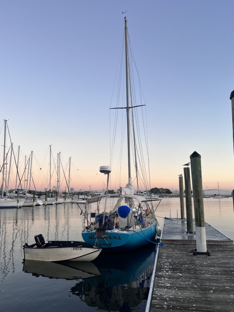
- Sea Tow is like AAA for boats. ↩︎
- The “wave period” is the time it takes for a wave to pass a stationary point, from crest to crest, and is measured in seconds. Generally speaking, if the period is at least as long in seconds as the waves are high in feet, the ride will be fairly comfortable (e.g., 6-foot seas with a 9-second period). If the periods gets less than the wave height (e.g., 6-foot seas with a 5-second period), it means the ride will be quite uncomfortable, if not dangerous. Thus, even twenty-foot seas with, say, a 20-second period can be more comfortable than five-foot seas with a four second period. ↩︎
- A “run” or “running” is when the wind is directly behind the boat. Wing-on-wing means that the Genoa (the front sail) is out on one side, and the main sail is out the other side, basically turning them into the biggest barn doors possible to just be pushed by the wind. It is tricky sailing, because if the boat yaws a bit toward the side the mainsail boom is out, the wind can quickly switch from being behind the sail to being a bit in front of it (“backwinded”), which causes the sail to rapidly and uncontrollably switch to the other side, bringing the boom with it. This is called a “crash jibe” and can injure and/or knock crew overboard if they are not expecting it and can cause major damage to the boat because of the forces involved. A run is also the slowest point of sail because there is no lift being generated by the sail, i.e., they are not acting as wings, but are just being pushed along by the wind. So, while “wing-on-wing” is one of the prettiest sail plans, it is one of the most inefficient and unstable of them. ↩︎
- Navigating in the ICW at night can be challenging and stressful. More on that later. ↩︎
- Non-sailors often don’t understand the point of trying squeeze out another knot of speed when cruising on a sailboat. (“What’s the point for just one more knot?”) But, on a long passage, on a vessel which is only traveling at five or six knots, an additional knot of speed can make a huge difference in the duration of the passage. An additional knot is a 20% increase in speed and corresponding decrease in duration for the trip. Take, for example, a 300 nm passage. At five knots, it will take 60 hours, or 2 days and 12 hours. But, at six knots, it will cut that time down to 50 hours. This almost half of a day saved can make the difference between getting into a new anchorage or harbor in the daylight or nighttime, being able to reach shelter before bad weather arrives, or just not having to go through another night at sea. ↩︎
- When the wind waves and swells come from different directions, causing inconsistent boat motion. ↩︎
- An emergency tiller is a small tiller intended to be used if the steering wheel linkage (cables and quadrant which transfers wheel inputs to the rudder) should break. It attaches directly to the top of the rudder post, completely bypassing the wheel system. Nicholay’s boat was originally built with a tiller, which a previous owner had replaced with a wheel, so his emergency tiller connection point was very accessible, right behind the wheel at the feet of the helmsman. ↩︎
- We subsequently learned that 32 trains a day pass over this bridge, which is why it is kept down. (There are a lot more trains that need the bridge down than sailboats which need it up!) Most of these trains were Florida’s Brightline high-speed rail going from Miami to Orlando. ↩︎
- The distance from the water to the tallest part of the boat. ↩︎
- Dolphins are a type of wood piling (telephone-pole-sized posts stuck in the water). They are like a super-piling, made up of three or more separate posts tied together to make a very secure barrier or tie-off place for boats and barges. Such dolphins were located at both the entrance and exits of each lock on the canal for boats to tie up to while waiting for the lock to open or to spend the night at after the lock closed for the day. ↩︎
- Using some water heated on the stove in a small garden pump-type sprayer and taking a shower sitting on the cockpit floor. Totally awkward, but still feels great! ↩︎
One thought on “Cruising Prequel–Part 4: (Moving Mexicana from Oriental, NC to Tampa, FL)”