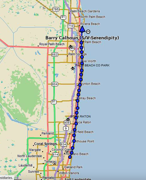
Distance: 33 nm/Time: 8.5 hrs
I woke up planning to head the mile up the ICW (through two bridges) to the Hillsboro Inlet, then transition outside for an overnight run to Daytona Beach. The winds had moderated nicely to a favorable east at 8-10 knots and seas 2-3 feet.
But, as I got down to brass tacks and looked closely at the inlet, I suddenly had second thoughts.
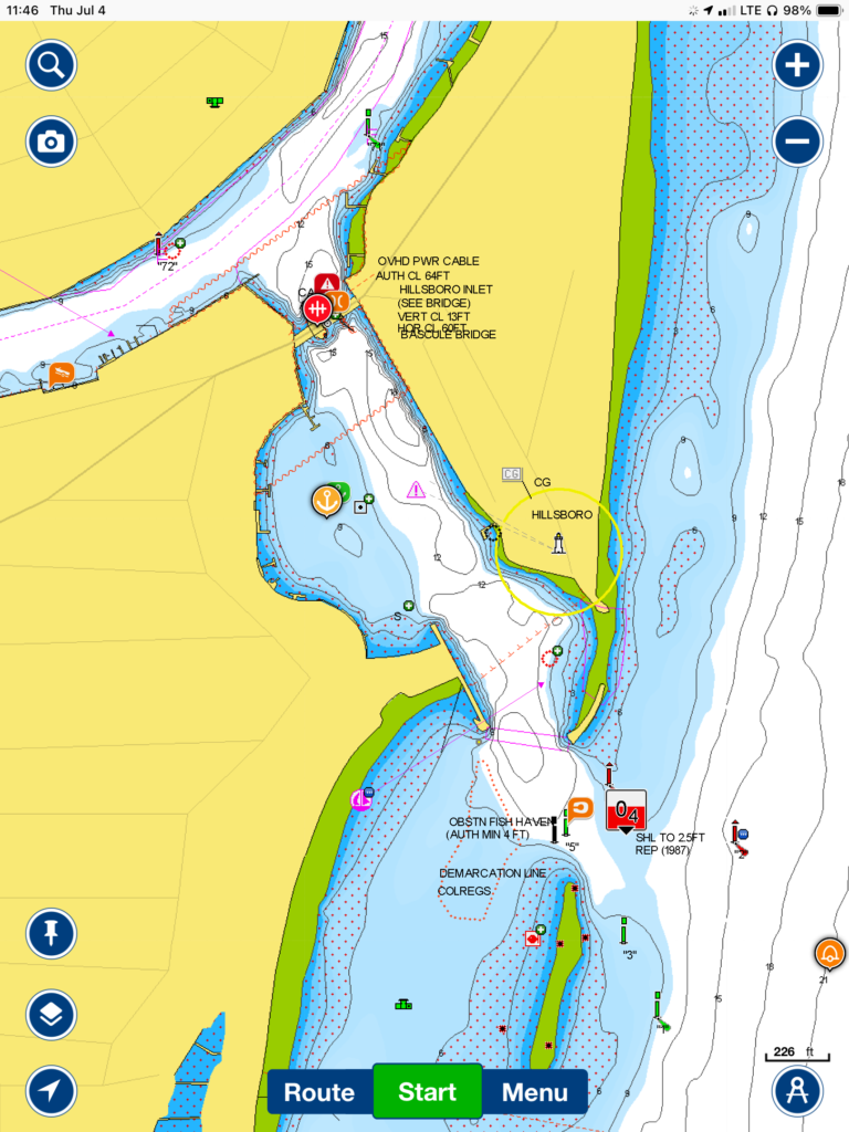
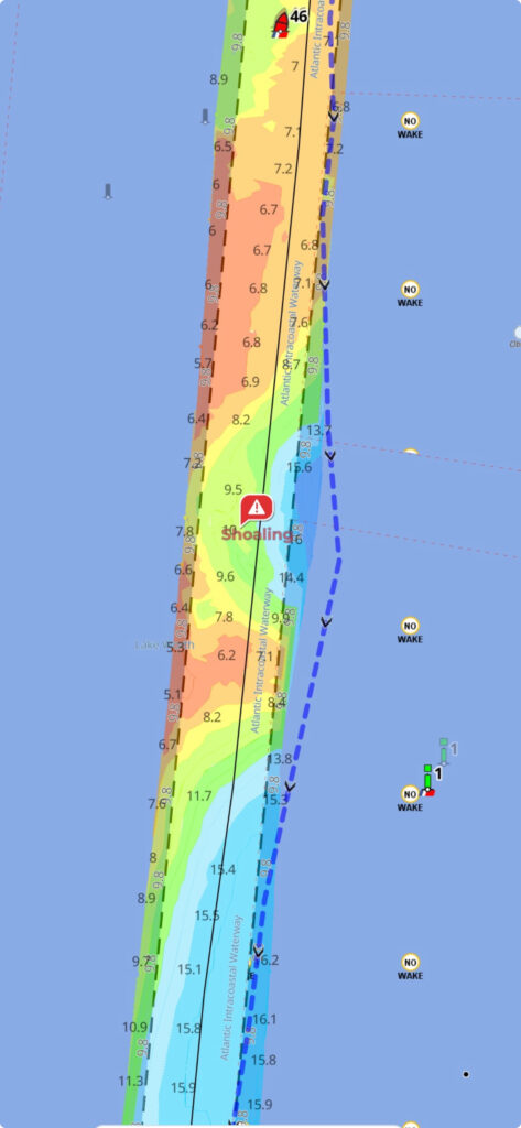
It was way smaller than I had realized, both in length and width. The southern side was bordered by a rock jetty and the north side had all kinds of shoaling. I broke out AquaMap to look at the USACE survey of the inlet, and that looked even scarier than the Navionics sonar view. According to the surveys, there was only a very narrow path of water that was 6′ or so. But, even worse, those surveys turned out to be older than three years! In reality, I had no idea what the status of the inlet was!
Even worse, because I had to go at slack tide to avoid the standing wave problem from the offshore winds, that meant going at the noon low tide, which was actually a negative 0.5′ tide, meaning I would actually see depths one half of a foot lower than the chart was showing! (High slack tide was at night time, which wasn’t an attractive alternative.)
Adding to all this was the fact that one had to wait for the draw bridge to open at the exit (from the ICW) to the inlet, then once through, there was no way back because the bridge wouldn’t open again for 30 minutes. All together, it was beginning to look very unattractive indeed.
I decided to get some local area knowledge, and so called up SeaTow and talked to a skipper who was actually out and about in the area, very familiar with the inlet. I told him my situation, my boat’s draft, when I planned to go, etc. He said (and I quote): “Well, if you stick real close to the green markers you might make it through.” !!! Okay, thanks.
And no thanks. I had to put the brakes on at that point. I realized that I was really trying to find any excuse to go through the inlet and get offshore because I didn’t want another torturous day of drawbridges. But after stepping back and trying to see the big picture, I realized that I probably would only have a 50/50 chance of making it through that pass without either going aground on the north side shoals, or getting swept into the rocky breakwater which would be only feet away from me on the south side. Why would I do that? Just because I didn’t want a less-than-fun day in the ICW? It didn’t make sense. So, I bit the bullet, changed my plans, and resigned myself to another day of drawbridges (16 this time).
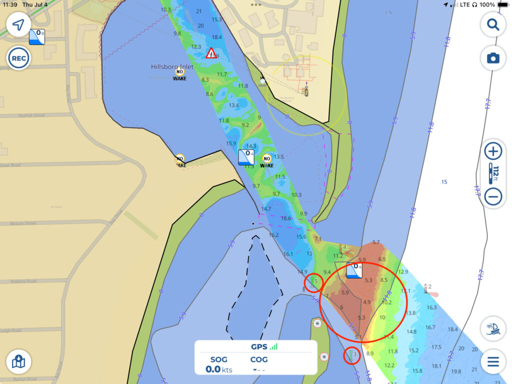
And it was indeed a long, frustrating, and slow day, and one which required a lot of concentration so as to not go aground. Thank goodness for Bob423’s tracks and AquaMap’s USACE surveys overlay. They definitely kept me from going aground when passing Boynten Inlet.
I had to go completely outside the channel and still saw only 6.6′ on the depth meter. Had I not been monitoring AquaMap and those surveys, I would have plowed into a 4′ shoal in the middle of the channel doing 6+ knots! A couple of other times I had to quickly turn to get on Bob423’s track when the track I was on started inexplicably getting shallow quickly. The time I spent loading his tracks into my iPad and the Garmin has definitely paid for itself!
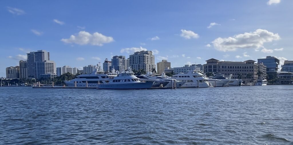
The scenery was generally similar to what I had seen coming up from Miami. One difference was at the end of the day in the West Palm Beach area, I passed four or five marinas that only had (and obviously were designed for) huge yachts in them. So much money. Where does it all come from?
I finally arrived pretty ragged out at Lake Worth at 7:30 pm expecting a big open anchorage (based on my research) only to find a completely packed, HUGE mooring field with hundreds of boats hanging on unofficial and unauthorized balls. Almost none of the boats was occupied. It was obvious that people had found some kind of loophole to allow them to store their boats for free here.
For some reason, seeing all these boats unoccupied was sort of depressing. It reminded me of a place I had delivered a helicopter to back in the early 1990’s: the “Bone Yard” at Davis-Monthan Air Force Base in Arizona where hundreds of superfluous military aircraft are stored in case they’re ever needed.

It took me 30 minutes to find an appropriate place to drop the hook, and even then I was closer than I would have preferred to a boat, an empty mooring ball, and a day board for my comfort. And, to add insult to injury, while trying to set the anchor–right when I had about 30 feet of chain out (but the anchor not set)–the chain jammed in the anchor locker below as I was drifting back towards other boats. So had to weigh the anchor, move back upwind, then run below to the v-berth and free up the chain before re-anchoring. I finished just before nightfall and hit the sack hoping to get some rest before proceeding offshore in the morning.